One Day Itinerary for the Snaefellsnes Peninsula in Iceland: 10 Awesome Things to See and Do
The Snaefellsnes Peninsula is the perfect place to visit in Iceland if you are looking for a one day detour off Iceland’s famous ring road, or if you are short on time and only have a few days in Iceland all together.
Why? Because it has everything. Looking for black sand beaches? Lava fields? Volcanoes? A glacier? Cute fishing villages? Waterfalls? Dramatic coastline? The Snaefellsnes Peninsula has all of this, and more!
In fact, the Peninsula is often called “Iceland in miniature” because of its ability to take the best of what Iceland has to offer in each region and squeeze it into one small loop just a few hours from Reykjavik. And the best part, you can see many of the highlights of the Snaefellsnes Peninsula in just one day. It’s a no brainer, am I right?!
Looking to add a visit to the Snaefellsnes Peninsula to your Iceland road trip? You’ve come to the right place. We’ll walk you through some of the best places to go on an epic one-day itinerary through the Snaefellsnes Peninsula, from a visit to the famous Kirkjufell mountain, to the exploration of coastal basalt cliffs, to a journey into ancient lava tubes.
We have a bunch of info, so if you’re looking for something specific, feel free to jump right to it!
Article Contents
Here we go!
Visiting the Snaefellsnes Peninsula
Ok, I know you want to see all the awesome things to do, but first, let’s get some important information out of the way.
Where is the Snaefellsnes Peninsula?
As the name suggests, the Snaefellsnes Peninsula is, well, a peninsula (you’re welcome) off the west coast of Iceland, and it’s just a few hours drive from Reykjavik to get to some of the main highlights.
Some of these highlights include the insta-famous Kirkjufell mountain, one of the most photographed locations in all of Iceland. Another place to note is Snaefellsjokull National Park, located at the most western tip of the peninsula and one of three National Parks in Iceland. This park is home to Snaefellsjokull, a giant glacier-capped volcano, made famous by the book A Journey to the Center of the Earth as being the actual gateway to the center of the Earth. You encircle this beast as you drive through the park, and on a clear day, the views are stellar.
Why the Snaefellsnes Peninsula is called “Iceland in Miniature”
As you drive around the Snaefellsnes Peninsula, you’ll start to understand why this place is known as “Iceland in Miniature”, especially if you have already travelled around the ring road. It’s essentially like a mini ring road!
In a single day, you’ll drive through lava fields and a volcanic landscape reminiscent of those of the highlands, travel past black sand beaches and cliff-side waterfalls much like those of the south coast, pass through farmland and fjords such as those you would see in the east fjords, and visit cute coastal fishing villages like those found throughout Iceland.
But it also has its own set of unique things, like golden sand beaches and its own National Park. This is a great reason to visit the Snaefellsnes Peninsula if you are short on time and can’t do the entire ring road. If you have one day, you can see most of what Iceland has to offer! Where else in the world can you visit black sand beaches, waterfalls, cute fishing towns, fjords, volcanoes, lava fields, farms, and a national park all in one day?
How to visit the Snaefellsnes Peninsula
Visiting the Snaefellsnes Peninsula is actually pretty easy. It can be easily done as a day trip or an overnight trip from Reykjavik, or as an easy add- on during a road trip along the ring road.
And you can travel to everywhere on our list with a regular 2 wheel drive car. There are a few places with dirt roads that were a little bit rough, but we had no issues in our 2WD campervan. There are few F roads on the peninsula and these mostly go to the interior really off the beaten path places.
How long does it take to get to the Snaefellsnes Peninsula?
From Reykjavik, it takes about an hour and a half to get to the beginning of the peninsula on the southern edge.
From Akureyri, it’s about 3 hours and 45 minutes to get to the start on the northern side. (And by the start, I’m referring to the points on road number 54 on both the northern and southern sides that are crossed by route 55 – check out the map below).
From the start of either the North or South end of the peninsula, it’s about 1 hour and 45 minutes to get to the very tip of the peninsula.
As you drive through the peninsula, you’ll likely stay on route 54, which juts off Iceland’s ring road in Borgarnes and enters the southern part of the peninsula. It travels along the entire south coast and loops around to the North coast just before hitting Snaefellsjokull National Park at the tip of the peninsula. It then traces the entire northern coast of the peninsula until intersecting with route 60 which will then take you back to the ring road. The only time you will detour off of this road is to travel through Snaefellsnes National Park at the tip of the peninsula.
One Day Itinerary for the Snaefellsnes Peninsula
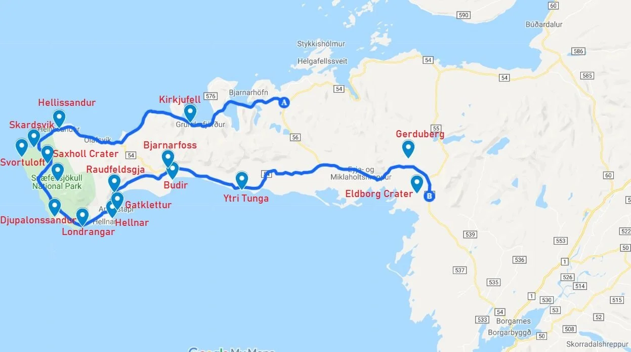
Here is a map of the best places on the Snaefellsnes Peninsula for an awesomely jam-packed one day itinerary.
We’ll walk you through each place as you would encounter them when starting on the North coast and traveling counter clockwise around the peninsula to the southern coast. We’ll also give you distances and driving times between each point of interest so you can plan your best Snaefellsnes road trip itinerary.
How much time will you need on the Snaefellsnes Peninsula?
In theory, it takes just three hours to drive the entire perimeter of the Snaefellsnes Peninsula. But, it won’t actually be that quick! Trust us, you’ll want to stop at all these places we list here, and then some.
The great thing about our Snaefellsnes itinerary is that you can easily hit most of the highlights on the Snaefellsnes Peninsula in just one day. It will be a busy day, for sure, but that’s how we do it here! We only had one day allotted to the peninsula during our time in Iceland and it was a lot of driving and a lot of stopping and made for quite a long day. But we loved every minute of it, and we’ll share that one day itinerary with you here!
But we get it, this itinerary is jam-packed. If you want a more relaxed time on the peninsula, and have more time for exploring the cute fishing towns and exploring the culture, opt for an overnight stay on the peninsula. There’s so much to see and do…enough to fill up several days… and plenty of places to stay. Throughout our one day itinerary, we’ve added optional trips and points of interest that could either be substituted for something else or added on altogether to extend your time on the peninsula.
10 Best Things to Do on the Snaefellsnes Peninsula
1. Kirkjufell Mountain
Getting here: 98 km – 90 minutes
This first stop on our Snaefellsnes itinerary is quite far down the northern side of the peninsula. It will take you about an hour and a half of driving down road 54 from its intersection with road 60. However, route 54 is mostly gravel (about 60 km of it), until it intersects with the road into Stykkisholmur, but it’s fairly smooth and unproblematic. You should have no problem with a 2WD vehicle.
Once past the intersection with Stykkisholmur, it’s paved road the rest of the way. Enjoy the views as you make your way down the coast and even weave in and out of a small fjord or two.
As you start getting deeper into the peninsula, the landscape will get more volcanic as you pass by mossy green craters, reminiscent of those in the highlands, and drive in between vast lava fields.
Visting Kirkjufell: Kirkjufell Mountain is probably the most famous and iconic natural feature in Iceland, making it onto pretty much everyone’s Snaefellsnes itinerary. It sits right next to the tiny fishing village of Grundarfjordur, prominently rising over the landscape.
The most famous photograph of Kirkjufell features a small waterfall, Kikrjufellsfoss, in the foreground… and this is the exact shot that everyone who comes here seeks to replicate.
To be quite honest, a stop at Kirkjufell was a bit underwhelming for us. It might have been partly due to the fact that it was our last full day in Iceland, so we had already seen so many other cool things. But also because of its popularity and the need for every single person there to get the one famous photograph (and yes, we got it, too!).
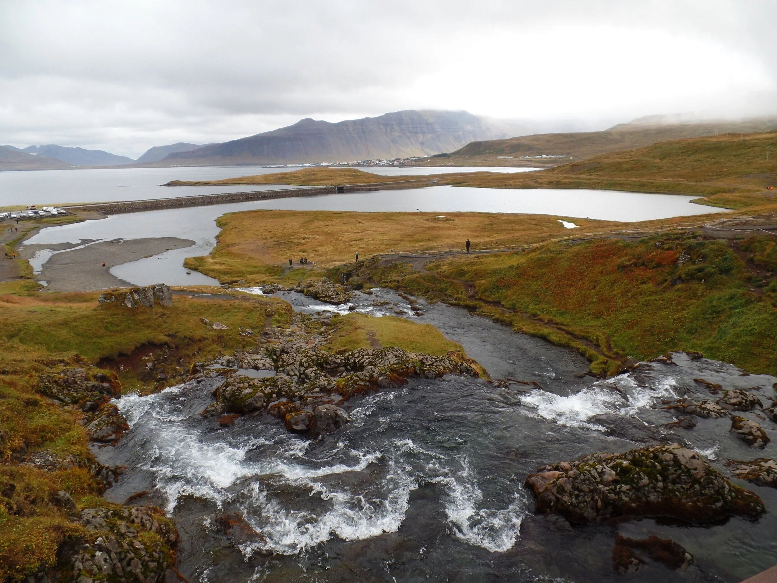
And actually, the angle of this famous picture is taken in such a way that it looks so different than when you’re driving towards it. In fact, as we were approaching the mountain in our campervan, we drove right by the parking lot for it! We saw a teeny tiny waterfall with a bunch of people around it, but I thought… that doesn’t look like the right spot at all. Well, it was! There’s a small parking lot across the road from Kirkjufell with a short walking path that takes you around and over Kirkjufellsfoss and to the famous shot.
The view back towards the parking area from the top of Kirkjufellsfoss
But the truth is, Kirkjufell is quite photogenic no matter which angle you see it from, and as you drive by, there are plenty of other more unique spots from which you can get a great picture! And although it is super popular, it’s still worth being on your list of things to do while you’re on the Snaefellsnes Peninsula – you’re here already, so why not, right?
Bonus side trip: Stykkisholmur is the largest town on the Snaefellsnes Peninsula. And by the largest, I mean there’s about 1100 residents, just to give you the perspective of what “large” means in Iceland. Though small in size, there’s plenty of activities, cultural sights, and delicious food to keep you busy for days if you wanted. It’s about a 35 minute drive east of Kirkjufell, and you could stop there on your way. From here, you can also take a ferry across to the West Fjords and back to save you the long drive.
2. Hellissandur
Getting here: 32 km – 30 minutes
Continue along road 54 for 18 km until you come to the intersection with 574. This road will take you along the tip of the Snaefellsnes Peninsula. After 14 miles, you’ll arrive at the entrance to Hellissandur.
Visiting Hellissandur: This is a tiny town located along the northern strip of route 54 known as “The Street Art Capital of Iceland”. And you’ll quickly see why with just a quick 5 minute jaunt through the town. This stop is a no brainer… you don’t even have to get out of your car to admire the beautiful artwork.
3. Snaefellsjokull National Park
Next up is one of Iceland’s three national parks, which sits at the very tip of the Snaefellsnes Peninsula, and should definitely be on your list of places to visit while on the peninsula. The most striking feature of this park is its namesake, the Snaefellsjokull glacier, which lies on top of a giant volcano famous for its role in the book A Journey to the Center of the Earth. While driving through the park, you encircle the glacier, and on clear days, the views are incredible.
And if you’re up for a real adventure, you can even climb it (with a guide of course).
But even if you opt out of climbing a volcano and glacier, there’s still adventure to be had in the park. The next four places on our list are in Snaefellsjokull National Park! And trust us, they are worthy of a spot on your Snaefellsnes itinerary. This part of Iceland is a bit off the beaten path and doesn’t see too many visitors, which makes for a nice respite from the crowds of tourists found along the south coast and ring road. You’ll drive through narrow coastal roads through desolate lava fields to some gorgeous destinations, including…
4. Skardsvik Beach
Getting here: 7 km – 9 minutes
Continue down road 574 for about 5 km. Take a right hand turn, and the small parking area for Skardsvik Beach will be on your right after about 2 km.
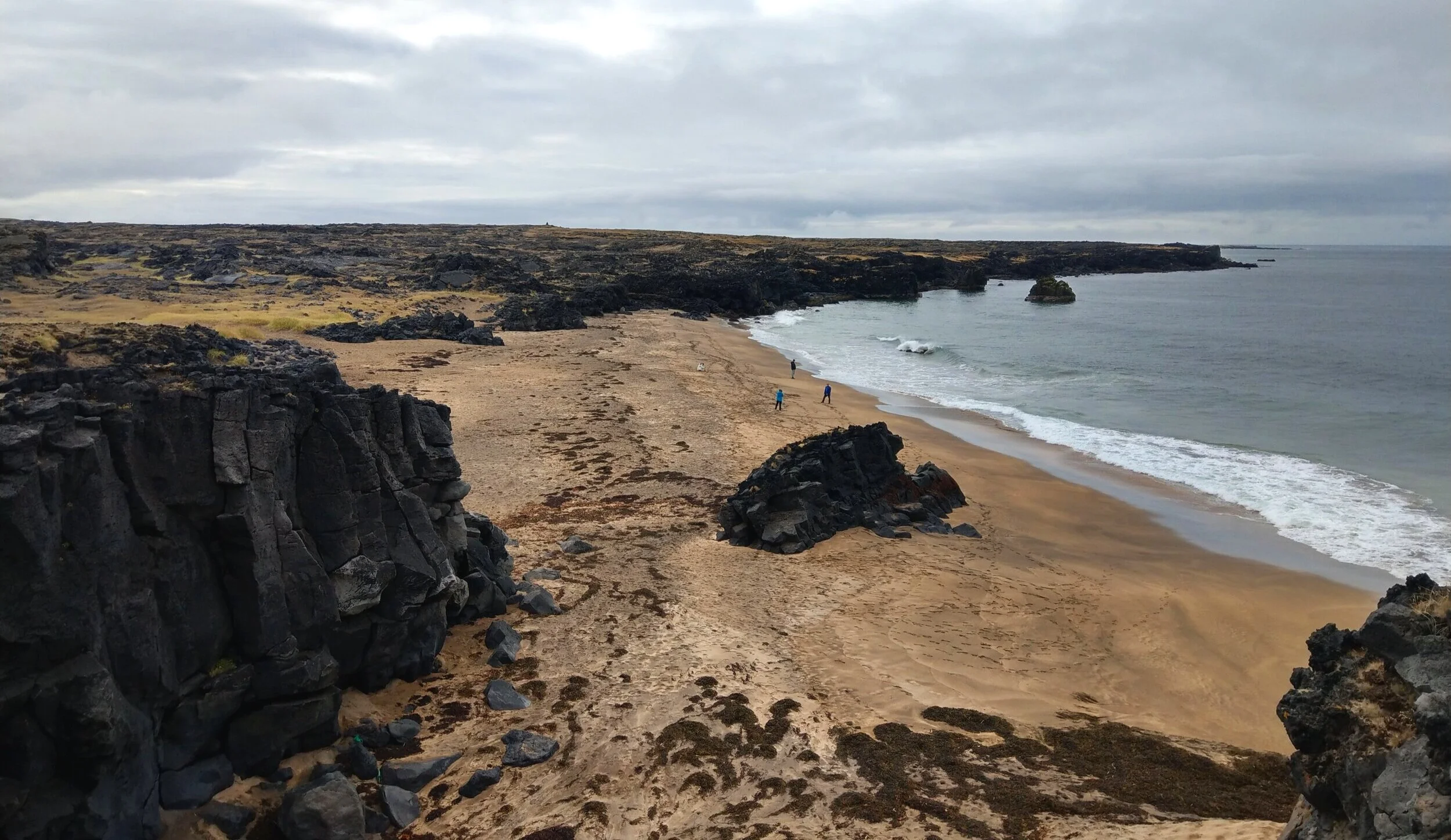
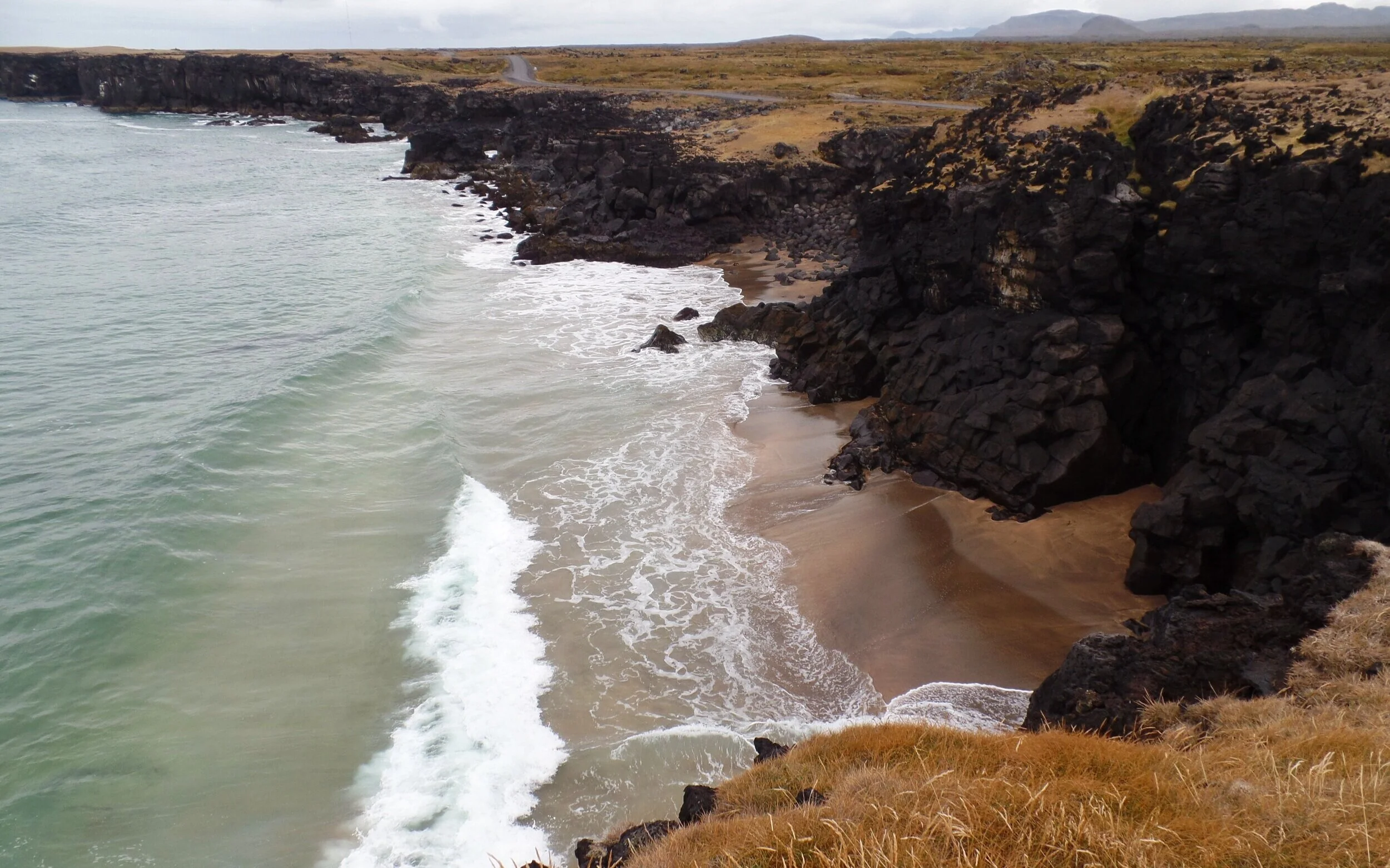
Visiting Skardsvik Beach: Iceland is famous for its black sand beaches, but Skardsvik Beach is unique because of its “golden” sand. We put “golden” in quotations because really, it was just like the beaches back home in the states, but for Iceland, it is definitely something different from all those black sand beaches found along the southern coast!
But the real draw for coming to Skardsvik Beach, at least for us anyway, was everything else about it! The tiny beach is surrounded by black lava fields that end in dramatic seaside cliffs with neat rock formations and crashing waves. And behind you is an awesome view of the Snaefellsjokull Glacier.
The isolation you’ll feel here, standing on a beach surrounded by lava fields at the tip of a peninsula in the northern Atlantic (how often can you ever say that?!), in combination with these gorgeous coastal views are worthy of the time and effort to make it out here.
5. Svortuloft Lighthouse
Getting here: 4 km – 10 minutes
To get here requires driving down a bumpy dirt road. It’s slow-going, but doable in a 2WD vehicle.
To get to Svortuloft Lighthouse from Skardsvik Beach, you’ll continue down road 579 . The road quickly becomes gravel, and you’ll be driving about 15 kph. It’s also very narrow, and you’ll have to pull over to let cars pass you from the other direction, but it doesn’t happen much, as this part of the park is so isolated.
The road ends at an intersection, and you’ll take a left (taking a right will take you to a different lighthouse, see below!). This new road ends after less than a kilometer at a small parking lot for the lighthouse.
Visiting Svortuloft Lighthouse: This lighthouse was actually way cooler than we were expecting and was surprisingly one of our favorite (not quite our top favorite) places on the Snaefellsnes Peninsula! The bright orange color provides a very photogenic contrast against the dark lava fields and the epic backdrop of the Snaefellsjokull glacier.
You can also walk the short path to the cliff’s edge and enjoy the views of the black lava cliffs, and even spot a cool arch formation.
Bonus side trip: The Ondverdarnes Lighthouse is another brightly colored orange lighthouse not too far from Svortuloft. When you reach the end of 579, instead of taking a left, take a right. This road ends at Ondverdarnes. Instead of tall and narrow, this light house in short and wide. This lighthouse actually sits on the very edge of the peninsula and contains the remains of an old fishing station, not to mention some great views back towards Snaefellsjokull.
Another bonus! Saxholl Crater is a small 100 meter high crater that has a staircase up to the top. A popular thing to do on the Snaefellsnes Peninsula is to climb to the top and walk around its rim. It’s a prominent feature in the area and you can’t miss it as you’re driving through the National Park.
6. Djupalonssandur Beach
Getting here: 26 km – 30 minutes
Retrace your way from the lighthouses back to road 574 and continue on. After a short drive, the parking area will be on your right.
Visiting Djupalonssandur Beach: We can’t pronounce it, but that doesn’t stop it from being our favorite spot on the Snaefellsnes Peninsula. And it seemed to be everyone else’s favorite, too… it was even more crowded than the famous Kirkjufell! Cars were lining the road far down from the actual parking lot, so expect a short walk from your car.
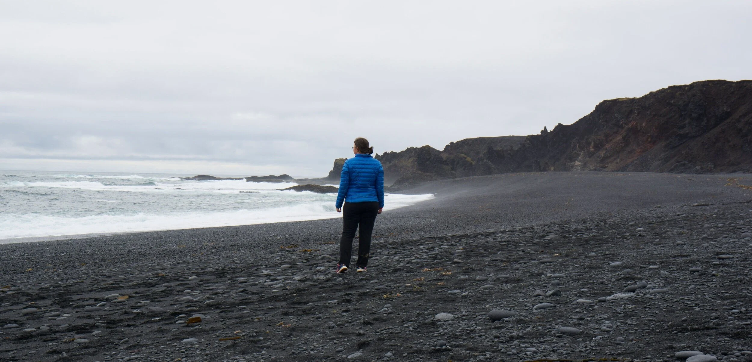
It’s a small stretch of black sand beach, much like its more famous south coast counterpart, Reynisjfara, but its position on the peninsula makes it a target for the stormy Atlantic seas, and that combined with fun rock formations and the lava field that surrounds it make this beach a fun place to explore and sight-see.
In the parking lot, there are free (!) bathrooms and plenty of signs to help you figure out where to go. We recommend taking a short flat walk to Utsyni, which will bring you to a viewpoint overlooking Djupalonssandur Beach.
If you’re looking to head down to the beach, from the parking lot, you’ll take a short walk down through a small canyon of volcanic rocks. There are some pretty cool rock formations to explore here, including a little arch through which you can see the Snaefellsjokull glacier on a clear day.
The base of the little canyon empties you out onto the edge of the black sand. One of the first things you’ll probably notice is the remnants of a shipwreck, a british trawler that washed ashore in 1948.
My favorite part, though, of Djupalonssandur Beach was watching the huge Atlantic waves crash against both the shore and the rugged rock formations found around the beach’s edge. They were almost mesmerizing as they came crashing in. This place really has that moody North Atlantic stormy sea feel to it, especially on a cloudy day like we had.
On the west edge of the beach, there’s a small sign marking the trailhead to Dritvik Cove. This is a 2km roundtrip trail over volcanic rock that leads to an overlook of Dritvik Cove, a smaller, quieter, black sand cove. The start up the trail is steep and rocky, but not long at all, and the views from the top of this climb back over Djupalonssandur are great, not to mention the beautiful views back at Snaefellsjokull.
We hiked this path about half way down the trail and enjoyed the scenery before turning around and heading back, not quite making it to see Dritvik Cove since it was getting late and we had a few more stops we wanted to make.
In our opinion, Djupalonssandur tops the list of the best things along the Snaefellsnes Peninsula, so make sure to add it to your itinerary!
Bonus side trip: On the way to our next stop, you’ll pass by Vatnshellir Cave, an 8,000 year old underground lava tube that you can explore if you’re feeling adventurous and have the time. But you’ll need to go on a tour to do this.
7. Londrangar
Getting here: 8 km – 8 minutes
Continue along road 574 and you will see the parking lot to your right.
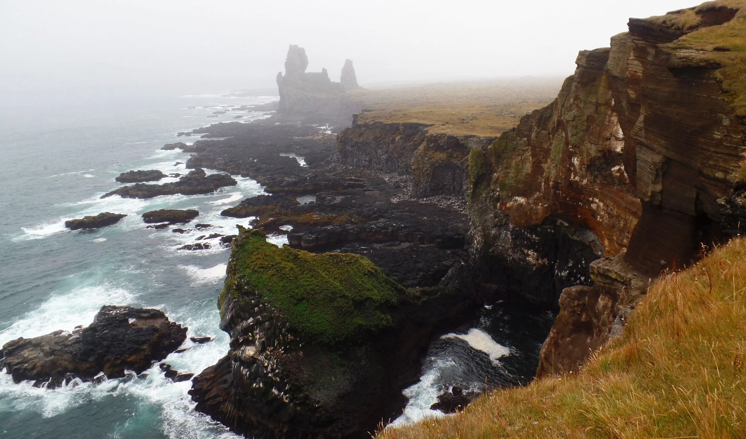
Visiting Londrangar: Londrangar is a quick stop along the southern coast of the Snaefellsnes Peninsula and an easy add on to a one day itinerary . A quick and easy walk out to the edge of the cliffs will give you nice views of the coast line, which consists of tall basalt columns…kind of like those famous ones at Reynisjfara Beach along the south coast. The difference here is that you can’t get up close to them or sit on them, but it’s a LOT less touristy.
This is a good place to marvel at the formations from afar, enjoy the views, and maybe look for birds, such as puffins, if you’ve come at the right time of year.
8. The Arc of Hellnar
Getting here: 7.6 km – 7 minutes
Continue along road 574. You’ll see road 5730 on your right. Follow this until it ends.
Visiting the Arc of Hellnar: Hellnar is a fishing village on the south coast of the Snaefellsnes Peninsula. The road into town ends at a small parking area right along the coast.
From here, you can look out over the coastline, but there’s some cool rock formations just a short climb down that you can go and explore up close! We think it’s worth the stop while you’re driving through this part of the Snaefellsnes Peninsula because instead of just viewing the cool rocks and basalt columns from afar like you’ve been doing up to this point, you can get up close and hop around them.
You’ll also see a neat little window in the rock called the Arc of Hellnar.
Just be careful here! The rocks are wet and slippery.
9. Arnarstapi
Getting here: 5 km- 7 minutes
Further along road 574, you’ll see a right hand turn onto Arnarstapavegur. Shortly after turning, a parking area will be on your right.
Visiting Arnarstapi: Arnarstapi is a past trading post that sits just outside the National Park along the southern coast of the Snaefellsnes Peninsula.
A small parking area to the right on your way into the village marks the starting point of a series of trails that runs along the coastal cliffs. You’ll know you are in the right spot when you see a giant statue of a troll – well, apparently it is half man half troll – named Bardur Snaefellsas. He is the legendary settler and protector of the area and you’ll walk right by him on your way to the cliffside.
The most popular feature in Arnarstapi, and a favorite thing to see on the Snaefellsnes Peninsula, is Gatklettur, a picturesque stone arch that juts out into the Atlantic Ocean and formed by the circular wave action around the cliffs. To get here, it’s just a few minutes walk. After walking by the troll statue, you’ll bear left on the trails and the viewpoint will be marked by a sign.
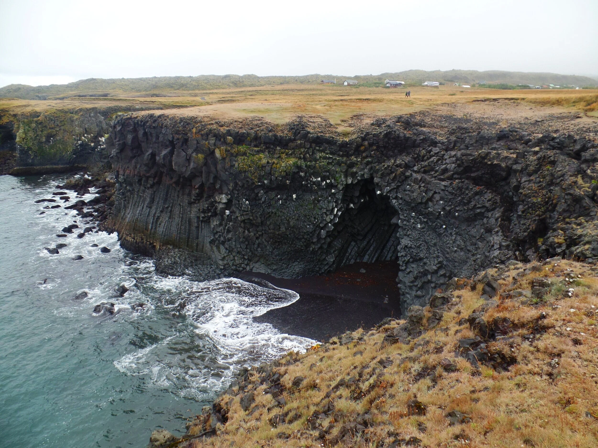
Don’t stop here, though. If you continue walking further along the trail, you’ll get more beautiful views of the coastline and its cliffs and basalt columns, and you can even spot a unique basalt cave. These cliffs are also great for spotting nesting birds in the spring and summer seasons.
But what was super cool and something we didn’t expect to see here were stone bridges, or arches, carved right into the cliffsides themselves. There were several of these “holes” where you could walk around them and peer down into the choppy waters below.
You can spend a lot of time here meandering on the trails. They do go on for quite a while. In fact, if you’re up for a longer walk and have the extra time, you can even walk a 2 km path along this coastline between Arnarstapi and Hellnar. But, most people come to see the arches and then continue along to the next stops on their Snaefellsnes itinerary.
Bonus side trip: Port Arnarstapi is just a few minutes further down, at the end of the road through the village (Arnarstapavegur). Here, on a clear day, you can get amazing views of the coast, and of the distant fjords and mountains running along the Snaefellsnes Peninsula. We weren’t so lucky weather wise, and opted to skip out on this quick detour. By the time we reached Arnarstapi, the clouds were building around us and any distant views were shrouded in fog and mist.
A few more bonus stops between Arnarstapi and the next destination on this list, Ytri Tunga Beach.
Raudfeldsgja Ravine- This is a narrow slit in the tall cliffside that can be seen as you are driving along road 54. You can actually drive, via a rough gravel road, to this narrow slot canyon of sorts and hike through it. We didn’t have time to do this hike, but it looks like fun – involving wading through streams and climbing up small waterfalls to get further and further into the canyon. Check out more about parking at and hiking the ravine.
Budir Black Church- This is a super famous and photogenic church, called Budakirkja, that you can just barely see from road 54 if you look out towards the water. To get here, you’ll turn onto Budavegur and drive until the end. You’ll find a beautiful black church surrounded by the Budarhraun lava field. It’s a popular spot on the peninsula for photography.
Bjarnarfoss – A beautiful waterfall that can be easily seen from the road, but you can also take a trail to get closer. The parking lot is off of road 54, on Bjarnarfossvegur.
10. Ytri Tunga Beach
Getting here: 35 km – 30 minutes
Road 574 will meet back up with road 54. Follow this until you see the parking lot to your right.
Visiting Ytri Tunga Beach: Ok, so this beach is actually pretty close up there to being one of my favorite places on the Snaefellsnes Peninsula. (I feel like I keep saying this…I guess I just really loved this peninsula!)
Ytri Tunga Beach is a small “golden sand beach” along the southern coast of the peninsula. To be honest, the beach itself was a bit underwhelming. It was tiny, filled with seaweed, and didn’t look very “golden” (but, again, it’s named in comparison to the more commonly found black sand beaches, so in Iceland, this is a rarity!). So, why was this place so great?
The seals! Ytri Tunga Beach is known as being a hangout spot for the common and grey seals, but you might have to put in a little bit of effort to see them. They likely won’t be right on the beach. If you look out to your left, there is a breakwater that juts out into the ocean. We thought we saw some seal-like shapes when we looked out in that direction so we rock hopped our way down the beach to get a closer look and when we squinted and looked through our camera’s super zoom, sure enough, they were seals!
Of course, I had to get a closer look, so I took a path along the beach that brought me to the beginning of the break water and walked along it. It’s definitely a rock hop to do this, and often slippery, so make sure you are wearing proper footwear if you spot some seals you want to visit.
I walked out as far as I could on the rocks before it just became globs of seaweed, and kept a nice distance between me and the seals. But check them out… so cute!
Just little blobs bobbing up and down on the water. And there were a couple playing in the water, doing somersaults and flips. It was worth the walk to get out to them!
This beach is a very quiet, lesser-visited place on the Snaefellsnes Peninsula, and we loved it for that! There was only one other group on the beach, but just for a short time, and then we had it to ourselves for the rest of our visit here. We hung out by the beach and made some dinner in our campervan, enjoying the sights, the sounds of the waves, the peacefulness and isolation, and the seals. Ahhh, perfect!
Bonus side trip: If you are up for a longer hike on the Snaefellsnes Peninsula, you don’t have to go too far. At the very start of the Peninsula, just an hour and half from Reykjavik is the Eldborg Crater. You can hike to the top of it in a 6 km round trip hike. You can actually see this perfectly shaped isolated crater off in the distance as you’re driving the southern portion of route 54 shortly after it branches from the ring road.
Where to Stay on the Snaefellsnes Peninsula
Like we said above, you can easily do a road trip and visit all the best places on the Snaefellsnes Peninsula in just one day, which is more than enough time to see all ten places we listed on this itinerary. It will be a long day with a lot of driving, but the varied sights will keep it interesting and you’ll never get bored!
If you’re looking for a more relaxing time exploring the peninsula, want to add on some of those bonus side trips we mentioned, or want to hang out more in the towns and get to know the culture a bit more, spending a night out here is a great option.
The Snaefellsnes Peninsula is sprinkled with small towns and fishing villages, filled with photogenic vistas, seaside ports, cultural highlights, and plenty of types of accommodation for anyone looking, ranging from hotels to hostels to bed and breakfasts to campgrounds. This awesome website is a great place to start when looking for places to stay on the Snaefellsnes Peninsula.
Camping: If camping is more your thing, check out your options for campgrounds here, and be sure to read our post that details everything you need to know about camping in Iceland!
We want to hear from you!
We hope this list helps you plan your perfect one-day (or more!) itinerary around the Snaefellsnes Peninsula so that you can hit all the best spots! If you have any questions, let us know in the comments below and we’ll do our best to answer them!

