15+ Amazing Things to Do in Virgin Islands National Park
Are you looking for things to do in Virgin Islands National Park? With beautiful white sand beaches, amazing snorkel spots, elaborate historic ruins, and hiking trails through tropical forest to gorgeous views, there is plenty to choose from! In this guide, we share all our favorite things to do in Virgin Islands National Park and all our best tips to help you plan your trip.
While a tropical beach getaway may not be the first thing that comes to mind when you think of National Park travel, this is exactly what you get when you visit Virgin Islands National Park!
Located on the small island of St. John in the eastern Caribbean, Virgin Islands National Park is quite unlike any other National Park, protecting and preserving some of the world’s most beautiful beaches, colorful reefs, a collection of historic ruins, and miles of tropical forest that cover the hills of this U.S. Virgin Island.
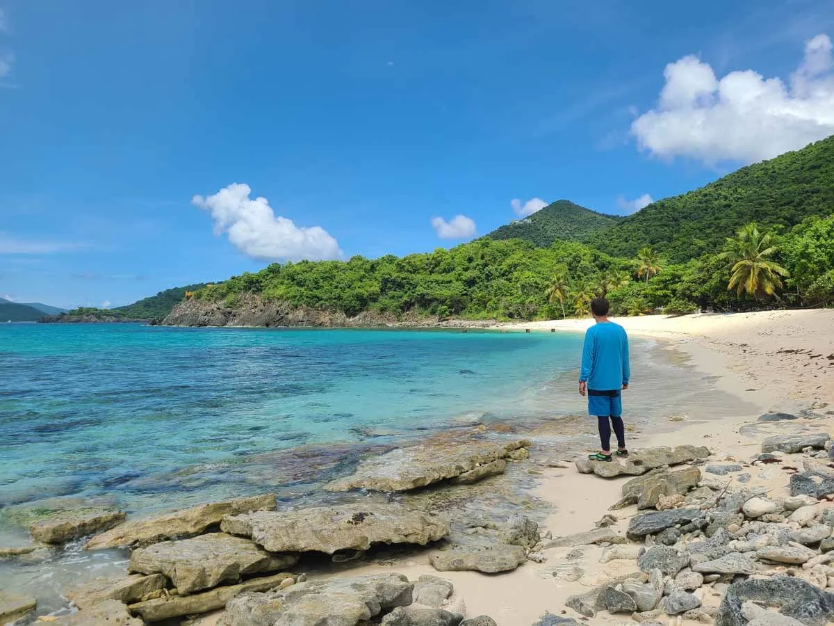
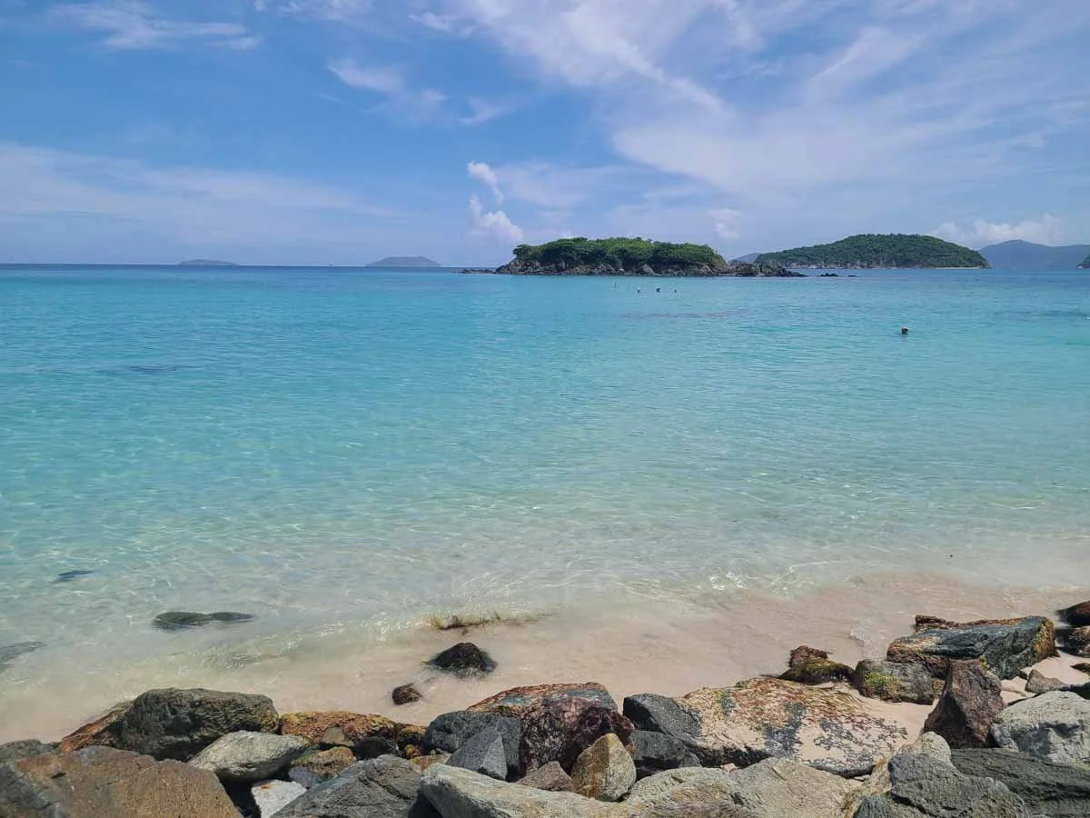
Because it’s so remote, Virgin Islands National Park is one of the least visited National Parks in the country, but it’s totally worth the effort to get here. Even for two people who don’t consider themselves “beach people”, we had trouble peeling ourselves away from the crystal clear blue water and white sand beaches that line the island.
Despite being located on a small island of less than 20 square miles, we were honestly surprised at all the awesome things to do in Virgin Islands National Park. We thought just a few days would be more than enough time to see and do everything we wanted. Surely we would get tired of beach after beach after beach, right?
Wrong! It turns out that no two beaches, snorkel spots, viewpoints, or hiking trails are the same, and we could have stayed here much longer and never really run out of things do.
Have we sparked your interest yet? We hope so, because in this guide, we’re going over all of our favorite things to do in Virgin Islands National Park, including sharing all our best tips to help you plan your own trip to this special piece of paradise. So, let’s get to it!
In this Virgin Islands National Park guide:
Tips for Visiting Virgin Islands National Park
Before we get into all the amazing things to do in Virgin Islands National Park, we wanted to go over some helpful information that will be good to know as you begin to plan your trip.
We give general tips here, but for tons more information, be sure to check out our massive Guide to Virgin Islands National Park to learn more about where to stay, how to get around, typical costs, when to go, what to pack, and much more!

Taking a dip in the clear blue water of St. John!
Where is Virgin Islands National Park?
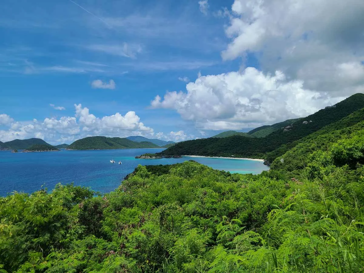
Virgin Islands National Park is located on the small island of St. John, which is in the eastern Caribbean and less than 20 square miles. The park itself makes up about 2/3 of the island, with about half of the park being entirely underwater! Many of the best things to do in Virgin Islands National Park involve the water in some shape or form- whether it’s swimming, snorkeling, paddling, or admiring the beach views.
To get to Virgin Islands National Park, the typical route is to fly into St. Thomas, a neighboring U.S. Virgin Island, and then take a ferry from St. Thomas to St. John.
Best time to visit Virgin Islands National Park
Winter months from December to April are the busiest time to visit Virgin Islands National Park. The weather is the mildest at this time (though still hot and humid!), but prices and crowds are higher.
The summer and fall months from June through October are hurricane season in the Caribbean, but the brunt of it is usually August and September, so it’s a bit risky to visit then and lots of places such as restaurants and accommodations might not be open.
We really loved visiting Virgin Islands in the spring- specifically in June. Though it was extremely hot and humid, it wasn’t too much different than any other time of year. Other than that, the weather was great, and it was still a bit early in the hurricane season so the risk of storms was low.
And the best part? We were out of peak season, which meant virtually zero crowds. We had no problem finding parking anywhere (other than at Trunk Bay- which is expected at a beach dubbed the world’s most beautiful!), and beaches weren’t packed. We even had some places to ourselves for a bit! I think coming to Virgin Islands National Park during the off-season really helped us have a much better experience, one where we got to enjoy the nature and scenery around us instead of fighting crowds for parking and beach spots.

Enjoying uncrowded beaches on St. John in the spring!
In general, though, no matter when you visit Virgin Islands National Park, expect very hot, very humid weather, with occasional short bursts of rain that last typically for five to ten minutes before the sun comes back out (typically not enough to ruin plans, and they are actually quite refreshing!).
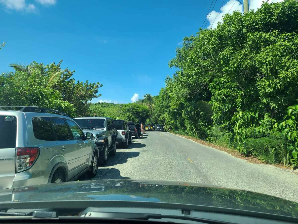
If you do come in the high season, expect some crowds as things can get busy. There is limited parking in downtown Cruz Bay and at all of the beaches and trailheads, and the Park Service recommends getting to the more popular places in Virgin Islands National Park, like Trunk Bay, Maho Bay, and Cinnamon Bay, before 10 am to get a parking spot.
One thing we did notice (and I’m not sure if this was an off-season thing or typical year-round) was that all the beaches seemed to start clearing out early, between 3 and 4 pm. By 4, we often found ourselves practically alone on some of the beaches! So if you’re looking for some solitude, even on the more popular beaches, late afternoon is the time to go.

An empty beach in the late afternoon!
How to get around Virgin Islands National Park
We would recommend renting a car to get around Virgin Islands National Park. There are only a few main roads that run through the park:
North Shore Road, which runs along the Northern coast of St. John where you’ll find many of the park’s most popular white sand beaches
Centerline Road, which runs through the center of St. John through the hills from west to east
Though mostly paved, the roads can still get quite rough, steep, winding, and narrow. And one important thing to remember- you have to drive on the left!

A typical view along St. John roads!
If you don’t feel comfortable driving or want to save some money, it’s also possible to get around Virgin Islands National Park by taxi. There are lots of open-air safari-style trunks that take people to all the popular places around the island. Taxis on St. John have set rates based on the destination, so you’ll always know what you’ll have to pay before going anywhere.
Things to pack for Virgin Islands National Park
Here are some things that come to mind that we would recommend packing for a trip to Virgin Islands National Park.
Sun protection- Hats, sunglasses, long sleeves, sunscreen- the whole shebang! Please make sure to use reef-safe sunscreen- anything else will damage the fragile reefs around the island. And make sure it’s SPF 1000 (just kidding…kind of…).
Bug spray- Some of the beaches can get pretty buggy. We experienced issues at Salt Pond Bay, Waterlemon Bay, and Francis Bay in particular.
Hiking boots or shoes- Even if you plan on just visiting beaches and snorkeling, we recommend a good pair of walking or hiking shoes. Some of the best beaches, like Waterlemon Bay, Salt Pond Bay, and Denis Bay, require a short hike, and the trails can get rough and rocky. We recommend wearing hiking shoes out and bringing a change of shoes for the beach once you get there.
Snorkels- If you plan on doing a lot of snorkeling like us, we recommend bringing your own snorkel set to Virgin Islands National Park. It will allow you to be more flexible on where and when you can snorkel, but if you do need to rent, there are plenty of places to rent a set for the day, including Maho Bay, Trunk Bay, Cinnamon Bay, and places in Cruz Bay and Coral Bay.
Plenty of food and water- There aren’t many food options throughout Virgin Islands National Park other than at a couple of the main beaches on North Shore Road, so we recommend always packing food and snacks with you for the day, and carrying plenty of water. You can always head back into either Cruz Bay or Coral Bay throughout the day for lunch and water…things are never too far away from each other on such a small island!
Where to stay in Virgin Islands National Park
The most common place to stay near Virgin Islands National Park is in Cruz Bay, the main hub of St. John on the western side of the island. Here, you’ll find the park’s visitor center, the ferry docks, restaurants, and plenty of guesthouses, villas, Airbnbs, hotels, and resorts ranging the whole gamut in price. There are also options in the quieter Coral Bay on the eastern end of the island.

A view of Cruz Bay on St. John
If you want to stay in Virgin Islands National Park itself, your only option is the Cinnamon Bay Campground located right on Cinnamon Bay Beach. You can choose from campsites or cottages with direct access to the beach.
Things to Do in Virgin Islands National Park
Now that we got some of the important details out of the way, let’s get into the good stuff!
There are plenty of things to do in Virgin Islands National Park- enough to fill days to weeks of your time, but they all fall into a few broad categories. The majority of things to do in the park often involve one of these:
Visiting a gorgeous beach for swimming, relaxing, or taking out a paddleboard or kayak.
Snorkeling along some amazing accessible reefs just offshore from the park’s popular beaches.
Visiting the ruins of historic sugar plantations scattered throughout the island, which date back to the 18th and 19th century Danish colonists. These plantations were used for sugarcane production and processing, and once played a big role in the island’s history, economy, and culture, and informational plaques around each of the ruins will teach you more about the island’s history.
Hiking on rugged trails through the tropical forest of St. John to get to ruins, beaches, and epic viewpoints over the island.
In this list of things to do in Virgin Islands National Park, we cover a little bit of everything, sharing with you our favorite beaches, snorkel spots, and hiking trails. To make it a bit easier, we’ll cover them in the order that you would encounter them when driving along the island on North Shore Road from Cruz Bay to Coral Bay (i.e. from west to east).
At the end, we’ll also share some extra things to do in Virgin Islands National Park that we ran out of time for, but that we’re keeping on our list for next time!
Hawksnest Bay

Hawksnest Bay
Hawksnest Bay is a small but beautiful beach along North Shore Road, just 2 miles from the Visitor Center in Cruz Bay. A narrow white sand beach stretches along the shoreline, with a few opportunities to set up under some shade along the tree line. We especially loved the backdrop to this Virgin Islands National Park beach, which had a mountains-meet-the-sea vibe that we love, and the contrast of the green hills with the clear blue water was beautiful.

Hawksnest Bay
It’s definitely worth a stop as you drive along North Shore Road, even if you don’t intend on hanging out for too long, though we suggest you do, because…
The snorkeling at Hawksnest Bay is really great and one of the best things to do in Virgin Islands National Park!

Snorkeling at Hawksnest Bay is an amazing thing to do in Virgin Islands National Park to see lots of coral and fish!
There are 3 small, narrow coral reefs that jut out right from the beach, so snorkeling here is really accessible. It was the first place we snorkeled in Virgin Islands National Park, and thought it was the perfect place for our introduction to snorkeling on St. John for a few reasons. The reefs were really shallow so we always felt safe and it was easy to see everything, and they were literally right off the beach so we didn’t need to swim far out to start seeing some really cool stuff. The water was super clear with good visibility, and the coral was really beautiful and colorful here with lots of different fish. Be sure to check out our Virgin Islands National Park snorkel guide to learn more about the snorkeling at Hawksnest Bay!

Snorkeling through coral formations on Hawksnest Bay

How to get to Hawknest Bay on St. John: Hawksnest Bay is just 2 miles down North Shore Road from the Cruz Bay Visitor Center. There is a small lot on the left that is often pretty full, but there is some room for parking along the side of the road on either side of the lot. Just make sure you are totally off the road and also not parking on any vegetation.

The parking lot for Hawksnest Bay

Roadside parking near Hawksnest Bay
From the parking lot, there is a short walking path to the beach. Here, you’ll find restrooms and changing rooms. There are also pavilions for rent, shaded picnic tables, and paved pathways that lead to different access points to the beach.
Peace Hill Ruins

Peace Hill Ruins
A visit to Peace Hill Ruins is a great thing to do in Virgin Island National Park to see the remains of an old sugar mill, and to get great views back over the North Shore of St. John.
From the parking lot, a very short, but consistently uphill, dirt trail leads up to the ruins. The trail can get quite rocky, so we suggest having sneakers or hiking shoes for this. We did it in our watershoes which we never changed out of after snorkeling in Hawksnest Bay, and it was doable since the hike was so short, but pretty uncomfortable and we really had to watch our step.


It took us just two minutes from the parking lot to reach the Peace Hill Ruins, once a windmill used in sugar production, and now a 300-year-old tall cylindrical tower that you can climb up into and explore.

Exploring the Peace Hill Ruins on St. John

Lovely views through the windows of the Peace Hill Ruins
Beyond the old sugar mill, a dirt path continues out onto the clearing at the top of the hill where you get gorgeous views over Hawksnest Bay to the west, and out over Trunk Bay to the east.

View over Hawksnest Bay from Peace Hill
View of Trunk Bay
And even better? We had this place and these amazing views all to ourselves the entire time! It’s not a very busy place, but it’s a quick enough stop to add to your Virgin Islands National Park itinerary for some solitude and views.
How to get to Peace Hill Ruins on St. John: The Peace Hill Trail is 2.7 miles down North Shore Road from the Cruz Bay Visitor Center. A small, well-signed lot will be on the left and can only hold a handful of cars, but parking will likely not be an issue here. On our visit, there were only a couple of cars here midday. The trail starts at the far end of the lot.

The parking lot for the Peace Hill Ruins
Denis Bay
Visiting Denis Bay ranks pretty high up on our list of things to do in Virgin Islands National Park. It’s an incredibly picturesque and secluded beach that you might have nearly all to yourself!

The beautiful Denis Bay on St. John
To get to Denis Bay, you’ll start the trail up to the Peace Hill Ruins, but just after you start, there will be an unmarked trail to the right. This goes down to Denis Bay. It took us about 10 minutes to get to the beach, with an 130 foot elevation loss. It’s entirely and consistently downhill, and sometimes a bit steep, however it’s entirely shaded which really helps.

Shortly after the trailhead for Peace Hill, you’ll see this unmarked split in the path. Continue uphill to Peace Hill Ruins, or take this right to go down to Denis Bay.

The hike to Denis Bay

A look back up the Denis Bay Trail
The trail is all dirt and rock, so we would recommend having hiking shoes or sneakers on. Again, we still had our watershoes on, which made it a bit uncomfortable and slower-going than it would have been otherwise, but it was doable.
Another neat thing about the Denis Bay Trail were the hermit crabs! As we got towards the bottom of the trail, we started to hear rustling in the woods around us, and we assumed they were lizards scurrying around…that is, until we found the culprit…hermit crabs!
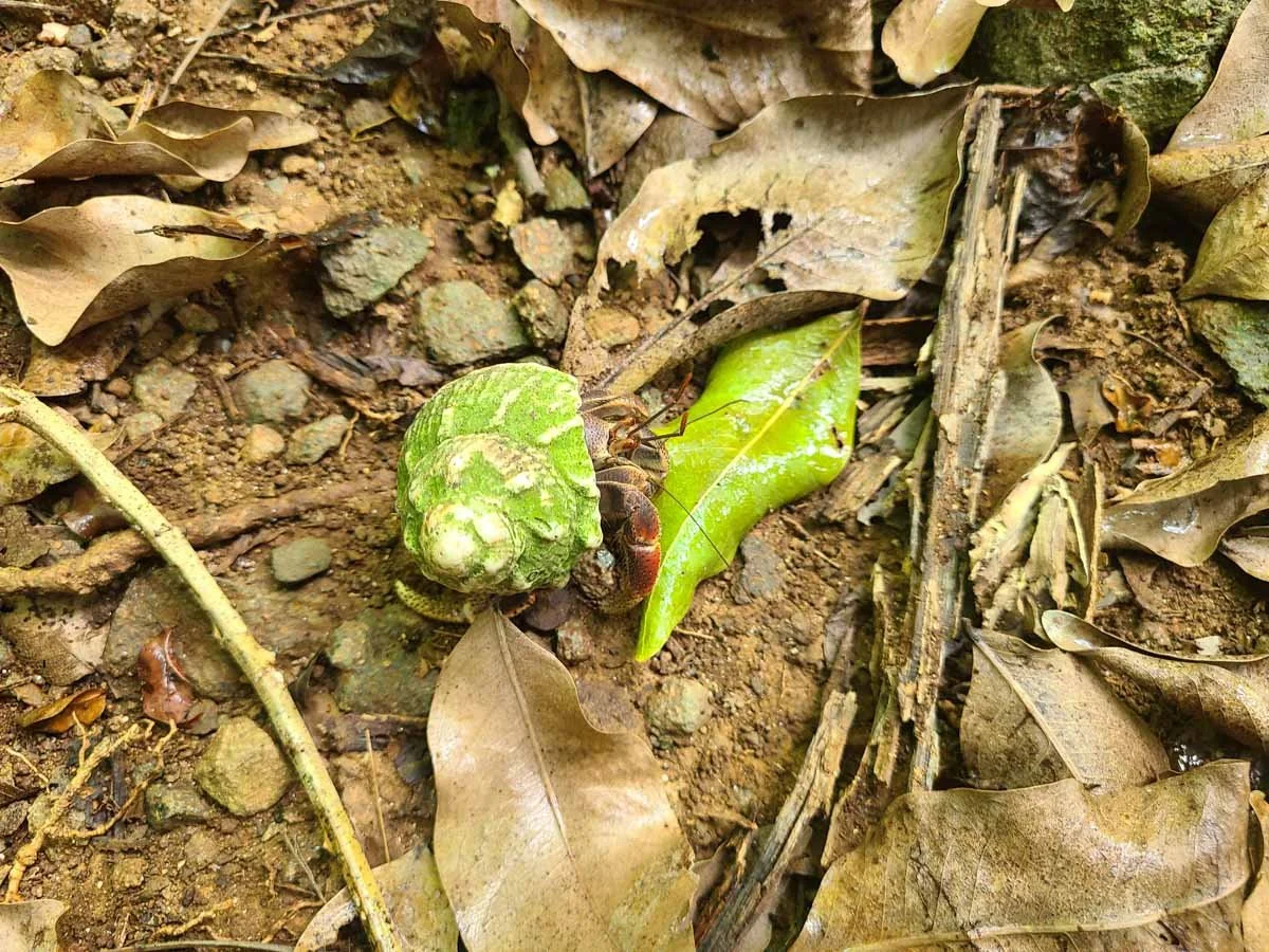
There were tons of hermit crabs on the Denis Bay trail!
These guys were pretty big, and a few of them had colorful shells. We noticed several of them along and on the trail on the way down to the beach.
After about ten minutes of hiking, the trail emptied us out onto Denis Bay. At first, it didn’t seem like it was anything special, but you’re at the far end of the beach here.
You’ll have to turn right and head further down the beach, and then things start to get really good! The water gets clearer and bluer, and the mountainous backdrop and palm trees come into view, and it’s absolutely gorgeous. In fact, this was probably our favorite beach in Virgin Islands National Park for its views!

Loving the blue water and tropical scenery of Denis Bay on St. John!

Not only is it really scenic, but it’s also a pretty empty beach. You won’t see the crowds of nearby places like Trunk Bay and Cinnamon Bay here, likely because it’s a little bit more off-the-beaten path, requiring a short hike to get here. There are also no obvious signs to this beach either (the parking lot only mentions Peace Hill and not Denis Bay).
When we got there, there were only a couple other groups at the beach, and by the time we left, it was just us and one other couple that had the entire place to ourselves. It truly felt like we had stumbled upon some remote and secluded piece of paradise!
And something else that makes Denis Bay so special? Well, the beaches of Virgin Islands National Park became particularly well-known and loved for their beautiful palm tree-lined beaches. Many beaches once had the picturesque and famous leaning palms that hung down over the sand. However, Hurricane Irma sadly destroyed most of these trees, but with a few exceptions. One of these famous leaning palms can still be found on Denis Bay, and it was really cool to see (and super picturesque)!
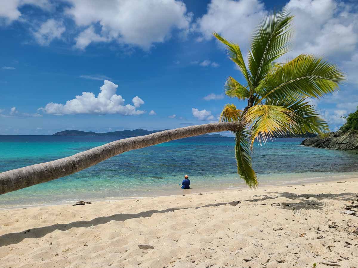
The hanging palm at Denis Bay

We spent quite a bit of time at Denis Bay enjoying the views and crystal clear water before slowly inching our way back to the trail. I was kind of dreading the hike back up, knowing that it was all uphill and super hot out, but it actually wasn’t at all as bad as I was expecting (mostly probably due to it being all shaded) and went faster than I thought it would.
One helpful distraction along the way back up were the tons of giant hermit crabs now scurrying about everywhere! I’m not sure if it was because of a brief rain shower we experienced while down on the beach that drew them all out, but the ground was now quite literally crawling. They were pretty fun to watch, and quite clumsy so it was funny to watch them roll around as they scrambled through the rocks and leaves.
Overall, we loved Denis Bay and would go back in a heartbeat. It truly felt like we had stumbled onto a hidden gem of Virgin Islands National Park.
How to get to Denis Bay on St. John: Park in the Peace Hill parking lot. Shortly after the start of the Peace Hill Trail, take the unmarked trail to the right all the way to the beach.
Jumbie Beach

Jumbie Beach on St. John
Jumbie Beach is a small, uncrowded, and picturesque North Shore beach. It has beautiful blue water, mountain backdrops, and some good shady spots under the trees that line the beach. The limited parking keeps this beach pretty empty, which we loved, and makes this a great thing to do in Virgin Islands National Park if you’re looking to avoid the bigger beach crowds.
From Jumbie Beach, you can look out over to the far more crowded Trunk Bay (and if you wanted to, you could probably swim between the two beaches along the rocky shore), but this felt like a quieter, more secluded version of Trunk Bay. We even had a deer and its baby visit as they munched away on beach-side vegetation. We spent about an hour a half here just enjoying the water and seclusion.

Swimming in the crystal clear water of Jumbie Beach. In the distance, you can see the more popular Trunk Bay.

How to get to Jumbie Beach on St. John: Jumbie Beach is just about 3 miles from the Cruz Bay Visitor Center along North Shore Road. There are a handful of parking spots on the right side of the road. You’ll cross the street to get to the signed trailhead. The walk to Jumbie Beach is easy and takes just a few minutes. Along the way, you might see some of the same giant hermit crabs that we also saw at Denis Bay!

The small parking area for Jumbie Beach. The trail is on the opposite side of the road.

The short path to Jumbie Beach
Trunk Bay
Trunk Bay often tops the list of things to do in Virgin Islands National Park, and for good reason- this picturesque white sand beach has been called the most beautiful beach in the world!

A famous view of Trunk Bay on St. John
At Trunk Bay, you’ll be treated to a long, beautiful white sand beach with crystal clear blue water. There are also a bunch of amenities not found at most other St. John beaches, such as a café and bar, a beach shop, showers and restrooms, and a place to rent snorkels and beach gear.
Offshore is Trunk Cay, a small island that houses a reef around its perimeter, and an underwater snorkel trail follows the west side of the cay. Along the trail, you’ll see coral and fish with informational underwater plaques that you can read as you swim along.
But you’ll have to pay a price for visiting the world’s most beautiful beach! Trunk Bay is the only beach on St. John that has a fee- it’s a small amenity fee of just $5 per person which can be paid at the booth in the parking lot, or ahead of time online at recreation.gov.
Because it’s such a famous beach, you’ll have to get here on the earlier or later side to get lucky with parking. The parking lot isn’t that big, and the Park Service advises you get there before 10 am to get a spot (though we would recommend earlier, especially if visiting during peak months). Even in the off-season, we drove by multiple times starting around 11 am and found the lot was filled, with a line of cars waiting for spots to open. It wasn’t until we drove back at around 5 pm that the lot seemed to be pretty empty.

A nearly empty Trunk Bay parking lot in the late afternoon!
So, if you’re not looking to spend the whole day here and just want to set your eyes on this world- famous beach without the crowds, then visiting Trunk Bay in the late afternoon is a great time. Most amenities here, like the café and rental shop are only open 8 am to 4 pm, so you might miss out on these.
To be completely honest, we didn’t visit Trunk Bay (cue the gasps!). I know, I know…we probably should have at least laid eyes on it, but by the time we drove by when parking was available, we were on our last day in the park and felt like Trunk Bay wouldn’t offer anything more than any of the other handfuls of beaches we had already seen, and to us it wasn’t worth paying the additional amenity fee at that point for just getting out and snapping a few pictures.
We did, however, admire the view of the famous beach from the Trunk Bay Overlook found along North Shore Road (the picture above was taken here). This is a well-known and beautiful view that you can find just before the Trunk Bay parking lot at these coordinates in Google Maps.
How to get to Trunk Bay on St. John: Trunk Bay is about 3.5 miles from the Cruz Bay Visitor Center down North Shore Road. The lot will be on the left, with easy access to the beach.
Cinnamon Bay

Cinnamon Bay
Cinnamon Bay is the longest beach in Virgin Islands National Park, and, like most North Shore beaches, has picturesque white sand and perfectly clear blue water. It’s a great alternative to Trunk Bay if you can’t find a parking spot there. Like Trunk Bay, there are also some nice amenities here, like an open-air restaurant (the Rain Tree Café) that serves breakfast and dinner, a food truck by the beach, a place to rent snorkels, paddleboards and kayaks, a small beach shop with food, clothes, and gear, and restrooms with showers and foot rinses.

The small shop at Cinnamon Bay
Cinnamon Cay, the island in the bay, is a good snorkeling spot
Because it’s so big, Cinnamon Bay makes a good spot to spread out from others and relax, walk along the beach, go for a swim, rent a kayak or paddleboard, and even snorkel around Cinnamon Cay, a small island in the middle of the bay which you can see right from shore. There are some good scattered shady spots at the tree line along the beach to set up under, but these are hot commodities so you might not luck out and get one.
The Cinnamon Bay area also provides easy access to some of the St. John’s historic sugar mill ruins. The remnants of an old warehouse (the oldest on St. John) are found right at the end of the main access path to the beach. Ruins of the Cinnamon Bay sugar plantation can be found along a half mile nature trail across the street from Cinnamon Bay.

Small ruins right on Cinnamon Bay beach
Another big draw to Cinnamon Bay is the Cinnamon Bay Campground. This is the only place to stay within Virgin Islands National Park, and can be a really great cheap option to stay on St. John if you don’t mind camping. The campground offers bare tent sites (so you’ll have to bring all your camp gear to the island with you, or you can rent camp gear and cookware for an extra fee), eco tents equipped with pretty much everything you need (basically beachside glamping!), and small cottages.
Staying at Cinnamon Bay will give you direct access to the beach, restaurant, watersport rentals, and beach shop. Plus, every other Wednesday night, the National Park Service holds their astronomy program right at the beach from November through May.
Of course, you’ll have to live without some basic comforts, like private bathrooms, reliable wi-fi, and A/C (actually, this was a dealbreaker for us…this island gets hot!)…but it might be worth it for such a cheap accommodation option (on an otherwise very expensive island) that’s right on the beach!
We spent about an hour and a half at Cinnamon Bay, floating in the crystal clear water, spotting iguanas along the shore, and taking in the views. We didn’t snorkel here because we had heard there were better places to snorkel in Virgin Islands National Park, and it was one of the more touristy beaches we visited, but we still really enjoyed it here.

An iguana on Cinnamon Bay beach!
How to get to Cinnamon Bay on St. John: Cinnamon Bay is about 4.5 miles from the Cruz Bay Visitor Center, or 15 minutes or so down North Shore Road. There’s a pretty large parking lot on the left side of the road. We got there at about 10:50 am in the off season and got one of the last two spots available, so it’s a pretty busy place and you’ll have to get here relatively early (or later in the afternoon), especially in the busier months.
Maho Bay

Overlooking Maho Bay
Snorkeling in Maho Bay was hands-down one of our favorite things to do in Virgin Islands National Park! Why is that? Because of the turtles!
Maho Bay is one of the best places to snorkel with turtles in Virgin Islands National Park. In the middle of the huge bay is a large sea grass bed where sea turtles and even southern sting rays love to hang out. On either side of the bay are rocky reefs with some coral and lots of fish, so overall, Maho Bay is definitely one of the best places to snorkel in Virgin Islands National Park.

Snorkeling with sea turtles at Maho Bay on St. John
Before visiting, we had read that early morning and late afternoon are the best times to see turtles here, and based on our experience, we can’t argue with this! We snorkeled for two hours in the late afternoon and saw 6 turtles! Some were small, but others were massive. We also saw some huge starfish in the seagrass bed, a southern sting ray, and lots of fish hanging out in the rocky reefs along the eastern edge of the bay. To learn more about our snorkeling experience at Maho Bay, check out our Virgin Islands National Park Snorkel Guide!
Maho Bay beach itself is beautiful, with the white sand, green mountain backdrop, and crystal clear water typical of the North Shore beaches.

The beautiful blue water of Maho Bay on St. John

There are some good amenities here, too, making it an easy place to spend an entire day. There are restrooms on the west end of the beach, pavilions to rent, and some picnic tables. Across the street is Maho Crossroads, with food trucks, small shops, snorkel and beach rentals, and paddleboard and kayak rentals that you can walk across the street for immediate water access. We have heard that a great place to kayak out to is Whistling Cay, the large island you’ll see from the beach. You can explore the island and bring snorkel gear for swimming around the surrounding reefs.

Maho Crossroads- just across the street from Maho Bay
How to get to Maho Bay on St. John: Maho Bay is about 5.5 miles from the Cruz Bay Visitor Center along North Shore Road (about a 20 minute drive). The beach runs right along the road on the left, with Maho Crossroads on the right. There are parking spaces lining the left side of the road along the beach where you can just hop out of your car and be on the beach in about 5 steps, so if you see one, grab it! There’s also a lot towards the eastern end of the beach, and you might get lucky with a spot there.
Tight roadside parking at Maho Bay
Francis Bay
Francis Bay is right next to Maho Bay and is another great place to swim with turtles in Virgin Islands National Park, but with less of the crowds found at the more popular beach.
Here, you’ll find a small parking lot on the southern end of the beach with some restrooms. The area of the beach right near the parking lot is where most people tend to hang out and swim.

Francis Bay on St. John
To get some space, you can head North along the beach, but just be aware that the northern half of the beach transitions from sand to pebbles and rock. This half of the beach isn’t exactly great for lounging out and relaxing, but it’s a good place to start snorkeling from, as the northern edge of the bay has a rocky reef with lots of fish and coral formations.
Also, not too far out from shore is a grassy bed, similar to the one in Maho Bay, where you’ll likely spot turtles and sting rays. We only snorkeled here briefly since it was the end of the day, but we did find one huge turtle in the grass beds and saw lots of cool fish along the northern reef.

View from the far end of Francis Bay

Swimming with a sea turtle at Francis Bay!

The reefs lining the edge of Francis Bay have lots of colorful fish!
Along the beach, there are some picnic tables and some shady spots under the trees that line the beach but just be careful here… a lot of the trees had thin thorny branches that kept poking us!
If you want to avoid a sandy and rocky beach walk to get to the other end of Francis Bay, there is a little shortcut you can take to get to the northern end of the beach. From the parking lot (near where the road comes in), there is the start of a boardwalk that makes up the bottom half of the Francis Bay Trail (we talk more about that below). This shaded boardwalk travels through mangroves and by a salt pond and quickly brings you to the rocky northern end of Francis Bay.

Look for this trail sign in the Francis Bay parking lot
The Francis Bay Trail
If you are looking to stretch your legs a bit, the Francis Bay Trail is a nice short nature loop near Francis Bay that takes you by some old ruins, around a salt pond that’s good for birdwatching, and down a mangrove-lined boardwalk.
As you’re driving down the road to Francis Bay, you’ll see an old building, trailhead sign, and small parking area that fits just a few cars on your right. It’s about a quarter mile up the road from the Francis Bay parking lot. Right by the small lot, you can explore the old Francis Bay sugar factory before starting on the trail.

Look out for this sign as you head to Francis Bay

Old sugarhouse ruins at the start of the Francis Bay Trail
The first part of the Francis Bay Trail brings you through a very lush, green path. Shortly, you’ll pass by remnants of the Mary’s Point Estate House. Between the looks of the ruins and the surrounding greenery, it almost felt as if we were walking through some sort of fairytale…it was kinda cool!

More ruins along the Francis Bay Trail

As you continue on the trail, you’ll get views over both the salt pond and Francis Bay. They look further down than they actually are, and it’s actually a very easy and quick walk down to the beach.

Looking out over the salt pond and Francis Bay
Eventually, the trail heads down through the trees (I was very happy to get some shade!), and it’s a quick and easy downhill walk to Francis Bay. Along the way, I kept noticing rather large holes in the ground along the side of the trail, and we wondered what made these…perhaps a mongoose?
It was then that I saw something move in one out of the corner of my eye…I glanced into the hole, and saw some of the creepiest-looking spider-like legs I had ever seen. But we had our answer…they were giant crabs! We never saw one come out, but I didn’t need to…

How creepy is this?!
After about only ten minutes (at a very leisurely pace), the Francis Bay Trail spilled us out at the rocky northern end of Francis Bay.
If you turn and walk left along the beach, you’ll see the lower part of the Francis Bay trail starting through the trees. This half of the loop is an easy and shaded boardwalk that wanders through the mangroves around the Francis Bay salt pond. It’s about a 5 minute or so walk along the boardwalk to the Francis Bay parking lot, but we took our time, admiring the tiny hermit crabs scurrying along mangroves on either side of the trail, and stopping at the two viewpoints over the pond to look for birds.

Walking through the mangroves at Francis Bay

The salt pond at Francis Bay
Once at the Francis Bay parking lot, you’ll have to walk back up the road (less than a quarter mile) to get back to your car in the upper lot.
How to get to Francis Bay on St. John: From Cruz Bay, Francis Bay is about 7 miles, or 25 minutes, down North Shore Road. Head all the way to the end of North Shore Road. At the end, you can either go right to the Annaberg Ruins, or take a left to Francis Bay. From here, it’s just a few minutes until the road ends at the Francis Bay parking lot right at the beach. The lot is fairly small, but if it’s full, cars might be lining the street (just be sure to park fully off the road and not on any vegetation), or you can try to park at the Francis Bay trailhead a quarter mile up the road and walk down via the road or the Francis Bay Trail.
Annaberg Plantation Ruins
A visit to the Annaberg Plantation is one of the best things to do in Virgin Islands National Park to learn about the island’s history and see one of the best and most extensive ruins on St. John.

The Annaberg Plantation Ruins on St. John
The Annaberg Plantation was actually the largest sugar plantation on the island and plays an important part in its history as part of the National Underground Railroad Network to Freedom.
When you visit the Annaberg Plantation, you can follow an easy walking path that loops through various ruins with several interpretive signs to teach you about the area and its history, and in the peak season from November to April, National Park staff are there to answer questions and give you more information.

In addition to the ruins, you’ll also get amazing views over the beautifully blue Leinster Bay, Mary Point, and the British Virgin Islands. It was one of our favorite views on St. John!

Views over the beautifully blue Leinster Bay
How to get to the Annaberg Ruins on St. John: From the Cruz Bay Visitor Center, the Annaberg Ruins are about 7 miles (25 minutes) down North Shore Road. Drive all the way to the end of North Shore Road, and take a right towards the Annaberg Ruins. After 0.3 miles, there will be a parking lot on you right- park here. If you continue up the road, the road ends in a cul-de-sac right at the ruins, but this is only for drop-offs and those with proper permits.
The Annaberg lot is a decent size, and when we visited here midday, we had no problem finding a spot, but we were here outside of peak season. The lot is also used by those wanting to visit Waterlemon Cay (next on this list!), so if you’re visiting in peak season, you might want to get here on the earlier side to ensure you have parking.

The parking lot for the Annaberg Ruins
From the lot, follow the sign to the Annaberg walking trail. The trail up to Annaberg Ruins is just a few minutes on a boardwalk, but it’s pretty much all stairs, so it’s a small workout (but at least it’s all shaded!). The trail will bring you right to the cul-de-sac at the end of the road, and from there, you can wander around the ruins.

Lots of stairs up to the Annaberg Ruins!
Waterlemon Cay and the Leinster Bay Trail
One of the best things to do in Virgin Islands National Park is to hike the Leinster Bay Trail to Waterlemon Bay and then snorkel around Waterlemon Cay. It’s an easy hike that leads to a beautiful bay with a small secluded beach and some of the best snorkeling that we did on St. John.

Views over the beautiful Leinster Bay (Waterlemon Cay is the small island on the left)
To get to the Leinster Bay trailhead, you’ll park at the parking lot for the Annaberg Plantation, and then walk across the street where you’ll see the obvious trail sign by the water. The hike starts off right along the narrow rocky shore, and on a sunny day, the water here is a brilliant blue that I couldn’t stop gawking over the entire time! Ahead and behind you, the green hills of Mary Point and the British Virgin Islands provide a beautiful contrast to the clear blue water. We absolutely loved the scenery from the Leinster Bay Trail!

The Leinster Bay Trail

Views over the beautifully blue Leinster Bay from the trail
The entire Leinster Bay Trail follows the Leinster Bay shoreline, and while it’s flat and easy, it is rocky, so even though you are headed to a beach, we would definitely recommend wearing a good pair of walking or hiking shoes for the hike out, and then changing into your water or beach shoes once you get there. There’s also no shade, so make sure you have plenty of sun protection for this hike.
After about 20 minutes of walking, you’ll come to Waterlemon Bay. There’s a small, semi-sandy beach area that makes a beautiful place to set up for a day of swimming and snorkeling. The Bay has a more remote feeling than the other more popular and easily accessible beaches along the North Shore.

Waterlemon Bay
Offshore, the narrow rock shelf gives way to a deeper grass bed (about 20 feet deep) where sea turtles love to hang out. We saw lots of turtle heads popping up as we looked out across the bay middle of the bay!

Two turtle heads pop up in Waterlemon Bay
We didn’t get in the water here, though…
Our sights were set on Waterlemon Cay, the small island at the edge of the bay ahead. Surrounding the small cay are beautiful rock and coral reefs with lots of opportunity to see colorful fish, turtles, and other sea critters, and it’s often cited as one of the best spots to snorkel in Virgin Islands National Park.
It’s possible to swim from the beach on Waterlemon Bay, but it would be a long swim. Instead, most people continue walking around the rocky and narrow shore to the opposite side of Waterlemon Bay, which will bring you to a point that’s directly adjacent to the island and will give you the shortest swim across the bay.
To get from the shoreline to the Cay, you’ll swim across some pretty deep water (again, probably about 20 or so feet deep), but along the way, we saw tons of southern sting rays gliding across the ocean floor, and schools of fish.
And once we got to Waterlemon Cay, we were treated to tons of colorful coral and fish. It was actually our favorite place to snorkel in Virgin Islands National Park!
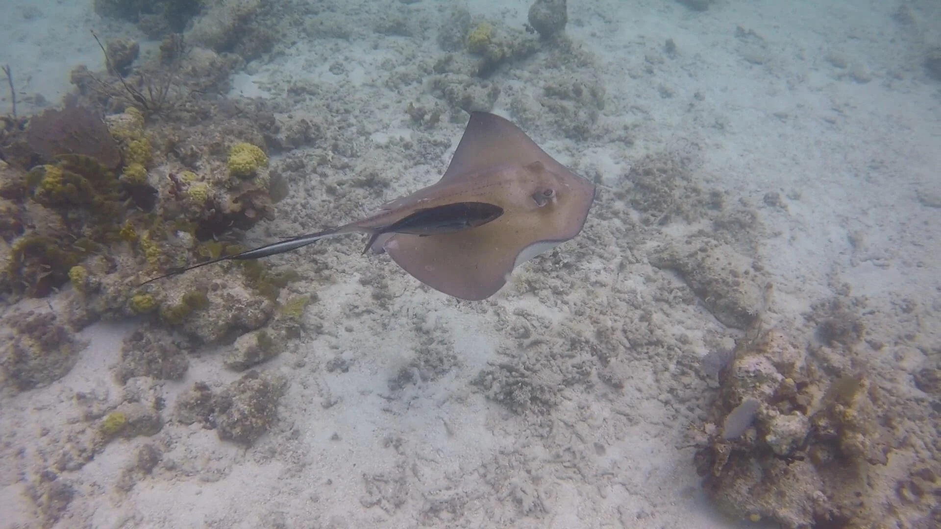
We saw lots of stingrays near Waterlemon Cay!

Lots of colorful coral and fish are found near Waterlemon Cay

How to get to Waterlemon Cay on St. John: Parking for Waterlemon Cay is at the parking lot for the Annaberg Plantation (about 7 miles from Cruz Bay down North Shore Road). Walk across the street to find the trailhead for the Leinster Bay Trail.

Look for this trailhead sign across the street from the Annaberg Ruins parking lot
While you’re out on Waterlemon Bay, there’s one more thing to explore here, which just happens to be next on our list of things to do in Virgin Islands National Park…
The Murphy Great House Ruins on Windy Hill
The Murphy Great House Ruins (or Windy Hill Ruins) are a lesser visited set of ruins in Virgin Islands National Park, as they require a bit of a hike to get to, but they are set at the top of a small hill overlooking Waterlemon Cay and out to Tortola and the British Virgin Islands. If you’re looking for a short hike with beautiful views and without the crowds, then hiking to Windy Hill Ruins is the perfect thing to do in Virgin Islands National Park.

Views over Waterlemon Cay from Windy Hill
The Murphy Great House Ruins sit atop Windy Hill along the Johnny Horn Trail that stretches about three miles between Coral Bay and Waterlemon Bay. The ruins are close to the Waterlemon Cay side of the trail. If you start from Coral Bay, you’ll have to hike much further (most of the length of the trail), and have much more elevation gain as the trail goes up and down the hills of St. John. So if you’re looking for a quicker and easier hike, then we suggest pairing your hike to the Windy Hill Ruins with a trip to Waterlemon Cay.
As we described above, you’ll walk along the flat and easy Leinster Bay Trail for about 20 minutes until you hit the beginning of Waterlemon Bay. Keep following the shoreline around the bay, and once the bay starts to curve back around to head up the other side, keep your eyes out for an opening in the treeline with a path into the woods.
Actually, there’s two openings. If you venture through the first opening, the path leads to a small set of ruins. Come back out to the beach and head just a tad bit further up to the next opening. Once you head in through here, you’ll see the trail sign for the Johnny Horn Trail (kind of hidden off to the right), and then the Johnny Horn Trail will start on the left.

Look for this path into the trees at Waterlemon Bay to start the Johnny Horn Trail to Windy Hill
The trail from here up to Windy Hill Ruins is a gradual but steady hike up the whole way. It’s not steep, but it’s pretty much entirely exposed to the sun, with very little shade, so the challenge here is the heat.

Views from the Johnny Horn Trail over Waterlemon Bay
It took us about 15 minutes of hiking to reach the ruins, where we were rewarded with amazing views over the bay and out to the British Virgin Islands. We didn’t stay too long because of the intense sun- we wouldn’t recommend doing this midday like we did! Instead, plan to hike to Windy Hill Ruins first thing, and then head back to Waterlemon Bay to cool off in the water with a swim and snorkel! Be sure to check out our Guide to Waterlemon Cay to learn more about hiking to the Windy Hill Ruins.

The awesome view over Waterlemon Cay from the Windy Hill Ruins
How to get to Windy Hill Ruins on St. John: Park in the lot for the Annaberg Plantation and take the Leinster Bay trail located across the street. Take the Leinster Bay Trail to Waterlemon Bay, where it connects with the Johnny Horn Trail that goes to the Windy Hill Ruins.
Salt Pond Bay

The beautiful Salt Pond Bay on St. John
Salt Pond Bay is another great beach in Virgin Islands National Park, but it’s not along North Shore Road. Instead, it’s found near Coral Bay on the southern shore of St. John. It’s generally less crowded than the more popular North Shore beaches, and there’s some great snorkeling here as well!
From the small parking lot off Coral Bay Road, it’s a quick 0.2 mile hike down to the beach. It’s a pretty rocky walk, so we’d recommend having a good pair of shoes on for the trek. It’s also all downhill from the lot- it gets a bit steep towards the bottom and there’s no shade along the trail (and remember…you’ll have to make the trek back up this to your car in the heat, so try to pack lightly!).

The trail to Salt Pond Bay
At the bottom of the trail, you’ll walk right onto Salt Pond Bay beach. It’s a pretty large sandy beach with vault toilets and picnic tables. We actually had read before going here that Salt Pond Bay beach wasn’t that pretty or scenic, but we’d definitely have to disagree with that… we loved it here!
I will say, you really have to walk across to the other end of the beach to get the full effect. As you walk further down to the center of the bay, the water becomes a beautiful blue, and from the far end of the beach, you can turn around to gorgeous views of the rolling green hills as a backdrop.

Salt Pond Bay
The beach is lined with trees that provide some nice shady spots as well as some picnic tables. But be warned…the mosquitoes and fleas here were vicious! We found it impossible to sit still without getting immediately swarmed and bit. We found what we thought would be a nice picnic table tucked into a nice secluded space in the trees, but quickly had to move out of there because the bugs were so unrelenting. The only way to avoid them seemed to be to get into the water!
But we absolutely didn’t mind getting into the water here. It’s a beautiful place to swim, as the water right offshore from the beach is amazingly shallow, clear, and blue…some of the clearest we had seen on St. John!
And even better? There’s amazing snorkeling in Salt Pond Bay as well, especially if you want to see turtles! As soon as I got into the water, I saw my first turtle right in the shallow part of the bay, and I got to swim with him for quite a while as he munched on the grass below- probably one of my favorite snorkeling experiences ever!

Snorkeling with turtles at Salt Pond Bay!
Further out in the bay, under the boat moorings, is a large sea grass bed where turtles are typically seen- and we saw five out here! The water does get deep out here (probably about 20 feet deep) and it didn’t have the best visibility, but we still had no problem seeing to the bottom and spotting all the turtles.

We found tons of turtles while snorkeling at Salt Pond Bay!
Along the edges of either side of the bay is some good snorkeling, too, among rocky reefs with fish and coral. We even got lucky enough to spot a moray eel! If you want to learn more about our experience snorkeling at Salt Pond Bay, check out our Guide to Snorkeling in Virgin Islands National Park!
While at Salt Pond Bay, there are a couple different options for more exploring and hiking if you’re up for it:
Drunk Bay: The trail to Drunk Bay leaves right from the beach (look for a well-marked sign along the edge of the beach). It’s a quarter mile trail to the other side of the peninsula where you’ll find a rocky area where you can watch waves crash against the shore and explore the boulder-filled coastline. We also hear there is some cool rock art here left behind by past visitors!
Salt Pond: Yes, there is actually a salt pond here that gives this bay its name! The Salt Pond is right behind the bay, and you’ll actually walk right along it on the Drunk Bay Trail. At certain times of year, piles of salt may actually line the shore of the lake due to a combination of salt entering from the bay and rapid evaporation. When we visited, it just looked kind of like a boring brown pond to be honest.
Ram Head Trail: If you’re looking for a longer trail that leads to awesome views, the Ram Head Trail is it! And it’s next on our list of things to do in Virgin Islands National Park, so stay tuned…

The Salt Pond
How to get to Salt Pond Bay on St. John: Salt Pond Bay is about 12 miles (40 minutes) from Cruz Bay. From Cruz Bay, you can take either North Shore Road or Centerline Road across the island to Coral Bay. From Coral Bay, head south on Coral Bay Road for 4 miles. The parking lot is a small dirt area that can hold about a dozen or so cars. It’s not particularly well-signed from the road, but it’s pretty obvious, and you’ll see the trailhead sign at the far end of the lot.

The Salt Pond Bay parking lot
The Ram Head Trail
Hiking the Ram Head Trail was one of our favorite things to do in Virgin Islands National Park. It’s a short 2.6 mile roundtrip hike past scenic beaches and through the drier, more desert-like landscape of St. John’s east end to a beautiful viewpoint at the southernmost tip of St. John.

View of St. John’s south coast from the Ram Head Trail
It’s not an overly challenging hike, but there’s not a lot of shade along the hike, so the heat and sun can get intense. Make sure to bring lots of sun protection and water, and try to avoid hiking this midday when the sun is at its strongest.
The Ram Head Trail starts from the Salt Pond Bay parking lot, passing through Salt Pond Bay beach en route. From the beach, you’ll climb up and over a small hill, with great views back over the bay, and then down to another secluded rocky beach (Blue Cobblestone Beach).

Hiking to Ram Head (seen in the distance)
From Blue Cobblestone Beach, make the final steep climb past groves of cacti and scenic views to the end of Ram Head. Look back for amazing views of St. John and on a clear day, you may be able to see St. Croix, another U.S. Virgin Island, faintly to the south.

Cacti and views on Ram Head on St. John
We loved this Virgin Island National Park hike…it was short and sweet (which was key for us in the intense heat of the Caribbean!) and had some of our favorite views on St. John.
The Reef Bay Trail
We didn’t do this, but hiking the Reef Bay Trail is a popular thing to do in Virgin Islands National Park, so we had to include it in our list!
This 4.4 mile roundtrip trail starts from Centerline Road high above the coast, and works its way down to a beach along the southern shoreline of St. John. Along the way, you’ll hike by some of the oldest and tallest trees on the island, get to explore the extensive ruins of an historic sugar plantation, take a detour to ancient Taino rock petroglyphs, and end at a scenic beach for swimming.
The trail is described by the Park Service as strenuous, and we could see why. Because the entire trail on the way out is all downhill, this means that the way back is all uphill. You’ll have to climb over 1,000 feet back to your car, and with the heat and humidity of St. John, this can be a challenge…it’s the main reason we chose to skip this hike!
We’re usually all for hiking (it’s really our jam), but after doing the shorter, less strenuous Ram Head Trail we described above, we knew that long hikes just weren’t in the cards for us here…the heat had really gotten to us, and we felt that there were easier ways to see beaches and ruins than to tackle this hike.
With that said, this hike gets rave reviews, so if you can handle the heat, then go for it (and tell us all about it, please!). Here are the hiking stats for the Reef Bay hike on AllTrails.
But hey! There is one way to make the Reef Bay Trail a bit easier if you’re willing to cough up some dough…
Reef Bay Trail guided hike
The National Park Service, in conjunction with the Friends of Virgin Islands National Park, hosts a one-way guided hike along the Reef Bay Trail.
The key word here is one-way.
The hike begins along Centerline Road and traverses downhill to the beach, with frequent stops for learning more about the area with the rangers. Once you make it to the beach, a boat will pick you up and take you back to the Cruz Bay Visitor Center, avoiding the long uphill hike back to the road…how great is that?!
There are a few things to note, though, about the Reef Bay guided hike:
It costs $100 per person
Rough conditions or other circumstances may prevent the boat from being able to pick you up, in which case you’d have to be prepared to hike back to the car. So boat pick up is not an absolute guarantee, but it’s highly likely.
The hike will be an all-day affair. You’ll start at the Cruz Bay Visitor Center at 8:30 am, and get dropped back off at 3 pm, so plan for the whole day.
The guided hike is only offered during primarily peak season, between November and mid-June.
Head here to book a spot on the Reef Bay Trail guided tour.
Other things to do in Virgin Islands National Park
Though we’ve already made a long list of things to do in Virgin Islands National Park that would take up several days to a week to complete, there’s still more! We told you, for such a small island, it certainly packs a punch.
Here are a few more things to do in Virgin Islands National Park that we didn’t get a chance to do, but that are still worth mentioning for those of you looking for more options.
Hiking in Virgin Islands National Park
Normally we are all for hiking…it’s our favorite thing to do! But let me tell you…the heat and humidity of St. John really got to me. We had intentions of doing more hiking in Virgin Islands National Park, but after doing the short hike to Ram Head, we knew that would be it for us.
But for those that can handle the heat, there are some more good options for hiking in Virgin Islands National Park in addition to the Ram Head hike and Reef Bay Trail that we already mentioned.
America Hill Great House Ruins: This trail starts on the Cinnamon Bay Trail that begins across the street from Cinnamon Bay Beach and Campground. About .2 miles in, you’ll reach an intersection- take the trail to the left for .4 miles to get to the ruins. In just .6 miles, you’ll climb over 400 feet, so it’s short but steep. At the top, you’ll get to explore the remnants of an old guest house and enjoy views over Maho Bay and Francis Bay. Here’s a great little review of the hike to the America Hill Ruins with pictures. And here’s the elevation profile and trail information for the American Hill Ruins on AllTrails.

Here, you can see the ruins of America Hill overlooking Francis Bay
Caneel Hill Trail: This is a roughly 600 foot climb to the top of Caneel Hill near Cruz Bay. At the top, a viewing platform gives way to great views over the North Shore of St. John. There are several places you can start the hike to Caneel Hill. One begins just past Mongoose Junction right on the outskirts of town, so if you can find parking in town, you can walk to the trailhead. Another trailhead is found along North Shore Road across from the Lind Point Trail near the National Park sign, but we didn’t see anywhere you could park around here. You can also start at the Caneel Hill Trailhead found along North Shore Road across from the old Caneel Bay resort. This will be a longer, more strenuous hike that also goes over Margaret Hill. This AllTrails review shows the Caneel Hill Trail as a point-to-point hike from either end of the trail (but you can do it as an out-and-back hike from either trailhead).
Honeymoon Beach via the Lind Point Trail: Honeymoon Beach is a remote beach with a not-so-remote feel to it. You have to hike to get to it, but once there, there are a good number of facilities (bathrooms/showers, some food options, and chair and cabana rentals from the Caneel Bay Beach Club) that make it a great all-day beach destination to hang out, swim, relax, and snorkel.
Honeymoon Beach is technically part of the now closed Caneel Bay Resort, and there are a few ways to get there.
The main way is to hike to Honeymoon Beach via the Lind Point Trail. This 1 mile trail starts at the Cruz Bay Visitor Center, passes by the Lind Point Overlook with views over Cruz Bay, and gives access to both Salomon and Honeymoon Beaches. There are just a handful of dedicated parking spaces for this trail at the Visitor Center- you’ll just need to head inside and grab a permit from the Park Service to display on your dash.

The Lind Point Trailhead at the Cruz Bay Visitor Center
You can cut out a portion of this trail by starting on the trail a bit up North Shore Road, by the National Park sign, but we didn’t see a good place to park here.
If you want to cut out the hike to Honeymoon Beach altogether, the Caneel Bay Beach Club runs a shuttle service from the resort to Honeymoon Beach for $6 each way, which can be reserved in advance.

The Honeymoon Beach shuttle
You can also get here by boat if you have one, or on a tour that includes Honeymoon Beach.
East End beaches of St. John
East of Coral Bay, a narrow peninsula juts out to form the East End of St. John. Here, there are a few more beaches of Virgin Islands National Park, including Brown Bay, and North and South Haulover Bays.
Brown Bay is quite remote, requiring a hike to get to (or you can visit by boat). We didn’t read anything spectacular about it, but it seems to be a good place to get away from the crowds and snorkel a bit around the reefs on either side.
North and South Haulover Bays have easy access with good snorkeling, but be prepared for rocky beaches.
Lameshur Bays
Further down Coral Bay Road, past the Salt Pond Bay trailhead and along the southern shoreline of St. John, you’ll find more remote regions of Virgin Islands National Park. The road turns into a rough and rugged dirt road that the Park Service recommends having a 4x4 high clearance vehicle for. Just a few miles down the road, you’ll find a couple of short trails and the gorgeous Little and Great Lameshur Bays.
These two bays are said to have some great snorkeling. In between is Yawzi Point. An easy and flat .3 mile trail goes past some small stone ruins to the tip of Yawzi Point, offering not only nice views, but small areas where you can access the water for snorkeling, which is supposedly super good around this point.
Catherineburg Ruins
These ruins are found along Centerline Road and above Cinnamon Bay, where you can explore the remains of an old sugar-producing windmill.
Hurricane Hole
Hurricane Hole is a large protected bay near the town of Coral Bay on the east end of St. John, famous for its mangrove mazes with unique coral reefs. It’s a great place to go out on a paddleboard or kayak (you can rent these from Crabby’s in Coral Bay). Or, you can take a tour that combines paddling and snorkeling through the bay’s mangroves and reefs.
Take a tour around St. John
There are tons of options for tours around St. John that include snorkeling, sailing, beaches, sunset cruising, kayaking, and more. Big companies like Viator, and more local companies like Cruz Bay Watersports and VI Ecotours, have lots of options.
Personally, we don’t think a tour is necessary to explore Virgin Islands National Park, especially if you’re looking to save some money in an already expensive destination. If you’re looking for snorkeling, amazing beaches, and places to kayak or paddleboard, there are plenty of awesome options that you can easily access yourself without having to pay for a tour.
But, if you want to leave the planning and transportation to someone else, or you want to access more remote places (such as Henley Cay, Caneel Bay, or kayaking in Hurricane Hole near Coral Bay), then tours are definitely an option.
Map of Things to Do in Virgin Islands National Park
We’ve covered a lot, so here’s a map of all the things to do in Virgin Islands National Park that we mentioned in this guide.
More Virgin Islands National Park Guides
Planning a visit to Virgin Islands National Park? Then check out all our Virgin National Park guides for tons more tips and information to help you plan your trip!
VIRGIN ISLANDS NATIONAL PARK GUIDES
We hope this guide gave you a better idea of all the awesome things to do in Virgin Islands National Park. Which one are you looking forward to the most? Let us know any questions you have in the comments below!