The Best Hike in Great Basin National Park: Alpine Lakes Loop, Bristlecone, and Glacier Trail
Looking for the best hike in Great Basin National Park? Luckily, three of the very best Great Basin trails- the Alpine Lakes Loop, the Bristlecone Trail, and the Glacier Trail- can all be combined into one epic hike. In this guide, we’ll go over everything you need to know to tackle this amazing hike in Great Basin National Park, including how to get there, when to go, and what to expect on the trail!
Great Basin is a National Park that is not high on many people’s lists. It sits in far eastern Nevada in the middle of the Great Basin Desert, kind of in the middle of nowhere, making it one of the least visited National Parks in the country.
But what if I told you that on just one amazing day hike in Great Basin, you could walk among the oldest living species on Earth, see Nevada’s only remaining glacier, and relax by two alpine lakes with amazing mountain views?
Not only that, but because it is such a remote park, you’ll likely have the views pretty much to yourself.
Interested? Then keep reading!
In this guide, we’ll tell you everything you need to know about how to combine three of the best Great Basin National Park hikes. You’ll tackle the Bristlecone Trail, the Glacier Trail, and the Alpine Lakes Loop and see many of Great Basin’s top sights all in one go!
Let’s get to it.
In this Great Basin National Park hiking guide:
About this Great Basin National Park Hike
Our favorite hike in Great Basin National Park combines three of the park’s best trails: The Alpine Lakes Loop, the Glacier Trail, and the Bristlecone Trail. Each Great Basin trail showcases a different aspect of what makes the park so special. Plus, it’s relatively easy for all the amazing stuff you get to see!
One of our favorite things about hiking in Great Basin was the solitude we found. Because these three Great Basin trails are pretty accessible and well-known, we thought that we would be fighting crowds all day, but that couldn’t be further from the truth. We enjoyed views of the Rock Glacier completely to ourselves for an hour and a half and saw very few people at the popular alpine lakes.
Great Basin National Park trail map
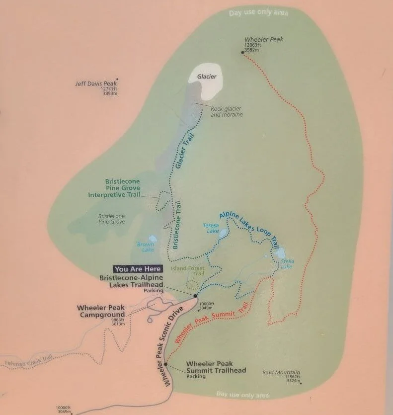
Here is a map highlighting where each of the three Great Basin hikes are located and why it’s easy to connect them into one larger hike. Each starts from the same trailhead found at the end of the Wheeler Peak Scenic Drive.
This is trail map of Great Basin found at the Alpine Lakes Loop trailhead. All of these hikes are found at the end of the Wheeler Peak Scenic Drive
The Alpine Lakes Loop-Bristlecone-Glacier Trail in Great Basin: Hiking Stats
Here, we give you the statistics of the total Great Basin hike (and below, we’ll break it up for you in case you are interested in hiking just one!).
Hiking stats for the Alpine Lakes-Bristlecone-Glacier Trail in Great Basin National Park:
Distance: 6.4 miles
Elevation Gain: 1,466 feet
Time: 3-4 hours (not including rest time at each viewpoint – we would say plan for more like 5 hours or so, so you can sit and enjoy the lakes and the glacier!)
Trail Profile:
The elevation profile of this Great Basin hike is from doing the Bristlecone-Glacier Trail first followed by hiking the Alpine Lakes Loop clockwise
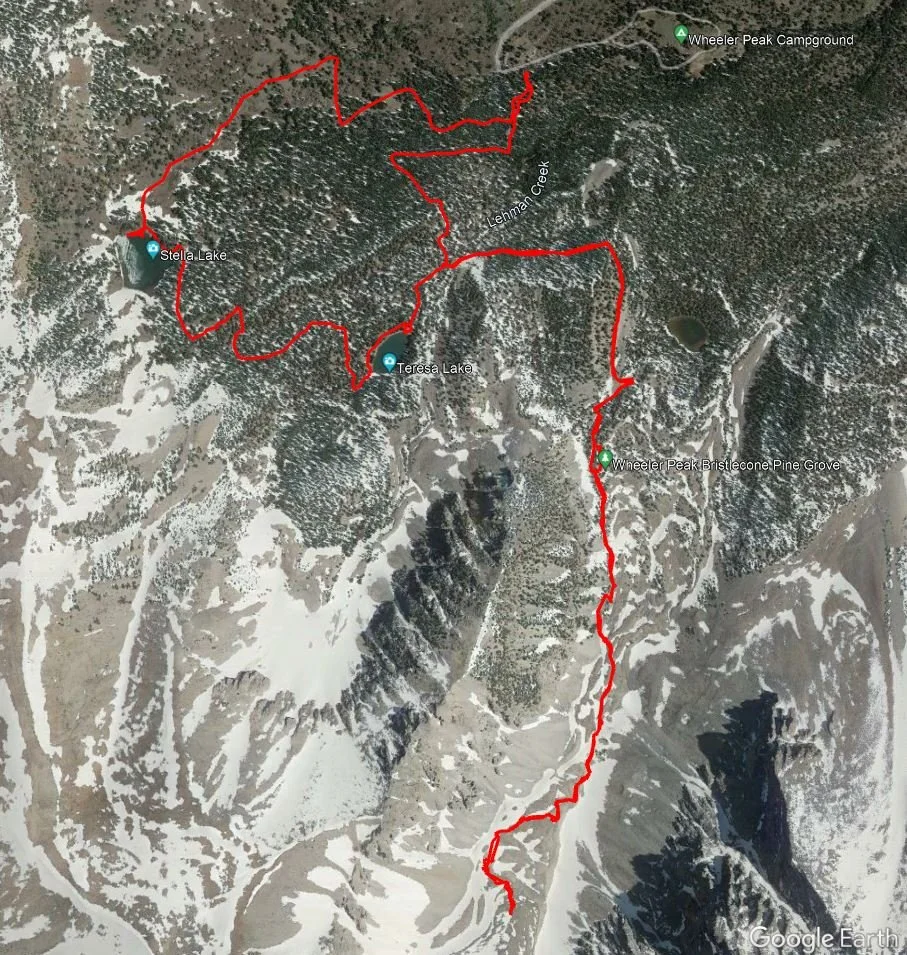
A satellite image from our tracking watch of our Great Basin hike
How difficult is this Great Basin hike?
Honestly, for all the amazing things you get to see, this Great Basin hike isn’t too hard at all! We would put it on the moderate side, though, mainly because of the altitude. Keep in mind that this Great Basin trail starts at 10,000 feet, and it only goes up from there, reaching just about 11,000 feet if you go all the way to the end of the Glacier Trail. You’ll probably feel the effects of this altitude, especially if you haven’t taken any time to acclimate. So take it slower, stay hydrated, and listen to your body. You might hike at a slower pace than you’re used to hiking because of this altitude, so plan in a little extra time that you normally would for this Great Basin hike. We would also recommend acclimating a bit at a lower altitude before taking on this Great Basin hike. Spend some time at the Lehman Caves Visitor Center, take a cave tour, walk the Mountain View interpretive trail, and spend a night camping at one of the park’s campgrounds.
Other than altitude, this Great Basin hike is pretty straightforward. The only part of the trail where we would say the terrain gets difficult is the end of the Glacier Trail. Once you get past the Bristlecone Pine Grove, you’ll enter glacier moraine territory where the landscape becomes rocky and unstable. You’ll be navigating a worn path through rock and boulders and you’ll be stepping over pointy rock and shale, so make sure you wear appropriate hiking shoes and step carefully.
Which direction should you hike the Alpine Lakes Loop-Bristlecone-Glacier Trail?
It doesn’t matter too much which direction you decide to hike this Great Basin trail, but we would recommend hiking in a clockwise direction. Start the Alpine Lakes Loop clockwise, and then take the branch that goes to the Bristlecone Pine Grove and the Rock Glacier. That way, you get most of your elevation gain out of the way early on in the hike. Once you hike back down from here, the Alpine Lakes Loop will be a breeze.
We also decided to hike this way to avoid crowds at both the Bristlecone Grove and on the Glacier Trail, and it certainly did work in our favor. We enjoyed the entire trail to ourselves and sat at the base of Rock Glacier for a good hour or so in complete solitude. On our way back down, there was quite a little crowd forming at the Bristlecones, so we were happy with our decision!
Great Basin National park hikes
Here is some information on each individual Great Basin National Park hike in case you wanted to tackle just one or two on their own.
Alpine Lakes Loop
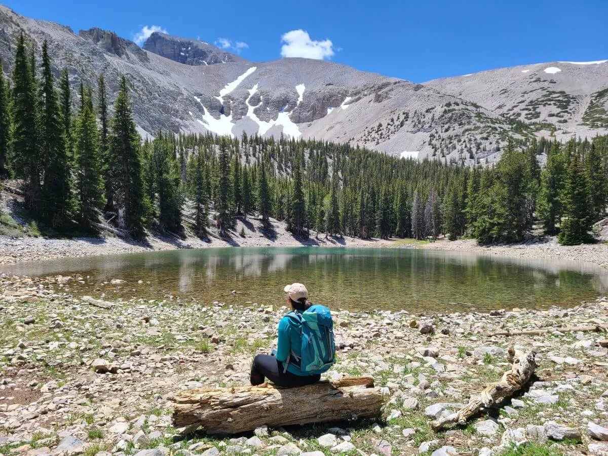
Stella Lake on the Alpine Lakes Loop in Great Basin National Park
The Alpine Lakes Loop is a popular hike in Great Basin National Park. It’s accessible, short, and pretty easy, and it will take you past two beautiful lakes (Stella Lake and Teresa Lake) with an epic mountain backdrop.
Something to note is that after particularly dry winters, these lakes can dry up to just small puddle-looking lakes. The epic alpine backdrop still makes the scenery beautiful and worth hiking to, but this is just something to keep in mind to keep your expectations at bay if coming during a dry year!
How long is the Alpine Lakes Loop in Great Basin National Park?
The Alpine Lakes Loop in Great Basin is just 2.7 miles, with only about a 450 foot gain in elevation.
How hard is the Alpine Lakes Loop?
The Alpine Lakes Loop is a very easy well-worn trail. We saw several families completing this Great Basin hike with no problem. Any elevation gain is pretty gradual. The highest point on the Alpine Lakes Loop is Stella Lake, so if you want to get all of the gain out of the way at the beginning of the hike, then walk the Alpine Lakes Loop counterclockwise to hit Stella Lake first. Then, it’s all downhill from there.
Bristlecone Trail
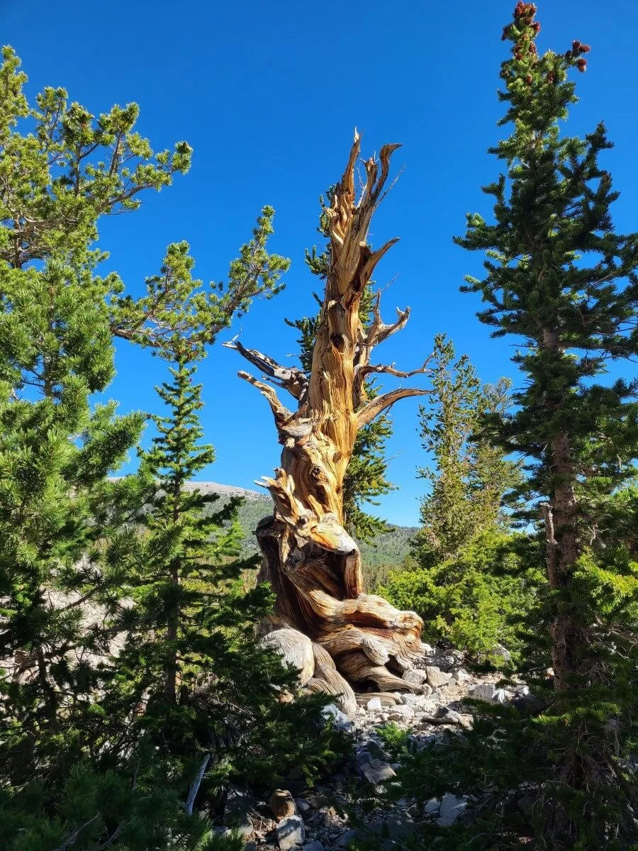
A particularly twisty Bristlecone Pine Tree along the Bristlecone Trail in Great Basin
The Bristlecone Trail is a short out and back hike to one of Great Basin’s most special features– a grove of Bristlecone Pines, which are the world’s oldest living species, the longest having lived almost 5,000 years! Not only that, but they are just generally a very cool and unique tree, taking on twisting shapes as they try to survive in their harsh alpine environment. The Bristlecone Trail takes you from forest up to the start of alpine territory, where you’ll find a short loop that navigates through the Bristlecone Pine Grove with interpretive signs to teach you all about these ancient trees.
How long is the Bristlecone Trail in Great Basin National Park?
This Great Basin hike is just 2.8 miles out and back with 500 feet of elevation gain.
How hard is the Bristlecone Trail?
This is another pretty easy hike in Great Basin. The elevation gain is pretty gradual, so even though you are at altitude here, the hike isn’t terribly steep. You’ll eventually start to hike on the beginnings of a rocky glacial moraine towards the end of the trail, so make sure to wear the proper footwear.
Glacier Trail
The epic Glacier Trail in Great Basin National Park
The Glacier Trail was our absolute favorite of the three Great Basin hikes we mention here. This trail takes you to an otherworldly alpine oasis that makes you feel like you’ve been completely transported out of Nevada. We had no idea this is what we could expect from Great Basin, and it certainly was a pleasant surprise!
The Glacier Trail shares its first half with the Bristlecone Trail, so it’s a good two-for-one hike! Once past the Bristlecone Pine Grove, you’ll continue onto the glacier moraine and navigate rocky terrain until you end your hike at the foot of Nevada’s only glacier- the Rock Glacier- at the base of Wheeler Peak. The glacier itself isn’t all that impressive, as it has succumbed to the effects of global warming, but just the entire alpine scene splayed out around you is totally worth the effort to get here.
How long is the Glacier Trail in Great Basin National Park
The Glacier Trail is a 4.8 mile out and back hike with just over 1,000 feet of elevation gain.
How hard is the Glacier Trail in Great Basin?
The Glacier Trail is the hardest of the three Great Basin Lakes we mention here. It has almost double the elevation gain, although it still remains pretty gradual for the entire hike except for the very end where the path briefly climbs steeply up the end of the moraine. Towards the end, the terrain becomes very rocky, and you’ll be navigating a worn path through rock and shale to get to the foot of the glacier. You might feel the effects of altitude up here as well.
How to Get to the Trailhead for the Alpine Lakes Loop-Bristlecone-Glacier Trail
All three of the Great Basin National Park hikes begin at the same trailhead found at the parking lot at the end of the Wheeler Peak Scenic Drive.
From where this road starts near the Lehman Caves Visitor Center, this road is about 12 miles one way and climbs over 3,000 feet in elevation as it winds its way up the Snake Mountain Range. Plan for about 20 minutes or so to drive this road.
The parking lot at the end of the scenic drive is fairly large. We would recommend getting there early, but you don’t have to get there at a crazy hour like some parks require in order to get a parking spot. We were a bit worried about this, so we drove up the road and got to the lot just before 8 am…and there were a whopping 6 cars in the lot! So there’s not a huge rush to beat the Great Basin “crowds”. Aside from crowds, though, you’ll want to get an early start, especially if you are hiking in Great Basin in the summer, as afternoon thunderstorms are common here. We would say 8 am is a pretty good time to start if you are completing this entire Great Basin hike. You’ll finish by about 1 or so, depending on how long you linger at various viewpoints and lakes.
The Alpine Lakes-Bristlecone-Glacier Trail in Great Basin National Park: Our Experience
Here’s our experience hiking this amazing Great Basin trail to give you an idea of what to expect!
The Bristlecone Trail in Great Basin
The trailhead for all three of these Great Basin hikes starts at the end of the Bristlecone Parking Lot at the end of the scenic drive. You’ll start off walking on a flat path through a sparse pine forest and almost immediately come to the junction for the Island Forest Trail on the left. This is a small interpretive loop trail which is easy to add on, but probably not worth it compared to what you’re going to see on the rest of this hike. Bear right to continue onto the Alpine Lakes Loop.
Shortly after this junction, you’ll get to another junction where the Alpine Lakes Loop splits and you can choose to go clockwise or counterclockwise. We took a left to go clockwise, so that’s how we’ll describe the hike here, going first to the Bristlecones, then up the Glacier Trail, and lastly, completing the Alpine Lakes Loop.
After leaving the junction, the trail begins to gently start climbing, but it’s very gradual, and remains gradual for pretty much the entire way. None of these trails are too strenuous, which is a good thing since you’re up at pretty high altitude.
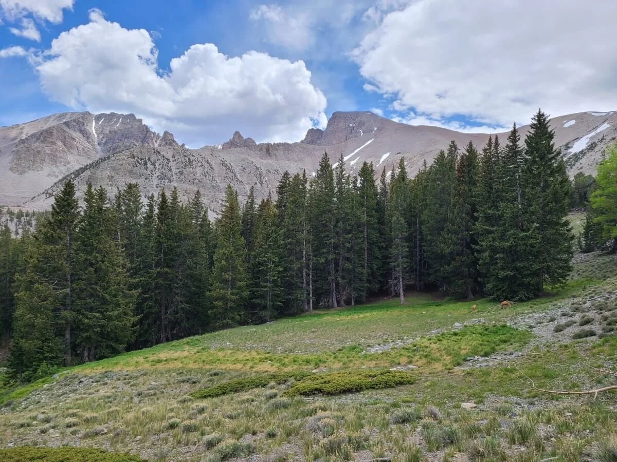
As the woods become more sparse the further you hike, you’ll start to get clearer views over to Wheeler Peak and the surrounding mountains. The trail also starts to become a little bit rockier, too, as you begin to transition into alpine territory.
Wheeler Peak coming into view from the Great Basin trails
About 0.7 miles into the hike, you’ll come to another junction. If you continue straight, you’ll continue along the Alpine Lakes Loop. Take a left here to branch off onto the Bristlecone Trail. This junction marks the halfway point to the Bristlecone Pine Grove.
Bear left here to continue onto the Bristlecone Trail in Great Basin
From here, the trail continues to steadily climb, but again, nothing is ever too steep. You’ll go in and out of sparse trees, and amazing views into the glacier cirque ahead begin to appear. Behind you, you can see the more desert-like landscape at lower elevations, and it’s pretty amazing to be in such a drastically different environment up here.
A switchback showing the typical trail grade on this Great Basin hike
The views really start to open up the further you hike on the Bristlecone Trail in Great Basin!
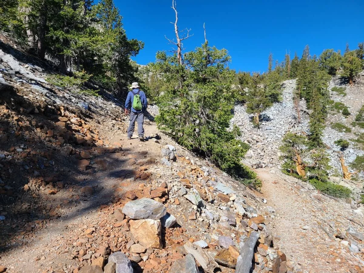
The trail gets rockier and the Bristlecones start appearing alongside the path
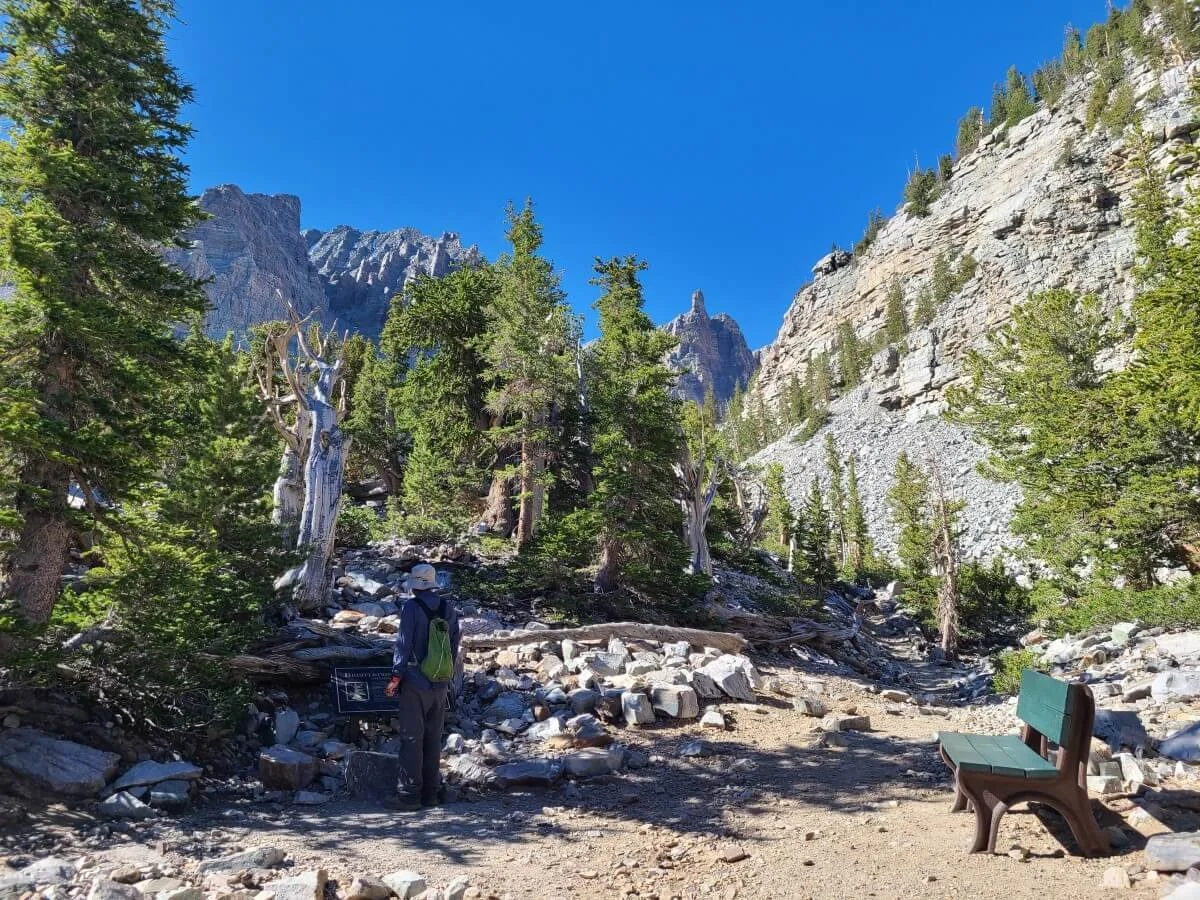
The landscape becomes very rocky the further you hike, but there’s still a very clear path. Eventually, the Bristlecone Pines will appear, and you’ll reach a bench with a sign which marks the start of the small loop that branches off the main trail and weaves its way through the Bristlecones.
The start of the short loop through the Bristlecone Pine grove in Great Basin National Park
These trees are super cool looking and totally worth hiking up here for. Take your time to wander the path, read all the signs, and admire the unique shapes of these ancient trees.
The Glacier Trail in Great Basin
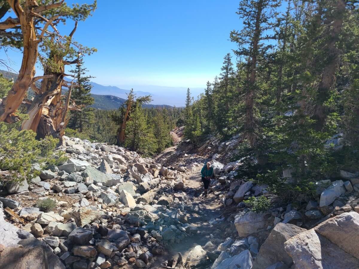
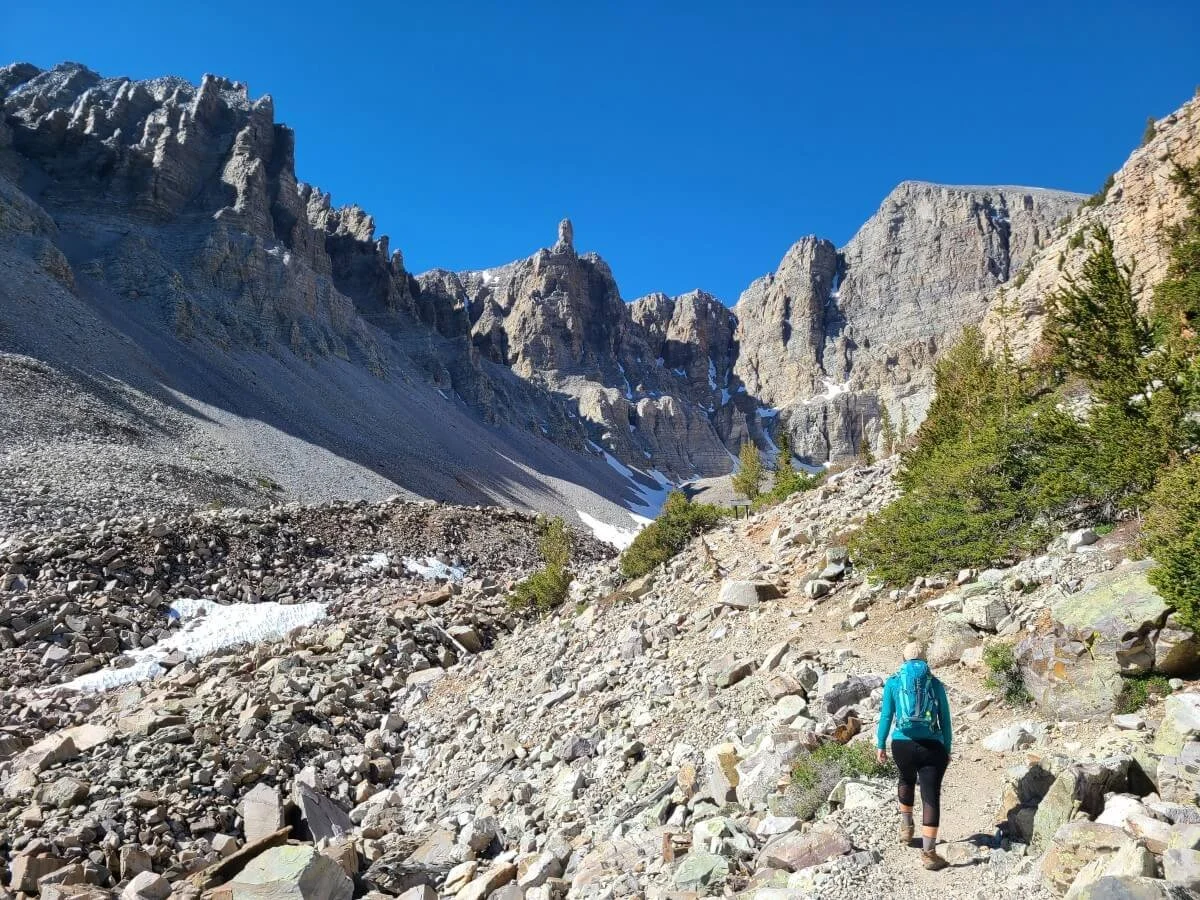
When you’re done with the Bristlecones, continue on the main path towards the glacier. Once on this Glacier Trail, you’re getting into true glacier moraine territory. There are sparse trees here and there, and it’s mostly a landscape of boulder and rock, and eventually, you’ll have to begin navigating this terrain as you walk across pointed rocks and shale. There are no trail markers, but the path is well- worn and easy to see.
Heading across the glacier moraine on the Glacier Trail in Great Basin
Eventually, you’ll come to a sign with a description of the Rock Glacier, which seems like the end of the trail, but this is only a viewpoint along the way, and you can see the well- worn rocky trail continue on a switch back as it continues to climb along the moraine. It’s possible to stop here and turn around if you don’t feel like navigating the rest of the moraine. You’ll still have had amazing views!
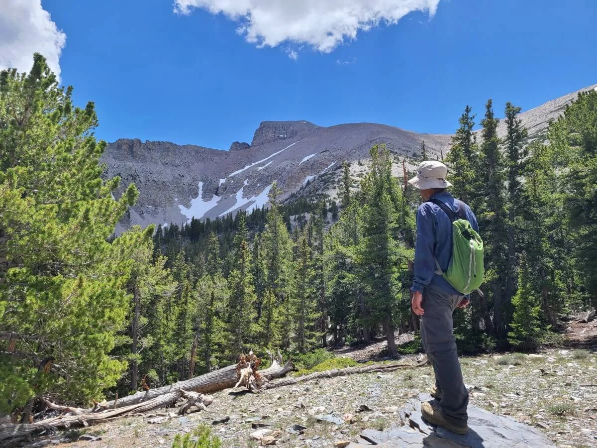
Kevin enjoying the views from the Glacier Trail. The signed viewpoint is just ahead on the trail (you can see it if you look closely).
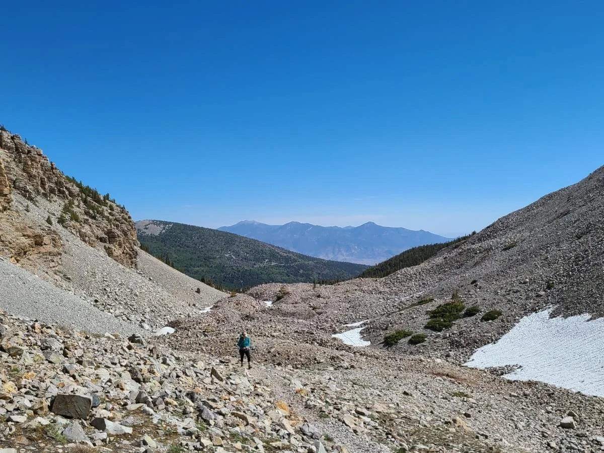
If you continue from here, you’ll just keep following the path into the glacial cirque as you get closer and closer to the Rock Glacier. If it’s early on in the season (this was June for us), you might have to cross some slippery snow patches here and there. We didn’t need any special gear like microspikes, but if you come early in the season, it’s just something to expect.
Navigating the rocky terrain on the Glacier Trail in Great Basin National Park
Lingering snow on the Glacier Trail
Towards the very end of the trail is the toughest part of the entire Great Basin hike (this is all relative…it’s still not that bad!). Ahead, you can see a series of small hills in the moraine that you’ll have to climb. These climbs are a bit steep, but they don’t last too long.
Hiking up the rocky hills of the glacier moraine on the Glacier Trail
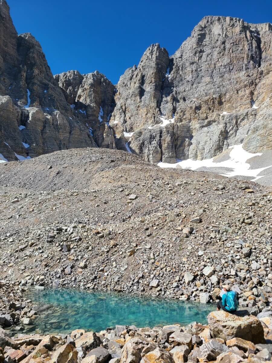
We topped out on the first bump and came to an unexpected little alpine tarn that I quickly became obsessed with. It was such a brilliantly deep blue color, and we spent some time hanging out here and admiring the views.
Look at that blue water!
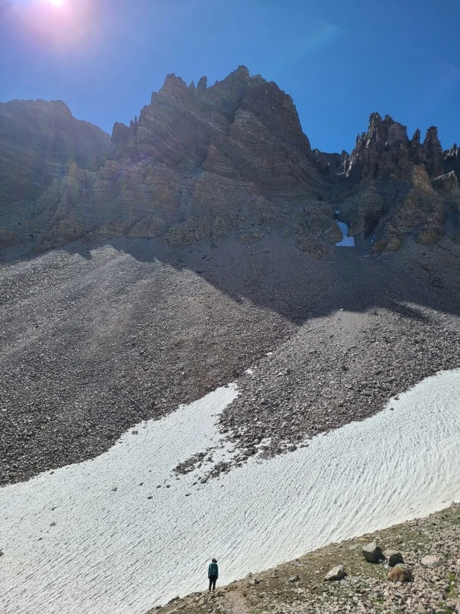
Looking tiny next to the giant mountains surrounding us on the Glacier Trail
But…the Glacier Trail continued. We weren’t sure where it went or how much further it would go (it seemed to keep going and going), but we decided to follow it as far as we could. Well, Kevin did anyway. For now, I was content sitting next to my little alpine tarn. So I watched as Kevin continued navigating and climbing up the rock piles. He was determined to see what unexpected view would be just over that next tall bump in the distance…maybe another tarn? Or a glacial lake?
Can you see Kevin standing at the end of the trail? He looks so tiny among the giant mountains!
As I watched him get further and further until he looked like a tiny ant among the giant mountains around him, I decided I should keep going, too. So I continued navigating my way through the moraine. At the end, our efforts weren’t rewarded with another tarn or lake, but instead this sign, which pretty much indicated the end of the road. Kevin climbed up the one last steep bump just past this sign, but the trail seemed to fizzle out and the views weren’t that much different from up there.
The end of the Glacier Trail in Great Basin
Kevin heading back down from the last hill at the end of the Glacier Trail
We hung out here at the end of the Glacier Trail for almost an hour in complete solitude. We seriously couldn’t believe the solitude here, and these views! It felt like we were miles and miles and miles into an alpine wilderness, and certainly not in Nevada. But in the distance, we could still see the brown Great Basin Desert. It’s definitely pretty neat to be able to go between two drastically different landscapes, especially on such a short hike…it makes you feel totally transported.
And we just couldn’t believe we had this all to ourselves! It was then that I remembered a little snippet from the Astronomy Program we attended the night before in the Great Basin amphitheater. The ranger was getting a feel for the audience and asked us to raise our hands if we came to Great Basin National Park specifically for the dark skies and stargazing. Not surprisingly, most people raised their hands. Then she asked us to raise our hand if instead we came for cave exploration. Next, she asked if instead we came to see the famous Bristlecone Pine Trees. With both, several hands were raised. And this is all expected…after all, Great Basin is known for all these amazing things. Last, she asked anyone to raise their hands if they came to walk among the alpine lakes and hit the trails. Crickets. No one raised their hands. All this to say that hiking in Great Basin is not the main draw for most visitors to the park. But, their loss is our gain, and if you do decide to hit the trails in Great Basin National Park, you’ll be rewarded with this kind of amazing solitude.
So, we sat there, listening to the wind and the echoes of the birds off the nearby mountains, just soaking it all in, feeling like we were in a different world. Eventually, we had to pull ourselves away and continue with the rest of the hike. On the way down, we made sure to stop one more time at my favorite little alpine tarn and get a few last pictures.
Still can’t get over the color of this tarn…my favorite spot in Great Basin National Park!
The Alpine Lakes Loop in Great Basin
When we got back down to the Bristlecone Pine Grove, a small crowd was actually starting to appear in this area, so we were definitely glad for our early start, but we were worried that the Alpine Lakes Loop, which is just as popular as the Bristlecones, would now be pretty crowded as well (spoiler alert: we were wrong).
We got back to the junction with the Alpine Lakes Loop and took a left to continue on the loop. From the junction, it was short easy walk to Teresa Lake.
Teresa Lake is a beautiful alpine lake with Wheeler Peak as a backdrop. Surprisingly, no one was there, and we enjoyed the view to ourselves for a few minutes. Luckily, the lake was pretty full (this one in particular can get pretty small in dry years).
Enjoying the view from Teresa Lake on the Alpine Lakes Loop
The view of Teresa Lake as you continue along the Alpine Lakes Loop
The Alpine Lakes Loop hike continues around the lake to the other side and follows the inlet stream for a bit before it starts a gradual climb of a few hundred feet up to Stella Lake. Despite being later in the day and being one of the more popular hikes in Great Basin, we only crossed paths with a few other people heading in the opposite direction, and the whole trail was pretty peaceful.
The uphill hike to Stella Lake on the Alpine Lakes Loop
Don’t forget to look behind you for views of Wheeler Peak!
Stella Lake, in our opinion, is even more gorgeous than Teresa Lake. When coming at it from this direction, make sure to go around to the other side of the lake, which is where the most epic views of Wheeler Peak are.
We hung out here for a while and ate some lunch as we watched several families play at the shore (it looked like a regular beach day here!).
The gorgeous Stella Lake in Great Basin!
Stella Lake is the highest point along the Alpine Lakes Loop, so from here, it’s all downhill to get back to the trailhead. Just past the lake, you’ll pass two junctions that go to the left. These are for the Wheeler Peak Summit Trail, so continue straight at both junctions.
Don’t forget to look behind you as you hike out from Stella Lake for your last views of the mountains
Say goodbye to the view of the Wheeler Peak cirque behind you before eventually ending up back in the forest for an easy walk back to the trailhead. And just like that, your epic hike in Great Basin is done!
Best Time to Hike in Great Basin National Park
If you hike in Great Basin early in the season (spring), expect some lingering snow on the trails!
As with most alpine environments, the best time to complete this Great Basin National Park hike is late spring to early fall, when the roads and trails are free from snow. In fact, the Wheeler Peak Scenic Drive which brings you to the trailhead is only open generally from late May to mid-October. However, in 2023, because of unusually high snowfall, the road is not projected to open until July 1st! So always check road status and conditions before you go.
Where to Stay Near the Best Hikes in Great Basin National Park
If you want to stay near these amazing Great Basin hikes, then you’ll have to camp in the park. There is no lodging in Great Basin, so camping will be your only option.
There are 5 developed campgrounds in the park (Baker Creek, Grey Cliffs, Lower Lehman, Upper Lehman and Wheeler Peak Campgrounds). The best place to stay right near the Alpine Lakes Loop trailhead is the Wheeler Peak Campground. This is found right at the end of the Wheeler Peak Scenic Drive as well, and you can walk right from camp to the trailhead. Upper Lehman Campground is the next closest place to stay near the Great Basin hikes, and is about 9 miles down the Wheeler Peak Scenic Drive from the trailhead. Lower Lehman Campground is a little bit further away down the scenic drive.
Our tent in the Wheeler Peak Campground near the Alpine Lakes trailhead
It's also possible to camp or stay in lodging just outside of the park in the small town of Baker, but your options are pretty limited. Otherwise, the best place to stay near Great Basin is about an hour away in the town of Ely, where there are many more options.
Can you camp in the Alpine Lakes Loop in Great Basin?
Backcountry camping is possible in Great Basin, but unfortunately not in the Wheeler Peak Day Use Area, and all three of these hikes lie in the area. So camping at Stella or Teresa Lake, along the Bristlecones, and at Rock Glacier, is off limits. If you are interested in backpacking in Great Basin, check out the park’s website for more information on where you can camp and how permitting works.
Tips for Hiking in Great Basin National Park
We’ve probably already mentioned most of these above, but here are just some extra tips when it comes to hitting the trails in Great Basin.
Start early. We’ve mentioned this above, and it’s not necessarily to avoid heavy crowds, which don’t really seem to exist too much on the Great Basin trails, but really it’s to avoid afternoon storms which can be pretty common here.
Wear good hiking shoes. As you can see in the pictures above, the Bristlecone and Glacier Trails can get pretty rocky with unstable footing. You’ll definitely want to wear appropriate hiking shoes or boots for these hikes.
Bring layers. It might be hot in the desert basin where you drive from in the morning, but at 10,000-11,000 feet, the weather can be quite different with a 10-15 degree temperature difference. Make sure to have layers and also rain gear- just in case.
Bring sun protection. Up at this high altitude, make sure to wear sunscreen, and have a hat and sunglasses.
Altitude. This Great Basin hike starts high up (10,000 feet) and only goes up from there. We recommend acclimating as best as you can at lower elevations by hiking around the Lehman Caves visitor center and maybe going on a cave tour. Camping at one of the park’s campgrounds will also help you acclimate. When hiking in Great Basin, be sure to stay hydrated and listen to your body. Turn around if you start feeling sick and don’t try to push yourself too hard.
Water and food. Great Basin only has one small café at Lehman Cave Visitor Center. We suggest packing in your lunch for the hike, and carry a lot of water with you. You can fill up at the Lehman Caves Visitor Center at a spigot on the side of the building (water is not typically available at picnic areas or the campgrounds anymore, so don’t expect to fill up at the Wheeler Peak Campground before your hike).
Check conditions. Make sure to check on road and trail conditions in Great Basin before heading out to the park (in case of any road or trail closures).
Looking for More Things to Do in Great Basin?
Heading to Great Basin and want more help planning your trip? Check out our other Great Basin articles!
Great Basin Guide and Itinerary – Check out the 10 best things to do in Great Basin, including hikes, cave exploring, and stargazing. Plus, learn how to spend one to three days in the park with our Great Basin itineraries.
Wheeler Peak- Looking for a more challenging hike in Great Basin? Check out our guide to hiking Wheeler Peak for everything you need to know about climbing the tallest peak in the park.
The Alpine Lakes-Bristlecone-Glacier Trail is an amazing hike in Great Basin National Park from start to finish. Let us know in the comments if you have any questions, we love to help!

