Things to Do on the South Rim of Black Canyon of the Gunnison National Park
During our road trip through Colorado, I will admit that the Black Canyon of the Gunnison wasn’t a high priority on our to-do list. But since we were driving from Breckenridge to Silverton, this National Park would be right along our route, so we decided to dedicate a couple of days to it. And I’m definitely glad we got to check this one off our list.
The Black Canyon of the Gunnison is a small park - it can be visited in as a little as a day, and doesn’t see the swarms of visitors of some of the more popular and well-known parks. And while it doesn’t receive quite the hype as somewhere like Yosemite or Glacier, I think it’s definitely worth your time if you happen to find yourself in Colorado, because seeing the canyon in person does what pictures will just never do.
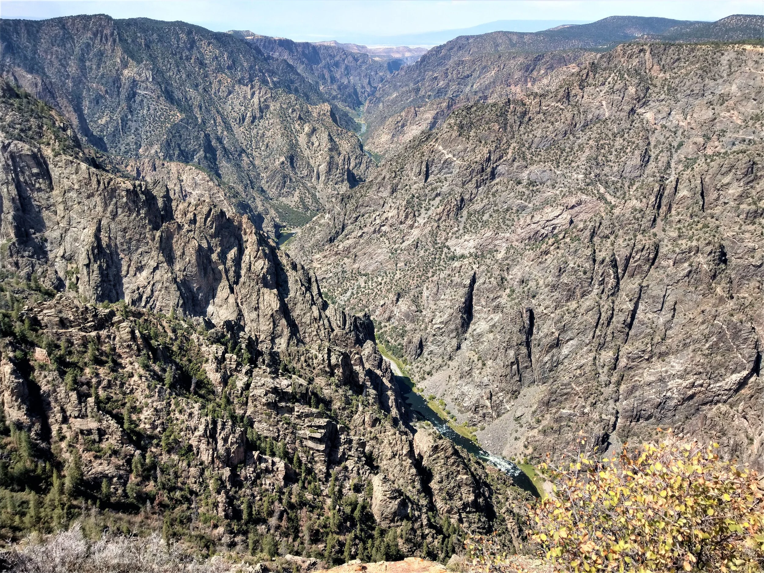
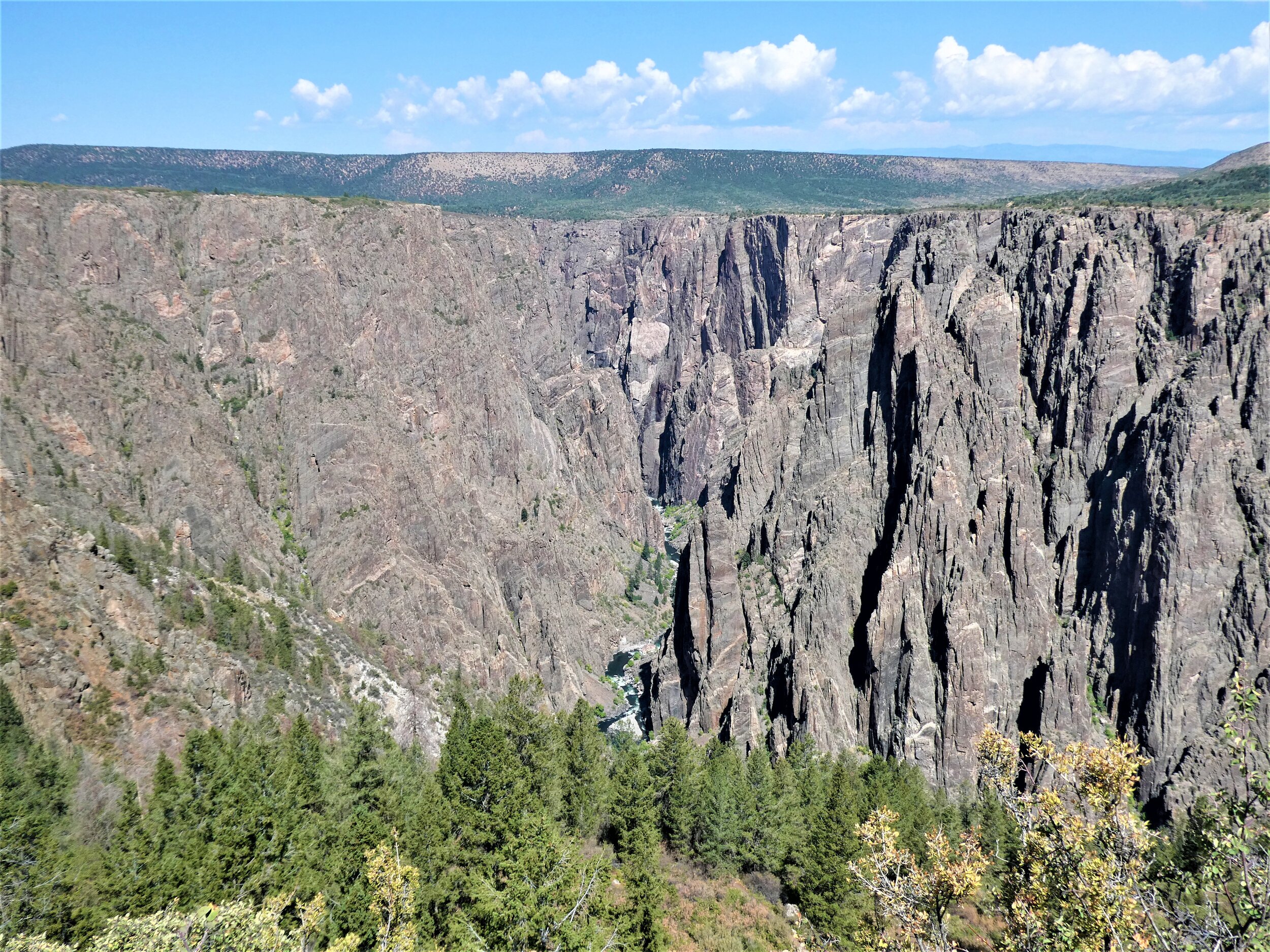
The Black Canyon of the Gunnison is a stunning, deep, jagged canyon that runs 48 miles. At its tallest, it stands at 2,722 feet, and at its narrowest it is 1,100 feet wide. At the park, you can view the canyon from every angle imaginable, getting good looks down to the Gunnison River flowing below you from dizzying viewpoints along the park’s scenic drives. Or if you’re up for the challenge, you can hike (more like scramble) one of several wilderness trails from the rim to the canyon floor to experience the canyon from a totally different perspective.
You can explore Black Canyon of the Gunnison from both its North Rim and South Rim. The South Rim is the more popular, busier, developed side of the canyon while the North Rim is much quieter and a bit more primitive with fewer facilities. If given a choice, most visitors choose to spend their time in the National Park on the South Rim. In this post, we’ll cover all the must-sees and best things to do along the South Rim of the Black Canyon of the Gunnison, go over how much time you’ll need to explore the South Rim, and give you our take on which side of the canyon we liked more!
Article Contents
Where is Black Canyon of the Gunnison National Park?
Best time to visit Black Canyon of the Gunnison
Best things to do on the South Rim of Black Canyon of the Gunnison
How much time to spend on the South Rim of Black Canyon of the Gunnison
North Rim versus South Rim of Black Canyon of the Gunnison
Where to stay on the South Rim of Black Canyon of the Gunnison
Want to save for later? Pin this post and come back when you’re ready!
Where is the Black Canyon of the Gunnison National Park?
This underrated park is located seemingly in the middle of nowhere, but not too far from major Colorado hotspots. Located near the Gunnison National Forest and the Curecanti National Recreation Area, it’s an hour and half southeast of Grand Junction, an hour and 45 minutes north of Silverton, and 4 hours south west of Breckinridge.
The entrance to the south rim of the Black Canyon of the Gunnison is located off of route 50 between Montrose and Cimarron. You’ll turn onto route 347 and arrive at the entrance station shortly after.
Best Time to Visit Black Canyon of the Gunnison National Park
Summer is the best time to visit this national park for the best weather and accessibility. All the park’s main roads, including both rim roads, are closed between November and April due to snow. In the summer, though, expect hot days with lots of sun exposure, and the biggest crowds (along the South Rim). Also keep in mind the chance for afternoon thunderstorms that can be common in this area, so plan your time accordingly and always check the forecasts.
Best Things to Do on South Rim of Black Canyon of the Gunnison
Drive the South Rim Scenic Road
The number one thing to do along the south rim of the Black Canyon of the Gunnison is to drive South Rim Road. This road stretches just over 7 miles one way from the entrance station to High Point, where the road ends in a parking area for the last viewpoint and a popular hiking trail.
Along the South Rim scenic drive, there are 12 viewpoints to see the Black Canyon from all different kinds of perspectives and really get a good grasp of all its features and its dizzying depth.
Many of the road’s 12 viewpoints require a bit of a walk to get to, up to 600 yards one way for some, so if you want to hit all of the viewpoints on the South Rim, you will be doing a bit of walking. The easily accessible ones that are right along the road with no walking are Tomichi Point, Chasm View, Sunset View and High Point.
The trail to Devil’s Lookout, the longest viewpoint walk along the South Rim
This is how I felt about the constant stopping and walking!
To drive the entire South Rim Road and stop at all 12 viewpoints along the way will take about 2.5 to 3 hours.
The big question is: is it necessary to stop at every single viewpoint?
We don’t think so. After a while, they do get kind of repetitive. And it’s a lot of stopping and going, and a lot of getting into and out of your car, which can also get a bit old. I mean, you’ll taking about three hours to travel a 7 miles stretch of road, which should give you a sense of just how much you’ll be stopping! We had every intent on stopping at all the viewpoints, but towards the end of the drive, we were getting a little tired of constantly getting in and out, and also felt we had seen the canyon enough times. We ended up skipping two viewpoints (Painted Wall because the lot was full (and you can see the painted wall from the two viewpoints that follow it) and Cedar Point, because we were tired of walking out to viewpoints and Cedar Point was one of the longer walks, so we were okay just skipping).
If you do want to stop at every viewpoint, then by all means go for it! But if you’re okay with picking and choosing, we’ll give you our favorite viewpoints along the South Rim of the Black Canyon of the Gunnison to help you decide which ones you want to go!
Tomichi Point
Gunnison Point
Pulpit Rock Overlook
Cross Fissures View
Devil’s Lookout
Chasm View
Dragon Point - This was my absolute favorite viewpoint on the South Rim of the Black Canyon of the Gunnison. It’s very similar to Cedar Point, but it’s less of a walk.
Sunset View - My second favorite view along the South Rim.
2. Take a short hike
The South Rim of Black Canyon of the Gunnison has 4 short trails along the canyon rim.
Three of these trails start right at the South Rim Visitor Center, which can be made into a large loop if you’re looking for a longer hike.
Rim Rock Trail – 1 mile point to point between the visitor center and the South Rim campground, going through Tomichi Point (the park’s first viewpoint). This is an easy flat path the follows the rim of the canyon. We didn’t hike this trail because the views along the way were views that you could get from both Tomichi Point and at the visitor center, so we opted to hike elsewhere since we had little time.
Uplands Trail – 1 mile point to point. This starts at the visitor center but crosses the street and meanders through the vegetation along side the canyon. It ends down the street near the campground.
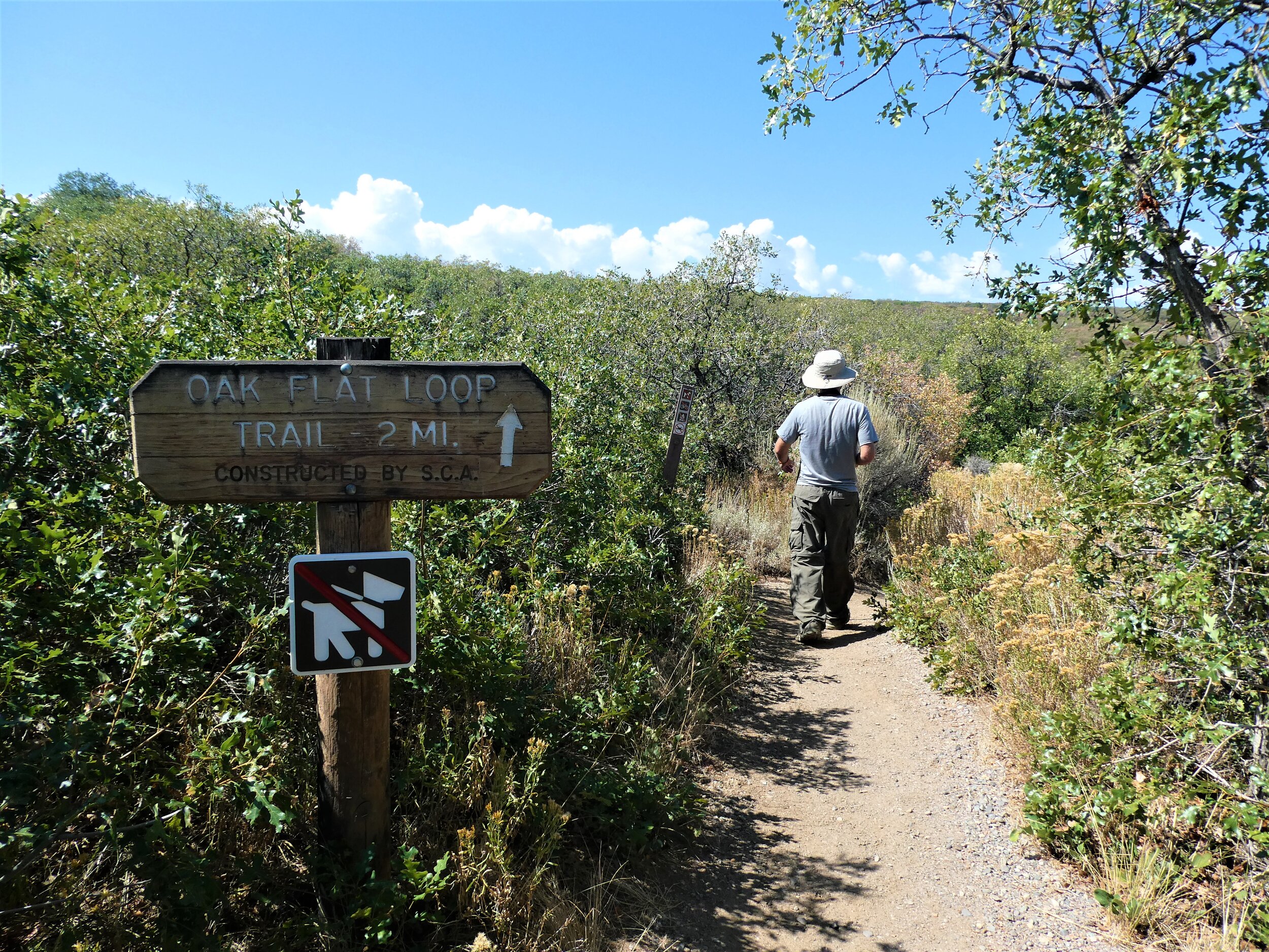
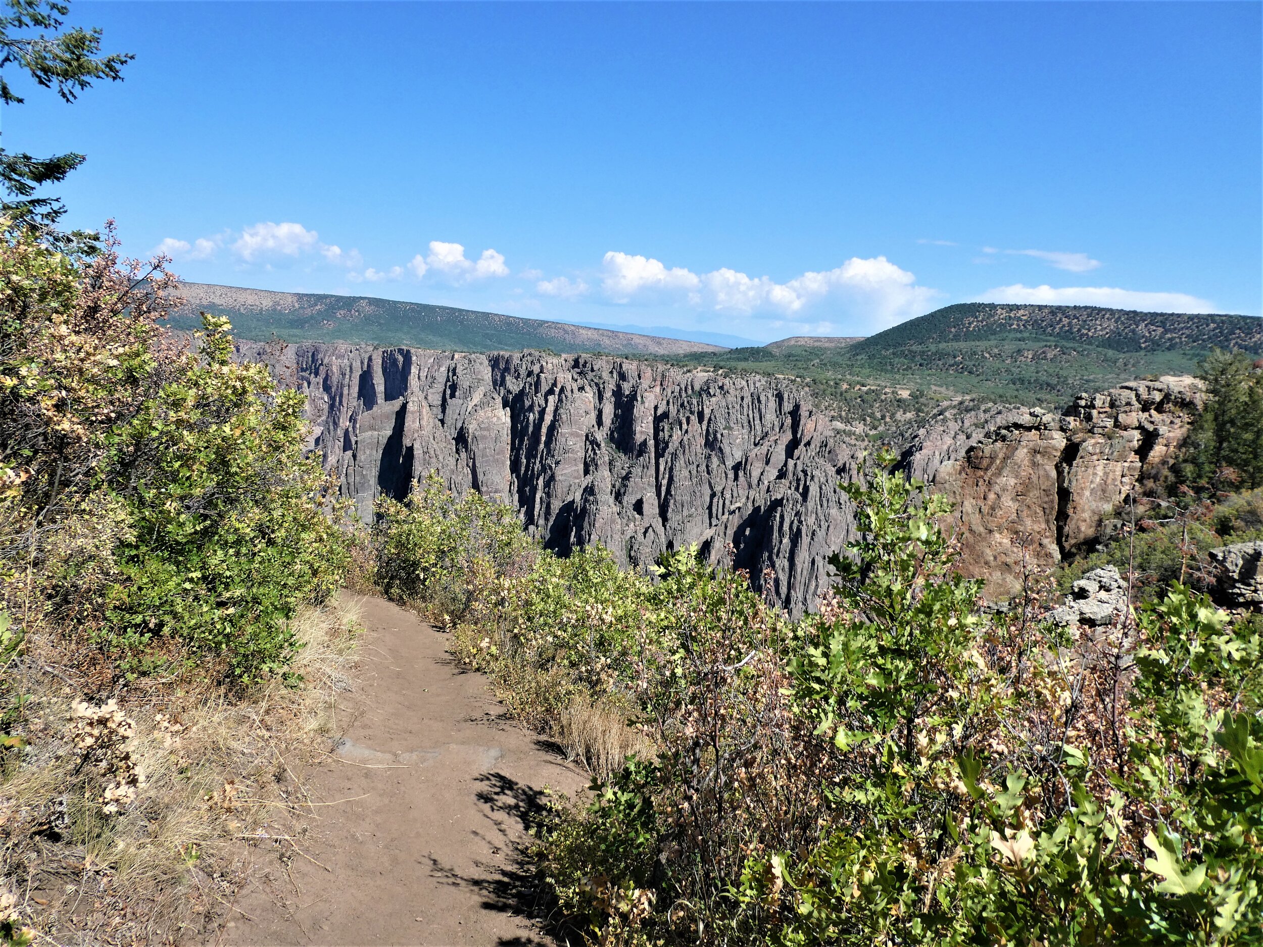
Oak Flat Loop – a 2 mile loop starting from the visitor center (although our tracker read 1.5 miles). This hike is labelled strenuous, and while we didn’t think it was at all, it probably is the hardest of all the hikes along the canyon’s south rim. This hike was the most appealing to us because it’s the one trail that dives a little bit below the rim and deeper into the canyon rather than just following the rim, so it allows for a different perspective without having to hike all the way to the bottom. Overall, you’ll drop and then reclimb about 350 feet. The trail is mostly wooded but there are a few clearings that give some good views into the canyon.
The final hiking option starts from High Point at the end of South Rim Road.
Warner Point Trail – 1.5 miles out and back. This is a popular choice, and a relatively easy walk along the canyon’s rim with views of Uncompahgre Valley, the San Juan range in the distance, and the tapering end of the Black Canyon.
3. Explore the inner canyon
If from atop the South Rim Road viewpoints you look down to the tiny Gunnison River carving its way through the valley and find yourself thinking, man, I wish I could somehow get down there…well, you can! There’s an easy way and a hard way to do it.
The hard way: hike down.
You might look at those steep, nearly vertical, jagged canyon walls and think, how the heck can someone hike down that? Trust us, we thought that, too. But, there are a few routes down into the canyon that follow gullies and drainages to the canyon floor.
We say hikes, but really, these routes are full on scrambles. They are not maintained or marked trails. They are rough, steep, challenging scrambles down loose rock, dirt and scree and require good route finding and are recommended only for experienced hikers. Other things to note about these routes is they are often in full exposure to the sun and heat, and poison ivy is pretty common along the routes and at the river, which it can grow as tall as five feet (a.k.a. wear long pants!).
From the south rim, there are three paths to the bottom. The most popular route, and the one recommended for your first time hiking into the canyon, is the Gunnison route. It begins at the South Rim visitor center, branching off from the Oak Flat Trail. The trail is a steep descent down drainages, dropping 1800 feet in just 1.5 miles (sounds pretty rough on the knees!...and believe it or not, the other routes are even steeper), and using a chain in one particularly steep section. These trails are so steep that it’s recommended to triple the descent time to figure out your estimated ascent time back up to the rim.
Wilderness Permits
If reading this makes you go, heck yea, bring it on!, and (a very important and) you are prepared, then kudos to you! Here’s how you can do it…
To hike to the bottom of the Black Gunnison, you’ll need a wilderness permit, but don’t worry, they’re free! They have a limited number but you can’t reserve them in advance. You have to get the at the South Rim Visitor Center either on the day of your hike or within an hour and a half of closing on the day before. You can opt for a day hike, or lug all your stuff down there and backcountry camp for a night at the river at an established site.
The easy way: drive down.
For those of us less inclined to scramble our way down to the bottom of the canyon, we are happy to tell you there’s an easier way! Drive down!
Yep, there’s road to the bottom of the canyon…East Portal Road. This road branches off from South Rim Road right at the entrance station.
Though not a challenging scramble like the first option, the East Portal Road down to the Gunnison River is still quite the adventure! It’s paved, but it’s a steep windy road that rapidly switchbacks down to the canyon floor, at some places reaching a 16% grade! Because of this, the park service recommends driving in low gear so you don’t burn out your breaks.
When you reach the bottom, you’ll be surrounding by the canyon’s towering rock walls. It’s a popular place for picnicking, fishing, and just reveling at the tall cliff walls. There’s also a first come first serve campground down here.
4. Learn about the canyon
On the south rim of the Black Canyon of the Gunnison, there is an extensive ranger program and a great visitor center filled with exhibits. Taking advantage of this is a good thing to do while on the south rim because these things aren’t offered on the more primitive and less developed North Rim.
With a ranger program, you can go on a guided walk, learn about the canyon’s geology, and even participate in a night astronomy program where you can peer through telescopes at stars and galaxies.
How Much Time Do You Need on the South Rim of Black Canyon of the Gunnison?
As you can see, there aren’t a ton of things to do on the South Rim of the Black Canyon of the Gunnison, so you don’t need a huge amount of time to adequately explore this park.
In as little as a half day, you can drive the entire South Rim scenic drive and do one or two of the park’s rim hikes and also drive into the canyon. As an example, we did the Oak Flat Loop hike and visited all but two viewpoints in just three hours. We spent another hour driving in and out of the canyon via East Portal Road. So all in all we spent four hours on the South Rim, and didn’t feel rushed at all. We felt like we had adequately explored what we wanted to see.
If you have a full day on the South Rim of the Black Canyon of the Gunnison, you could spend half the day on South Rim Road and doing a hike or two, spend a bit more time at the bottom of East Portal Road, and explore the visitor center’s exhibits, park film, and go on a ranger walk.
If you want to do one of the hikes into the canyon, we would say to plan for at least a half day for that, most likely in the morning to avoid the strong midday and afternoon sun and any afternoon storms. Then you can spend the afternoon stopping along some viewpoints along South Rim Road depending on how much energy you have left! Or you can split the big hike and the scenic driving into two separate days.
Overall, a half day is adequate and no more than two days are needed on the South Rim of the Black Canyon of the Gunnison.
Rocky Mountain National Park Guide and Itinerary
Best Things to do at Great Sand Dunes National Park
Should I visit the North Rim or the South Rim of Black Canyon of the Gunnison?
If you only have one day at Black Canyon of the Gunnison, we recommend concentrating your time on either the South or the North Rim. Sure, you can see right across the canyon and make out the cars driving along the opposite rim and see the people along the viewpoints across the canyon, so it’s a short drive in between the two rims, right?
Nope! It actually takes about two hours to drive between the North and the South Rim because, you know, there’s that big canyon in the way. It’s doable to see both rims in a day if you just want to drive the scenic roads along each rim, but it will be a lot of driving and might seem a little rushed. If you want to visit both the North and South Rim of the Black Canyon of the Gunnison, we recommend setting aside two days for the park.
So, should you visit the North or the South Rim of the Black Canyon of the Gunnison? Well, it depends on what you’re looking for. Here’s our take on the two rims.
The South Rim of Black Canyon of the Gunnison
The South Rim is by far the more popular and crowded of the two sides of the canyon. You’ll likely be one of many cars inching their way down South Rim Road, encountering the same sets of people as you each make stops along all the viewpoints. Sometimes, you might have to pass up a viewpoint because of a full parking lot. And in the case of High Point, the final viewpoint along the south rim where the road ends in a parking lot, it’s a matter of luck being able to park (we had to circle around for a while with a bunch of other cars until a spot opened up). Now, don’t get me wrong, the park doesn’t see the same types of crowds as more popular parks like Yosemite or Zion, but because the park is so small and there’s really only one 7 mile road to drive to see all the viewpoints, and because the parking areas are so small, it can get congested here.
The South Rim is more developed and has more going on than the North Rim. The visitor center is open all summer and staffed with rangers, and has exhibits, a park film, and a gift shop. Ranger programs are available throughout the summer for geology walks and night sky viewing. This side of the park has flush toilets and all the roads are paved.
The South Rim has more viewpoints. I wouldn’t necessarily say that this is a pro, since you don’t have to stop at each one as we explained above, but there a few select view points that we would make sure to stop at. I would say that my favorite roadside viewpoints were found along the South Rim, but if you were to ask me favorite viewpoint of the canyon overall? That’s found along a hike on the North Rim (see below).
If you want to experience the views from the bottom of the canyon without a strenuous scramble, the South Rim offers the chance to drive to the bottom via East Portal Road.
The North Rim of Black Canyon of the Gunnison
The North Rim is much quieter than the South Rim. Much quieter. There were hardly any cars on the road and we rarely shared a view point with someone, and when we did, it was only for a minute or so. We loved this about the North Rim.
There are fewer viewpoints along the North Rim…only five. But that didn’t bother us at all and we felt it still gave good glimpses into the canyon. The viewpoints along the North Rim don’t require much walking either like the ones on the South Rim do.
For us, the North Rim has the best viewpoint in the entire park, but it’s not found along a roadside pull off. It’s called Exclamation Point, located on a 3 mile round trip trail.
The North Rim is a bit more primitive. The entry road and rim road is unpaved gravel (but still doable in a 2WD car most of the time), and there are vault toilets. There is a small visitor center that’s open sporadically throughout the summer, but there are no exhibits or ranger programs offered.
The North Rim provides access to the bottom of the canyon only via strenuous scrambles. There is not option to drive to the canyon floor from this rim.
In summary, the South Rim of Black Canyon of the Gunnison is good for those who are looking to see as much as the canyon as they can, participate in park programs, explore informational exhibits, want some better facilities, and don’t mind crowds. The North Rim is good for those looking for a much quieter experience away from the hustle and bustle and don’t mind having to drive dirt roads with less developed facilities.
Where to Stay on the South Rim of Black Canyon of the Gunnison
There are no hotels or lodging inside this National Park. The nearest town to the South Rim of Black Canyon of the Gunnison is Montrose, which is about 20 minutes from the South Rim entrance.
Camping in Black Canyon of the Gunnison
There are three frontcountry campgrounds in Black Canyon of the Gunnison, one along the South Rim, one along the North Rim and one at the bottom of East Portal Road. Standard sites are $16 per night and are pretty basic sites with vault toilets and no showers.
The South Rim campground has 88 sites - two loops that can be reserved in advance at recreation.gov and one loop that’s first come first serve. According to the ranger, these are hard to get on weekends.
The East Portal campground has 15 sites that are all first come first serve and the North Rim campground has 13 sites that are all first come first serve. These seem to be easier to get…when we drove through on a Saturday afternoon, there was still some availability as far as we could tell.
There are also some dispersed camping areas just outside of each entrance. They’re free but have no facilities so you have to be pretty rugged and self sufficient.
Curecanti National Recreation Area
When we went to reserve a campsite at the South Rim, it was all booked up, and since we were visiting on a Saturday, we didn’t want to take our chances on trying to find an available first come first serve site anywhere in the park. If this is the case, there’s another good option…
Curecanti National Recreation Area, which is also run by the NPS, sits just to the east of Black Canyon of the Gunnison and has a number of campgrounds you can stay at and reserve easily in advance. We stayed at Lake Fork Campground, which was an idea location for visiting both rims, because it sits right at the fork between the access roads to each rim. However, it’s still a good 45 minutes to the South Rim entrance and an hour and a half to the North Rim entrance. Check out the camping options here.
And that’s a wrap! We hope this helps you plan your visit to this underrated but super cool National Park! If you’ve been, what were your favorite things to do along the South Rim of the Black Canyon of the Gunnison? Let us know if we missed anything!

