How to Visit Hurricane Ridge in Olympic National Park: The Complete Guide
Hurricane Ridge is one of Olympic National Park’s most popular destinations, and for good reason. With amazing views of the Olympic Range and easy hiking trails, Hurricane Ridge is a great place to experience the higher elevation regions of Olympic National Park without too much effort. In this guide, we’ll go over everything you need to know to visit Hurricane Ridge in Olympic National Park, including when to go, how to get there, things to do, and more!
Although quiet, moss-covered temperate rainforests and rugged coastline are what may immediately come to mind when someone mentions the Olympic Peninsula, trust us when we say that there is so much more to this epic region of Washington than that!
The Olympic Peninsula is a hugely diverse area, and Olympic National Park helps to preserve and protect a large portion of this diversity, from rainforests to river valleys, coastline, subalpine meadows, and even snow-capped mountains.
And if there is one place to go in Olympic National Park to see the beautiful mountain landscape, it’s Hurricane Ridge. Believe it or not, a short 18-mile scenic drive can bring you from the forests and coastline found at sea level up to the beautiful subalpine environment of Hurricane Ridge at 5,200 feet, with rugged mountain views as far as the eyes can see. Because it’s so accessible and easy to get to, visiting Hurricane Ridge is one of the best and easiest ways to experience the higher altitude region of Olympic National Park. At Hurricane Ridge, you’ll find subalpine meadows, wildflowers, wildlife, and panoramic views over the Olympic Range and out over the Strait of Juan de Fuca to Canada starting from the moment you step out of your car.
Though it’s popular and can get crowded in the summer, Hurricane Ridge is definitely not to be missed on your Olympic National Park itinerary, and there are still ways to avoid or escape the crowds when you’re up there.
In this guide, we’ll go over everything you need to know to visit Hurricane Ridge in Olympic National Park. We’ll give you all the details on when to go, how to get there, and all the wonderful things to do in Hurricane Ridge once you’re there. So, let’s get to it!
In this Hurricane Ridge guide:
Make sure to check out all our Olympic National Park guides to help you plan your perfect trip!
Where is Hurricane Ridge in Olympic National Park?

The scenic Hurricane Ridge parking area in Olympic National Park
Hurricane Ridge is located on the Northern end of the Olympic Peninsula, right outside of the town of Port Angeles. It’s one of the best places to experience the high elevation subalpine environment of Olympic National Park. In contrast to the wet, mossy rainforests and famous rugged coastline back down at sea level on the western half of the peninsula, Hurricane Ridge sits at 5,200 feet, and as part of the rainshadow effect across the peninsula, the rain that falls in the rainforests below turns to snow up in the mountains. In fact, Hurricane Ridge famously receives between 30 to 35 feet of snow every year!
Up at this high elevation, you’ll find beautiful subalpine meadows backdropped by the snow-topped Olympic Range, along with the opportunity to see wildlife such as deer, elk, and marmots.
Olympic National Park map
Here is a map of Olympic National Park highlighting where Hurricane Ridge is in relation to other regions of the park.
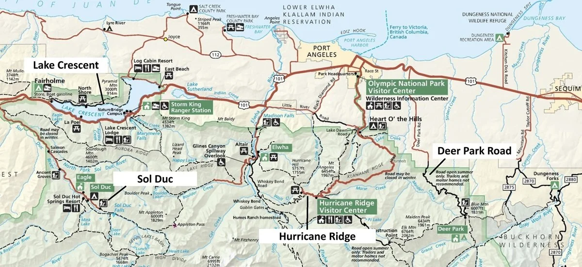
This map is found in the NPS park brochure and shows the northern portion of Olympic National Park. We’ve labeled where Hurricane Ridge is in relation to other popular areas in the park, such as Lake Crescent, Sol Duc, and Port Angeles.
How to Get to Hurricane Ridge in Olympic National Park
To get to Hurricane Ridge from Port Angeles, you’ll drive Hurricane Ridge Road into the interior of the park. This road starts just past the Olympic National Park visitor center in Port Angeles, off of Mount Angeles Road.
En route, you’ll pass through the Heart O’the Hills entrance gate into Olympic National Park, where you’ll be required to pay for a park pass ($30 per vehicle and good for 7 consecutive days in the park), or show one you’ve already purchased previously at another entrance gate or online.
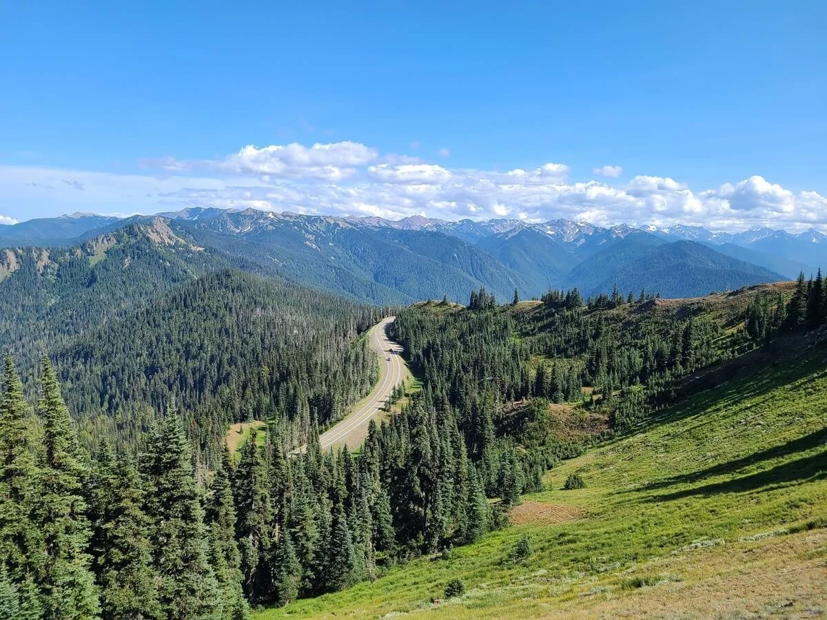
As it climbs from sea level in Port Angeles up to 5,200 feet, Hurricane Ridge Road becomes incredibly scenic, with mountain views opening up as you leave the treeline behind.
The road ends at the top in a large parking lot for the Hurricane Ridge area, where amazing views and hiking trails await.

A view of Hurricane Ridge Road in Olympic National Park
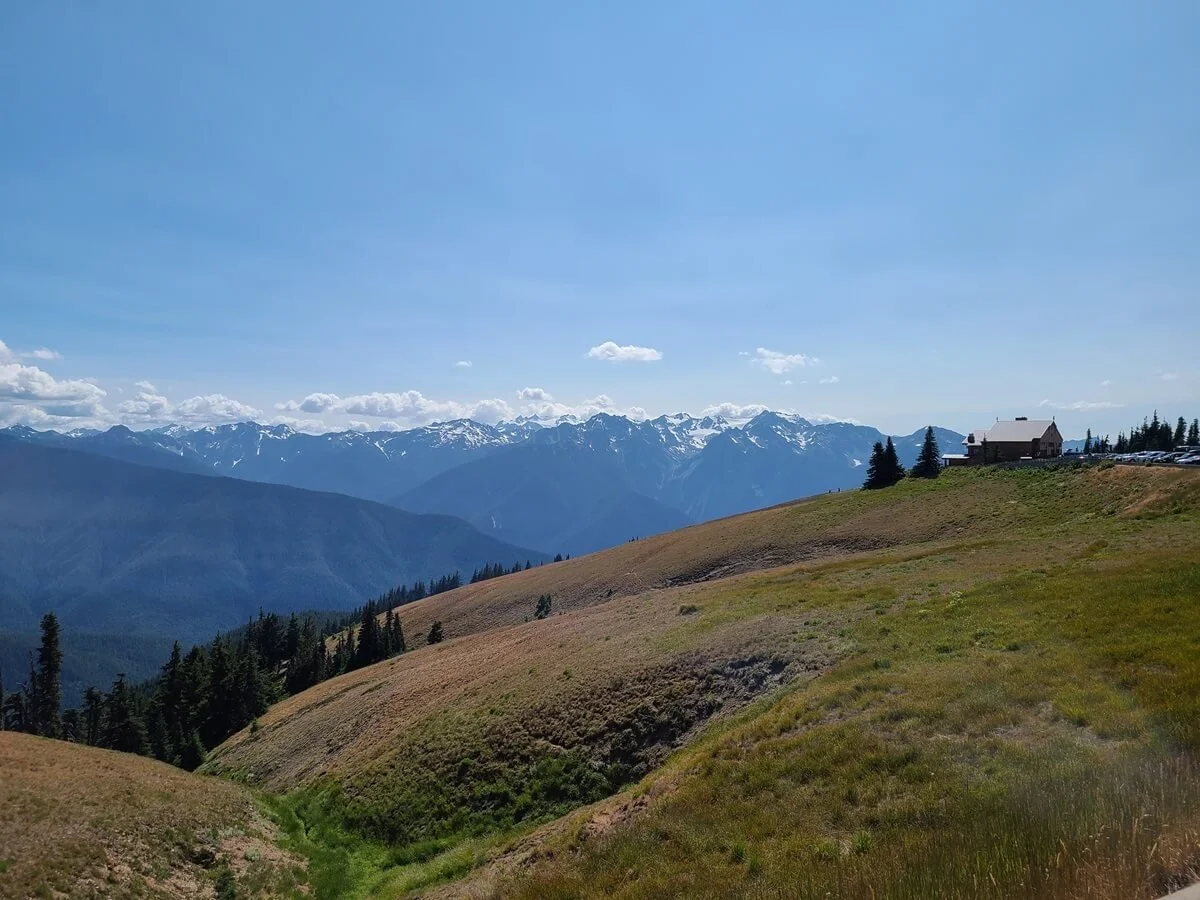
The view from the parking area at Hurricane Ridge in Olympic National Park. Unfortunately, the scenic and famous day lodge seen above is no longer there, as it was burned in a fire in 2023.
Below is some need-to-know info about driving Hurricane Ridge Road before you head out.
How long is the drive to Hurricane Ridge?
From the Olympic National Park Visitor Center in Port Angeles to the Hurricane Ridge parking lot, Hurricane Ridge Road is almost 18 miles, and will take you 30-40 minutes to drive.
How long it takes to get to Hurricane Ridge from other places in Olympic National Park:
Lake Crescent to Hurricane Ridge: 38 miles/ 1 hour
Sol Doc to Hurricane Ridge: 60 miles/ 1.5 hours
Hoh Rainforest to Hurricane Ridge: 105 miles/ 2.5 hours
Mora to Hurricane Ridge: 85 miles/ 2 hours
Staircase to Hurricane Ridge: 107 miles/ 2 hours and 45 minutes
As you can see, Olympic National Park is pretty big and spread out. Be sure to check out our Olympic National Park itinerary to help you figure out how to plan your time and visit all the best places in the park!
Is the drive to Hurricane Ridge scary?
Hurricane Ridge Road climbs and weaves its way into the mountains as it heads up to Hurricane Ridge, but we wouldn’t say it’s super scary… although there are places that might make some drivers a bit nervous.

Views from the car as we drove Hurricane Ridge Road
Hurricane Ridge Road is a standard 2 lane paved road, with the first half through the forest. When you break treeline, the views open up and there is some exposure as the road carves its way along a mountain slope. Sometimes there are guard rails, but often there aren’t, so this might make someone who isn’t used to driving on mountain roads like this a bit nervous. The exposure is on the left side of the road as you drive up (so it will be directly next to you on the drive down rather than on the drive up).
Also, be sure to keep your eye out for bikers, who are often making their way up or down the road.
When is Hurricane Ridge Road open?
Hurricane Ridge Road is usually open every day in the summer. In the winter (generally November through March), Hurricane Ridge remains accessible on weekends (Fridays through Sundays) between 9 am to 4 pm, but can close at any time in bad conditions and weather.
Be sure to check the NPS site for road status and conditions before you head out to make sure Hurricane Ridge Road is open.
Is there public transportation to Hurricane Ridge?
If driving Hurricane Ridge Road yourself sounds a bit too scary, or just something you don’t want to deal with, then you’re actually in luck, because there is a public bus that runs between Port Angeles and Hurricane Ridge! It runs between June and September, costs just $1 each way, and will allow you to bypass any lines at the entrance gate…how convenient! Check out the Clallam Transit website for more information about where the bus picks up in Port Angeles and to see the schedule.
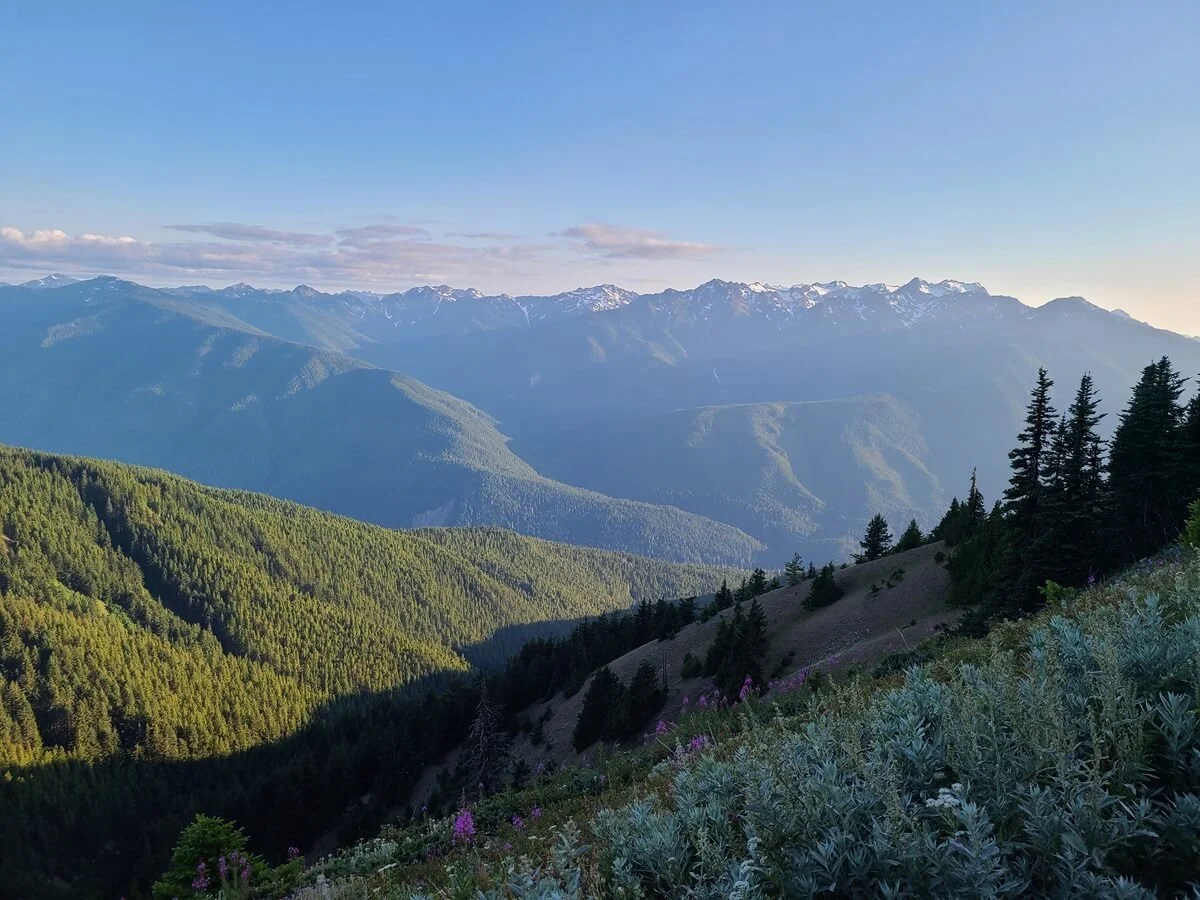
Best Time to Visit Hurricane Ridge in Olympic National Park

Summer views at Hurricane Ridge in Olympic National Park
Hurricane Ridge can be visited all year depending on what you’re looking to do. The best time to visit Hurricane Ridge if you’re looking to hike is between June and October when trails are most likely to be accessible and snow-free. If coming earlier or later within this timeframe, check trail conditions for any lingering snow or early/late season hazards, as this area does get a lot of winter snow and wind.
The summer months are the busiest time in Hurricane Ridge, though, particularly on weekends and holidays. Since Hurricane Ridge is one of the most popular areas of the park to visit, parking can fill up early. When this happens, cars are held at the Heart O’the Hills entrance gate and metered in as spots become available. During peak times (summer weekends and holidays), you might have to wait for up to 2 hours to get through! The park suggests getting there before 10 am and after 2 or 3 pm to avoid longer wait times. We visited Hurricane Ridge midweek at the end of July and had no issues getting in midday…there was no line at the gate and the lot at the top was probably only about 75% full, so weekdays still seem to be okay here.
Hurricane Ridge can also be visited in the winter for snowshoeing, skiing, and sledding! Hurricane Ridge Road opens in the winter Fridays through Sundays from 9 am to 4 pm, pending conditions, and all cars must carry chains for their tires to drive the road. It’s also important to note that since the Hurricane Ridge day lodge burned down, there are no facilities up there other than temporary restrooms, so there’s no good indoor place to warm up. Make sure to pack lots of layers to stay warm, and all the food and water you’ll need for the day.
Things To Do At Hurricane Ridge in Olympic National Park
While there aren’t a ton of things to do at Hurricane Ridge, there is definitely enough up here to fill anywhere from a few hours to your entire day if you wanted to. Here are some of the best things to do on Hurricane Ridge!
Enjoy the views
Honestly, the views alone are enough reason to drive to Hurricane Ridge. This area is the best place to experience the higher elevation subalpine environment of Olympic National Park because it’s so accessible and easy to get to. Just from the parking lot alone, the views out to the Olympic Range, including Mount Olympus, are stunning.

Take in the views at Hurricane Ridge right from the parking lot!
Unfortunately, the iconic Hurricane Ridge Day Lodge and Visitor Center was destroyed in a fire in 2023 and is no longer there. So not only will it not be there to add its magic touch to photos, but this also means that there are currently no facilities up on Hurricane Ridge (no gift shops, food, or water), just temporary bathroom facilities. So be sure to bring all the essentials with you for the day!
Regardless, if all you do is drive the scenic Hurricane Ridge Road up to the lot and enjoy the mountain views just a few steps from your car, we’d say it’s well worth it!
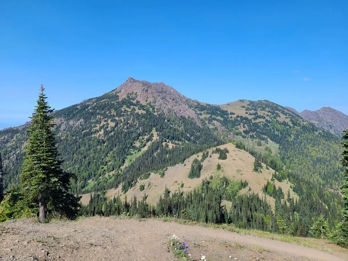
Hike Hurricane Hill
The Hurricane Hill hike in Olympic National Park
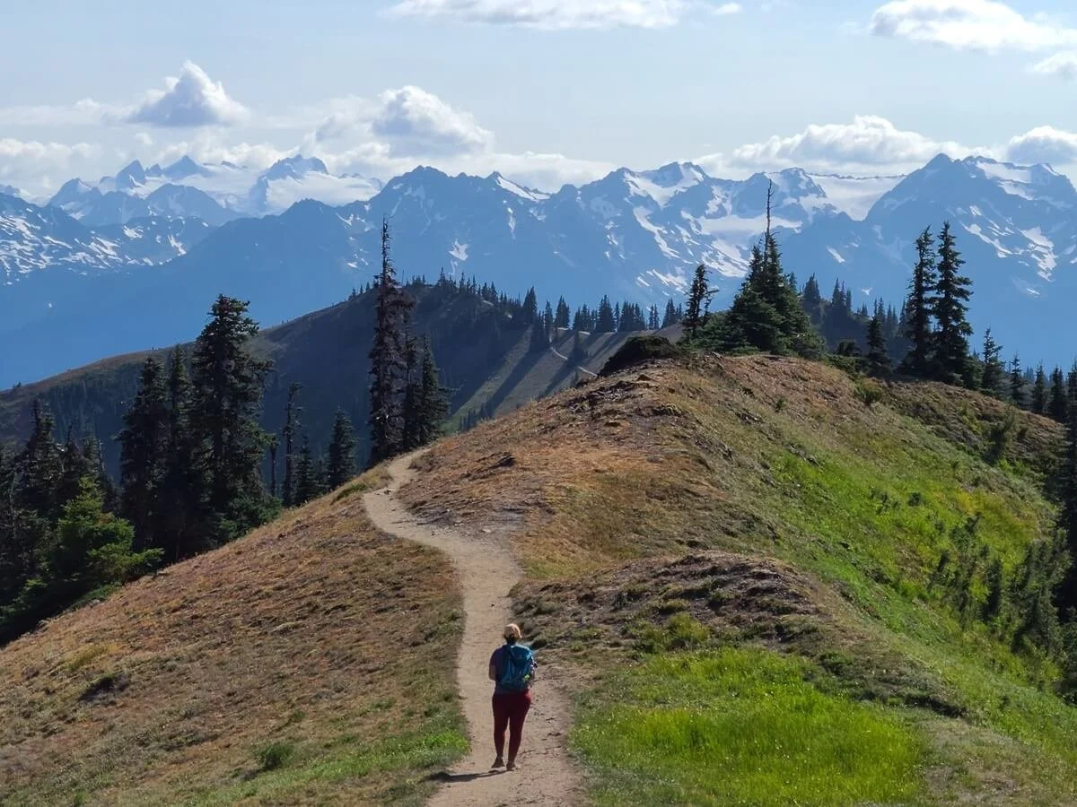
While the views may be stunning from the parking lot, they get even better as you venture out, and the best thing to do in Hurricane Ridge is to hit the trails. There are several easy and short trails in the area in addition to a few longer and more challenging hikes, but the most popular hike in Hurricane Ridge is the trail to Hurricane Hill.
The Hurricane Hill trail is an entirely paved trail that climbs steadily, and quite steeply at times, 1.6 miles and 680 feet up through beautiful subalpine meadows to the Hurricane Hill summit, where you’ll get panoramic views over the Olympic Range to the south, and out over the Strait of Juan de Fuca and Canada to the North. Along the entire trail, the views are stunning, and it’s also a great place to spot deer and other wildlife.
How to get to the Hurricane Hill trailhead
Hurricane Ridge Road actually continues past the large parking lot where the visitor center used to be. Past the lot, it turns into a narrow paved road that winds through the trees for about 1.2 miles until it ends at the small tight parking lot for Hurricane Hill. If this lot is full, there are two small parking/picnic areas about a quarter mile back along Hurricane Ridge Road, but of course, it will add about a half mile extra of walking to your roundtrip hike. The Hurricane Hill trail starts at the far end of the lot at the end of the road.

The tight parking area for Hurricane Hill at the end of the road
Hurricane Hill stats and map
Here are our hiking stats for the Hurricane Hill Trail in Olympic National Park.
Distance: 3.38 miles out and back
Elevation gain: 679 feet
Time: 2 hours (this includes some time hanging out at the top)
Elevation profile:

Hurricane Hill elevation profile
Hurricane Hill map:
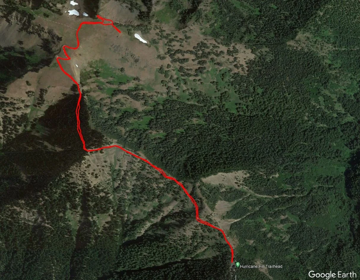
A satellite view of our Hurricane Hill hike from our tracking watch
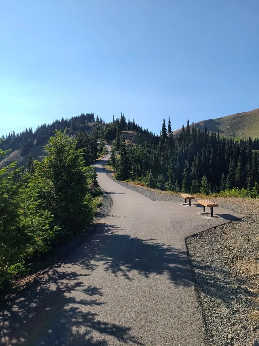
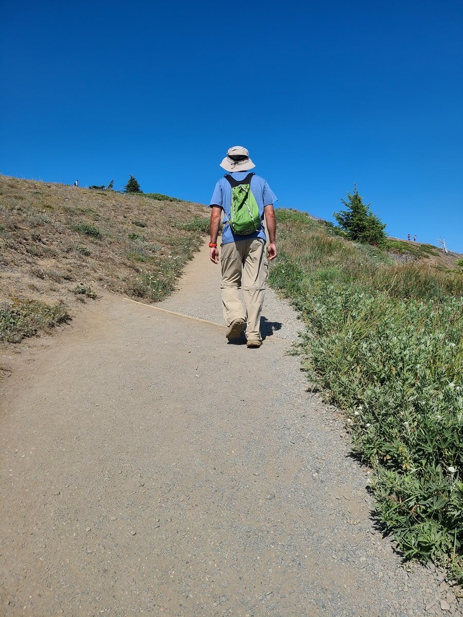
Hiking Hurricane Hill in Olympic National Park
The trail up to Hurricane Hill is entirely paved, with wide open views out to the Olympic Range pretty much the whole time, which is why this hike is so popular!
The trail climbs steadily pretty much the entire way without much of a break, and gets a bit steeper the further up you hike. Because it’s all paved, it really isn’t too bad…just a steady push to the top, and there a several resting points along the trail with benches for enjoying the views. You may even have some cute critters, like chipmunks and rabbits, cheering you on from the side of the trail.


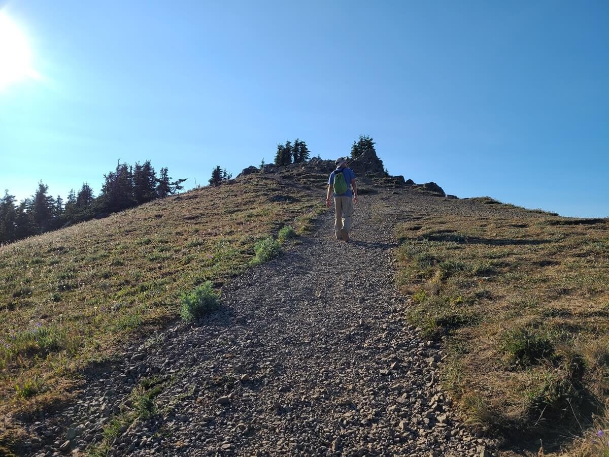
Early views from the Hurricane Hill Trail. You can see the path on the left running along the slope of the hill.

The Hurricane Hill hike ends at the top of the ridge ahead

The Hurricane Hill trail is consistently steep to the top
The Hurricane Hill trail makes a few big switchbacks as it climbs to the top, and the views just get better and better the higher you get. In the summer, the meadows may be adorned with pretty purple wildflowers, making the whole scene even better.

Switchbacks on the Hurricane Hill Trail

Purple wildflowers and mountain views on the Hurricane Hill trail

Gorgeous views from Hurricane Hill
At a couple of points along the way, there will be dirt trails branching off from the paved path that head through the meadows to further- out destinations in the park, so just be sure to stick to the main path.
After the steep and steady climb, the paved path ends just below the true summit of Hurricane Hill, in a little cul-de-sac with panoramic views and a sign labeling everything in sight. A short and flat dirt herd path leads out through the meadow to another viewpoint at the edge of the ridge, where another sign points out all the mountains in view. We saw a few deer grazing in the meadows nearby, and because we were up here just before sunset, we got to see the golden hues start to light up the landscape around us (highly recommend!).

The herd path out to the viewpoint at the top of Hurricane Hill

Admiring the views from Hurricane Hill

Catching the golden hues of sunset on Hurricane Hill

You’ll likely see some deer on top of Hurricane Hill!
At the end of the paved path, the Hurricane Hill trail becomes dirt for its very last stretch up to the true summit. This is a short climb up to a small rocky point where you’ll find the battered Hurricane Hill summit sign on the ground. It’s not entirely necessary to come up to this point, and not many people were, as the views aren’t really different from where the paved part of the trail ends. But we liked doing it just for the sake of completion!
The final gravel climb to the true summit of Hurricane Hill

The faded Hurricane Hill summit sign

A view from the summit back down to the Hurricane Hill trail and viewpoint
The hike down from Hurricane Hill goes pretty fast as it’s all downhill, and the views of the Olympic Range are out in front of you for most of the time, so it’s a super pretty hike!

Hiking down from Hurricane Hill

Gorgeous views from the Hurricane Hill trail
The only downside is that because it’s such a steady downhill on hard pavement, it can beat up the knees a bit, and we were feeling it by the bottom!
How long does it take to hike Hurricane Hill?
It took us about 50 minutes to hike the entire Hurricane Hill trail from the parking lot to the summit going at a steady pace with no breaks. We stayed up there for about a half hour, and then it took about 35 minutes to get back to the trailhead. So in total, the whole Hurricane Hill experience took us about 2 hours.
Hike to Sunrise Point (and beyond)

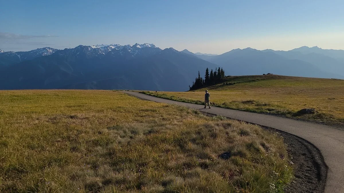
Hiking to and around Sunrise Point is another great thing to do at Hurricane Ridge
Another great thing to do at Hurricane Ridge is to hike to Sunrise Point. This Hurricane Ridge hike is short and sweet, and leads to more panoramic views over the entire area. While there are usually a lot of people hiking to Sunrise Point, you can continue the trail beyond the viewpoint to escape some of the crowds and experience different views over the ridge. So let’s get into how to hike to Sunrise Point (and beyond!) in Olympic National Park!
How to hike to Sunrise Point
While there are a couple of short nature trails near the main Hurricane Ridge parking lot that you can ultimately take, the best and most direct way to start the hike to Sunrise Point is at the trailhead right at the beginning of the lot (on the right- hand side as you are driving in). This is the start of the Cirque Rim Nature Trail, and is a wide paved path that starts its climb right from the parking lot.
Shortly after the start, you’ll take the High Ridge Trail which branches off to the right.
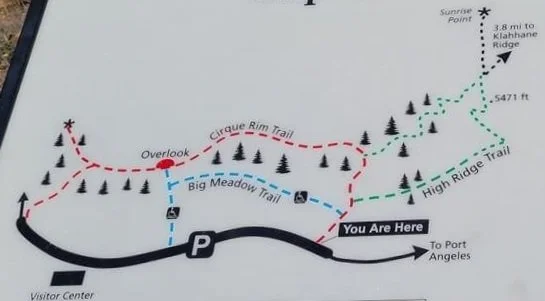
This trail map located near the Sunrise Point trailhead shows part of the trail system on Hurricane Ridge. To hike to Sunrise Point, you will start at the point on the map labelled “You Are Here” and then complete the green loop trail.
This very short section of the High Ridge Trail gets fairly steep, but it’s over quickly as it ends at a nice viewpoint over Mount Angeles and the northern side of the Hurricane Ridge area, with Hurricane Ridge Road below, and the Olympic Range to the south. There’s a sign here labeling what’s in view, and a nice bench to sit on and relax.
The initial short but steep climb on the way to Sunrise Point

A look back down the trail to Sunrise Point, back to Hurricane Ridge Road and the parking area

The view down to Hurricane Ridge Road and the Hurricane Ridge area from the viewpoint at the top of the initial climb
From here, the trail switchbacks and climbs just a tad bit more, with the views continuing. Ahead, you can see the top of Sunrise Point.

The Sunrise Point trail climbs just a tad bit more

Looking back down the Sunrise Point Trail
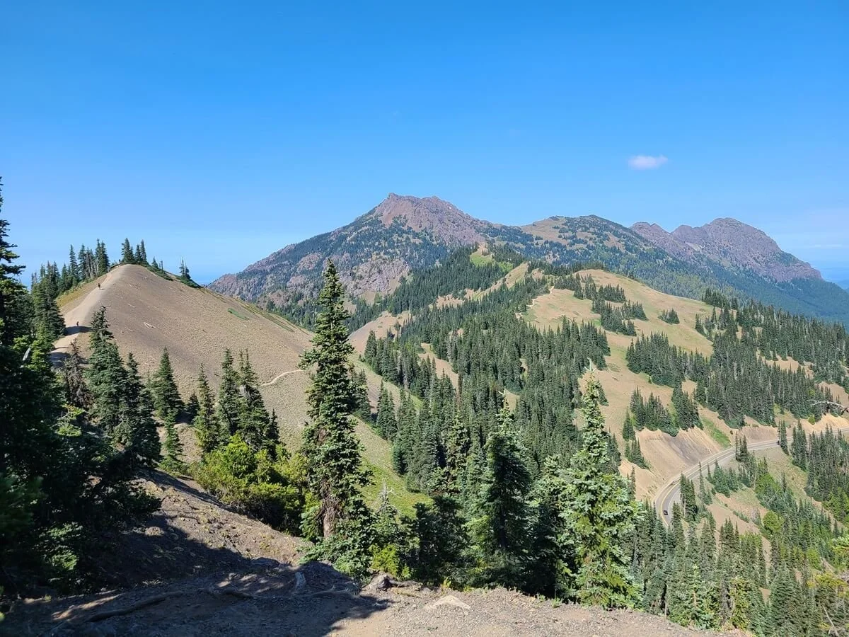
Looking out to Mount Angeles and the Klahhane Ridge. To the left, you can see the trail continue up to Sunrise Point, the small hill in the foreground.
Just before you get to the final short climb to Sunrise Point, the trail will split three ways. Head straight up the hill ahead to reach Sunrise Point and panoramic views. If you take a left here, you complete the High Ridge loop and head back to the parking lot.
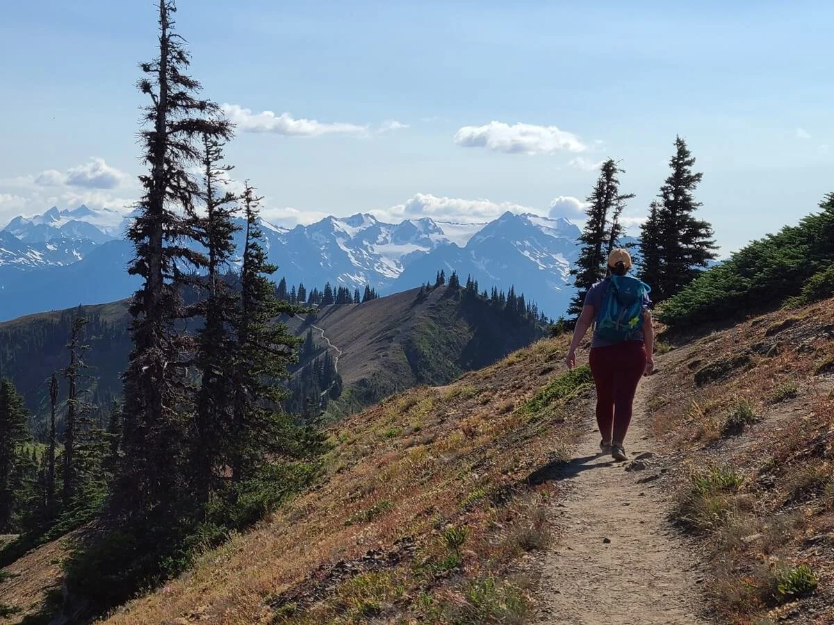
When we got to this intersection, we looked up at Sunrise Point, saw the small crowd of people, and decided instead to take the trail to the right, knowing that there was another unofficial viewpoint further along this ridge that we were interested in checking out. This is the Klahhane Ridge Trail that continues much further into the Hurricane Ridge wilderness and out to Mount Angeles, but our goal was to just get to that viewpoint not too much further down the trail.

Here you can see Sunrise Point on the left, and the Klahhane Ridge Trail continuing ahead along the slope of the hill
From the intersection near Sunrise Point, the Klahhane Ridge Trail dips down and follows the slope beneath the viewpoint. Along the way, you get great views over Hurricane Ridge Road and out to Mount Angeles ahead. After reaching a low point, the trail begins its steady climb back up the ridge. The trails gets steep in spots, and sometimes follows along the edge of the ridge at times, but the views are non-stop.

The Klahhane Ridge Trail as it heads towards Mount Angeles
A view over Hurricane Ridge Road from the Klahhane Ridge
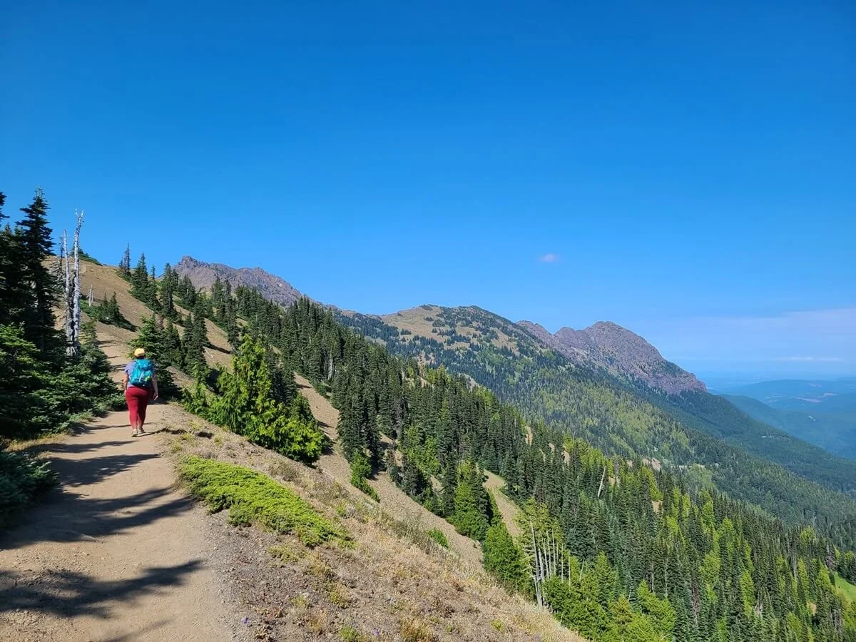
Views from the Klahhane Ridge Trail
After almost a mile past the intersection with Sunrise Point, there will be another split in the trail. You can either go straight up the small hill ahead, or take the trail around it to the right. The trail to the right continues further out to Mount Angeles. Our goal was the viewpoint straight ahead.

Ahead, you can see the trail split- climb up the hill to get to the viewpoint. The trail to the right bypasses this viewpoint and heads to Mount Angeles.
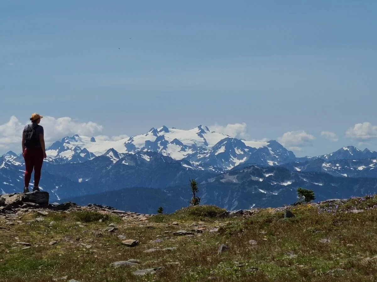
On top of this small hill, you’ll get 360 degree panoramic views over the Hurricane Ridge area, including a perfect view of Mount Angeles. We particularly loved the view looking south back over the ridge trail, with the Olympic Range in the background. It was a super pretty spot, and better yet, we barely saw anyone out here compared to the people that were walking up to Sunrise Point.

One of our favorite views of the day while in the Hurricane Ridge area!
Mount Angeles in full view

More mountain views
We enjoyed the views for a bit and then retraced our steps back to the Sunrise Point intersection. We loved hiking in this direction more because the views over the Olympic Range were ahead of us on the way back! Along the way, we saw a deer, so keep your eyes peeled!
Heading back towards Sunrise Point (the small point ahead)


We spotted this deer near Sunrise Point!
Once at Sunrise Point, we took the other side of the High Ridge Loop back to the Hurricane Ridge parking lot.

Heading back to the Hurricane Ridge parking lot
Sunrise Point hiking stats
For the hike to Sunrise Point only (via the High Ridge Loop), it’s about 0.9 miles with 200 feet of elevation gain. It’s a slightly steep but quick climb up to the viewpoint.
For the full hike we did to the viewpoint on the Klahhane Ridge Trail, these are our hiking stats:
Distance: 2.5 miles
Elevation gain: 653 feet
Time: About an hour and a half with some time for breaks at the viewpoints. It took us about 15 minutes to get to Sunrise Point from the parking lot, and then another 20 minutes to get to the Klahhane Ridge viewpoint.
Elevation profile:

Elevation profile of our hike to the Klahhane Ridge viewpoint in Olympic National Park (the first point at around 0.4 miles in is Sunrise Point)
Trail map:

A satellite view of our hike to Sunrise Point and the Klahhane Ridge
Hiking beyond Sunrise Point
If you want a longer and more challenging hike in Hurricane Ridge, you can continue the Klahhane Ridge Trail to one of two places. We didn’t feel the need to do these hikes, but we wanted to share these options in case you’re looking for more things to do in Hurricane Ridge!

Mount Angeles in Olympic National Park
Mount Angeles- the Klahhane Ridge Trail leads to the base of Mount Angeles (the big dominating mountain in the distance), where you’ll start the steep climb to the summit. After the viewpoint along the Klahhane Ridge Trail described above, the trail dips a bit in elevation. At an unsigned junction, take the left to head up to the summit. Once on this side trail, the hike gets steep through forest, then rock and scree, and the trail becomes more of a worn herd path as you get closer to the top. The final push up the summit block is rocky and requires a bit of scrambling, but the views from the top over Klahhane Ridge, Hurricane Ridge, and the Olympic Range look incredible. To hike to Mount Angeles, the total distance will be about 5.6 miles roundtrip from Hurricane Ridge, with 2,200 feet of gain.
For a shorter hike, you can start at the trailhead along Hurricane Ridge Road, but it will be consistently steeper. Hiking to Mount Angeles from here will be only 3.2 miles roundtrip but with 1,600 feet of elevation gain.
Lake Angeles- the Klahhane Ridge Trail also continues beyond the base of Mount Angeles into Heather Park and to Lake Angeles, a beautiful subalpine lake surrounded by forest. This is a longer more challenging trail, at 12.6 miles out and back from the Hurricane Ridge lot, and 4,500 feet of elevation gain. Again, you can make this hike a little shorter by starting from the trail found along Hurricane Ridge Road.
If you want to make it a multiday trip, you can actually backcountry camp at Lake Angeles! Spend the night in solitude and divide the trek across two days. For information about how to secure a permit for backcountry camping, check out the National Park Service backpacking page for Olympic National Park.
Drive Obstruction Point Road

Views from Obstruction Point Road near Hurricane Ridge
Our favorite thing to do at Hurricane Ridge in Olympic National Park was drive Obstruction Point Road! This narrow, rugged mountain road twists its way into the mountains for 8 miles from Hurricane Ridge to Obstruction Point, where epic views over Olympic National Park await. It’s definitely a contender for being one of the most scenic drives in Olympic National Park, but the catch? Well, Obstruction Point Road has also been called the “scariest road in Washington”…and for good reason! It’s narrow, often rough, and has quite a bit of exposure that can make even the best of drivers a bit nervous.
If you can make it to the end of Obstruction Point Road, there are more hiking trails to choose from, and actually, the short hike we did here was our favorite hike in the entire Hurricane Ridge area!

Views from the trail near Obstruction Point!
Obstruction Point has some of the best views you can get of Mount Olympus!
Visit Hurricane Ridge in the winter
Olympic National Park can be visited any time of year, including the winter. Winter is still a good time to check out the lower elevation beaches and rainforests, but exploring the higher elevation areas of the park might be impossible, or quite a bit more challenging at the very least. Trails will be snow-covered, and many roads into the mountains will be inaccessible.
Hurricane Ridge, however, is actually one of the higher elevation areas of the park that you can visit year-round, because it stays open throughout the winter for sledding, skiing, and snowshoeing! During the months of winter operation (typically November through March), the road remains open Fridays through Sundays from 9 am to 4 pm. Just remember that with the destruction of the old day lodge and visitor center, you’ll have to be extra self-reliant in the cold winter weather- make sure to pack all food, water, and warm layers with you for the entire day! Learn more about visiting Hurricane Ridge in the winter on the NPS website.
Map of Hurricane Ridge in Olympic National Park
This Hurricane Ridge map gives an idea of where all the things to do in Hurricane Ridge are located.

This map is taken from the Hurricane Ridge brochure from the NPS, and we’ve highlighted the locations of the things to do in Hurricane Ridge that we mentioned above
How Long Do You Need At Hurricane Ridge in Olympic National Park?
Depending on what you are looking to do, you can easily spend an entire day up at Hurricane Ridge, but even just a few hours will do. We would say that a full day is more than sufficient to experience this part of Olympic National Park. We spent nearly 8 hours on Hurricane Ridge, hiking Hurricane Hill and the Klahhane Ridge Trail, and driving Obstruction Point Road, and we felt like we adequately explored the area.
The only time we would say that more than one day in Hurricane Ridge is needed is if you planned on backpacking or wanted to do one of the longer day hikes in the area, such as the hike to Lake Angeles, in addition to the handful of shorter trails.
And don’t forget! Remember to include the drive time up and down Hurricane Ridge Road, which will add about another hour and a half to your day.
Here’s what we would recommend doing based on how much time you have in Hurricane Ridge:
With one hour in Hurricane Ridge: Enjoy the views from the Hurricane Ridge main parking lot, and do the short hike to Sunrise Point.
With a half day in Hurricane Ridge: Hike to Hurricane Hill, and hike to Sunrise Point and the viewpoint along the Klahhane Ridge Trail.
With a full day in Hurricane Ridge: Drive Obstruction Point Road (if you’re up for it!) and spend a few hours on one of the trails at Obstruction Point. Drive back to Hurricane Ridge and hike Hurricane Hill and the Sunrise Point/Klahhane Ridge Trail.
Two days in Hurricane Ridge: With two days, you can backpack and spend the night at Lake Angeles, hiking to Mount Angeles along the way. With any remaining time, squeeze in the hike to Hurricane Hill.
Alternatively, spend one day out in Obstruction Point, hiking a longer trail from there to Grand Lake. Spend the second day hiking Hurricane Hill and Klahhane Ridge to the viewpoint or all the way out to Mount Angeles.
Is Hurricane Ridge Worth Visiting?

There’s a reason Hurricane Ridge is one of the most popular places to visit in Olympic National Park. We absolutely think Hurricane Ridge is worth visiting to get incredible mountain views that you probably won’t get anywhere else during your time in the park. Plus, it’s pretty easy to get to.
It can get crowded up here, but don’t let that deter you. People spread out pretty well, and it’s easy to escape the crowds of Hurricane Ridge by coming on weekdays, or just venturing out a bit further on the trails past the more popular places like Sunrise Point.
Like we said above, even if you were to only go to Hurricane Ridge to admire the views from the parking lot, we think it’s worth the quick visit in your Olympic National Park itinerary!
Tips for Visiting Hurricane Ridge in Olympic National Park
Before we wrap up, here are a few more quick tips for visiting Hurricane Ridge in Olympic National Park.
Is there a fee to visit Hurricane Ridge?
You’ll need a park pass to visit Hurricane Ridge, whether you come in your own car, or on the Port Angeles shuttle bus. You can buy the pass at any park entrance gate, or online. It cost $30 per vehicle and is good for 7 days in the park.
Tip: If you plan on visiting more National Parks in the year, consider buying the Annual America the Beautiful Parks Pass, which will get you into all National Park and Federal Recreation Areas for a whole year! We used it multiple times during our Washington road trip for places like Mount Rainier, the Mount Baker Wilderness, the Enchantments, and other places in Olympic National Forest. It quickly paid for itself.
Visit on a weekday
If your schedule allows, visiting on a weekday will help you avoid the potentially long entry line to get into Hurricane Ridge. If you’re visiting on a summer weekend or holiday, the park recommends getting there before 10 am or after 3 pm to avoid the worst of the crowds and the long lines. We visited midday on a Tuesday in the summer and had no issues!
Bring everything you need
With no visitor center and day lodge, there really are no facilities at Hurricane Ridge other than bathrooms. Remember to pack all your food, water, maps, and gear that you’ll need for the entire day.
Bring sun protection
The entire Hurricane Ridge area is totally exposed and open, so having sunscreen, a hat, and other sun protection is a must!
Stay on trail and leave no trace
The subalpine meadows of Hurricane Ridge are quite fragile, so it’s important to stay on trail wherever you go! Also, you’ll likely encounter quite a bit of wildlife up here, like marmots, chipmunks, and rabbits. Hurricane Ridge is also a good area for spotting deer! You may also even see mountain goats, particularly near Obstruction Point. Remember to keep a safe distance and don’t approach or feed any of the wildlife. Just enjoy observing them in their natural habitat from afar!
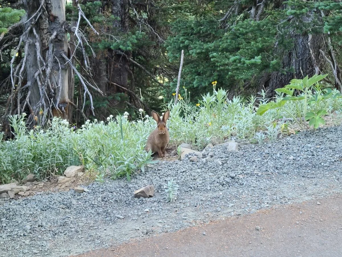
A rabbit greeted us along the Hurricane Hill trail!
Where to Stay Near Hurricane Ridge in Olympic National Park
The closest town to Hurricane Ridge is Port Angeles, found just at the start of Hurricane Ridge Road. If you’re looking to camp, the Heart O’the Hills Campground in Olympic National Park is found just past the entrance on Hurricane Ridge Road, is first-come-first-served, and gets great reviews.
There are actually tons of places to stay on the Olympic Peninsula, depending on where else you plan on going and how you want to organize your time. You can stay a little bit further from Hurricane Ridge, for example, at Lake Crescent, in Forks, or in Sequim, but be closer to other popular Olympic National Park areas. Make sure to check out our Olympic National Park Guide + Things to Do (coming soon!) to learn more about all your accommodation options for Olympic National Park and how to plan your time.
Things to do near Hurricane Ridge in Olympic National Park
Olympic National Park is big. It covers most of the Olympic Peninsula, with long drives in between popular points of interest, like Hurricane Ridge, the Hoh Rainforest, and the Pacific Coast beaches.
The closest regions of the park to Hurricane Ridge are the Elwha Valley, about 9 miles west of Port Angeles on WA-101. Lake Crescent and the Sol Duc Valley are a bit further west, about 20 and 28 miles away from Port Angeles, respectively.
To the east, the road to Deer Park is about 5 miles east of Port Angeles on WA-101. Deer Park Road is another narrow gravel mountain road, much like Obstruction Point Road, that leads to views over the Olympic Peninsula.
For more information, check out our other Olympic National Park guides:
Olympic National Park itinerary for one day to one week (coming soon)
Best hikes on the Olympic Peninsula (coming soon)
How to visit the Hoh Rainforest
More Washington Travel Guides
Heading out on a Washington road trip and plan on visiting more than just the Olympic Peninsula? We have lots of guides to help you plan your travels through the Washington National Parks and beyond!
MOUNT RAINIER NATIONAL PARK: Check out our favorite hikes in Mount Rainier National Park, and learn how to spend one day in Mount Rainier or up to 4 days in the park.
NORTH CASCADES NATIONAL PARK: Check out the Hidden Lake Lookout Trail.
MOUNT BAKER WILDERNESS: Learn more about our favorite hikes near Mount Baker.
We hope this guide helps you plan your visit to Hurricane Ridge in Olympic National Park. Let us know in the comments below if you have any questions about Hurricane Ridge, and as always, happy travels!